MyTopo
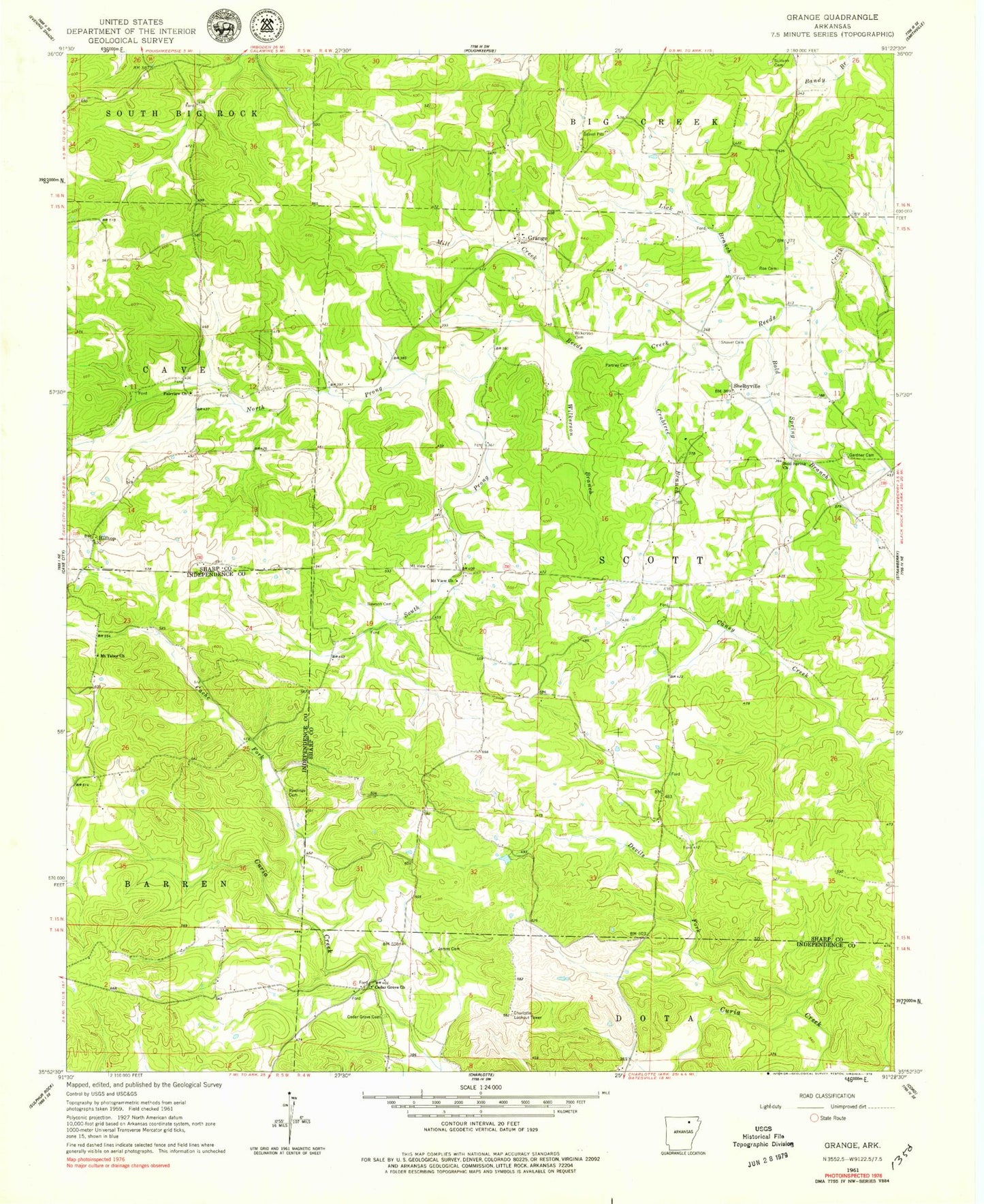
Classic USGS Grange Arkansas 7.5'x7.5' Topo Map
Couldn't load pickup availability
Historical USGS topographic quad map of Grange in the state of Arkansas. Map scale may vary for some years, but is generally around 1:24,000. Print size is approximately 24" x 27"
This quadrangle is in the following counties: Independence, Sharp.
The map contains contour lines, roads, rivers, towns, and lakes. Printed on high-quality waterproof paper with UV fade-resistant inks, and shipped rolled.
Contains the following named places: Aetna, Bold Spring Branch, Bold Spring Church, Cache Fork, Cedar Grove Cemetery, Cedar Grove Church, Cedar Lake, Ceder Lake Dam, Charlotte Lookout Tower, Crabtree Branch, Dawson Cemetery, Devils Fork, Fairview Church, Gardner Cemetery, Grange, Grange - Calamine Volunteer Fire Department Main Station, Hilltop, James Cemetery, Lick Branch, Mill Creek, Mobley, Mount Tabor Church, Mount View Cemetery, Mount View Church, North Prong Reeds Creek, Parsley Cemetery, Pools Chapel, Rawlings Cemetery, Roe Cemetery, Shaver Cemetery, Shelbyville, Simco, South Prong Reeds Creek, Township of Scott, Wilkerson Branch, Wilkerson Cemetery