MyTopo
Classic USGS Granger Lake Texas 7.5'x7.5' Topo Map
Couldn't load pickup availability
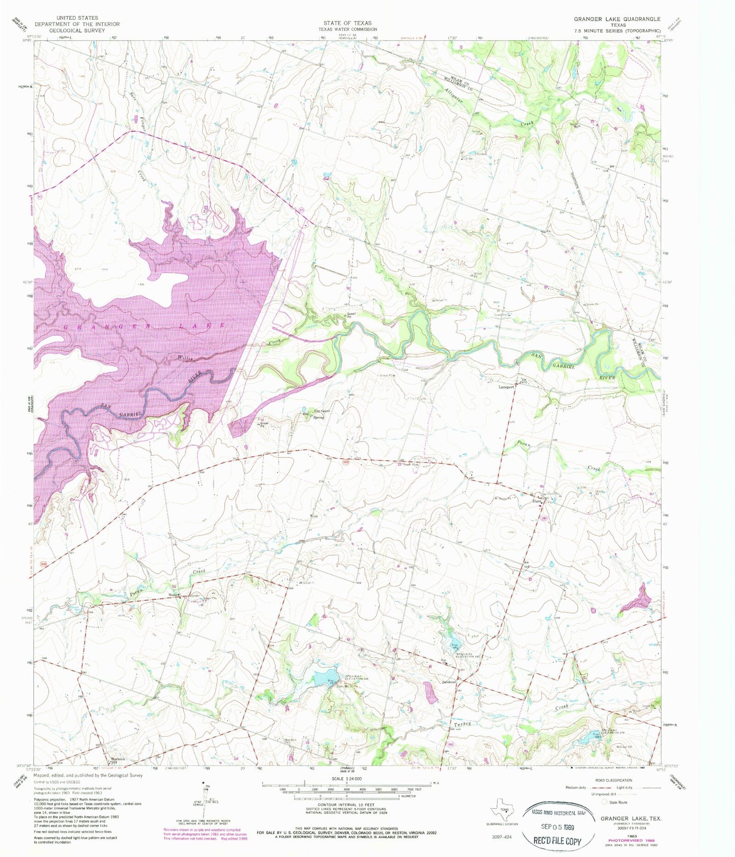
Historical USGS topographic quad map of Granger Lake in the state of Texas. Map scale may vary for some years, but is generally around 1:24,000. Print size is approximately 24" x 27"
This quadrangle is in the following counties: Milam, Williamson.
The map contains contour lines, roads, rivers, towns, and lakes. Printed on high-quality waterproof paper with UV fade-resistant inks, and shipped rolled.
Contains the following named places: Allison Cemetery, C A Hamblen Cemetery, Dam Number 3, Elm Grove, Friendship, Friendship Park, Granger Dam, Granger Lake, Granger Lake - Taylor Park Trail, Granger Wildlife Management Area, Hare, Hejl Lake, Hejl Lake Dam, Hoxie, Laneport, New Bern Cemetery, Pecan Grove Wildlife Area, Sandoval, Soil Conservation Service Site 10 Dam, Soil Conservation Service Site 10 Reservoir, Soil Conservation Service Site 3 Dam, Soil Conservation Service Site 3 Reservoir, Soil Conservation Service Site 4a Dam, Soil Conservation Service Site 4a Reservoir, Soil Conservation Service Site 6 Dam, Soil Conservation Service Site 6 Reservoir, Soil Conservation Service Site 7 Dam, Soil Conservation Service Site 7 Reservoir, Soil Conservation Service Site 8 Dam, Soil Conservation Service Site 8 Reservoir, Sore Finger Creek, Sore Finger Wildlife Area, Taylor Park, Willis Creek, Wilson Fox Park, Wuthrich Hill, Young Cemetery, Zion Church