MyTopo
Classic USGS Granger Mountain Utah 7.5'x7.5' Topo Map
Couldn't load pickup availability
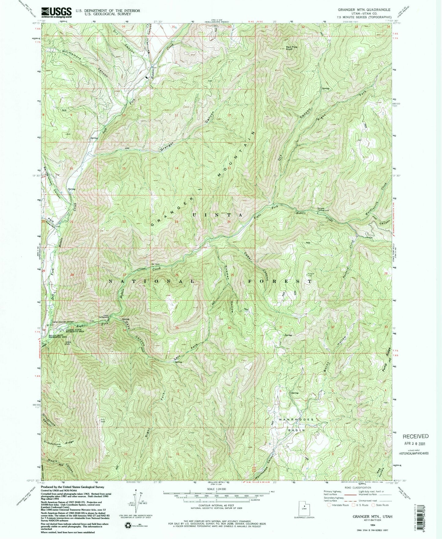
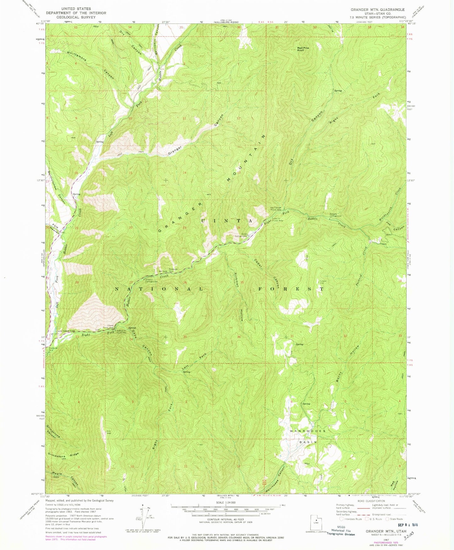
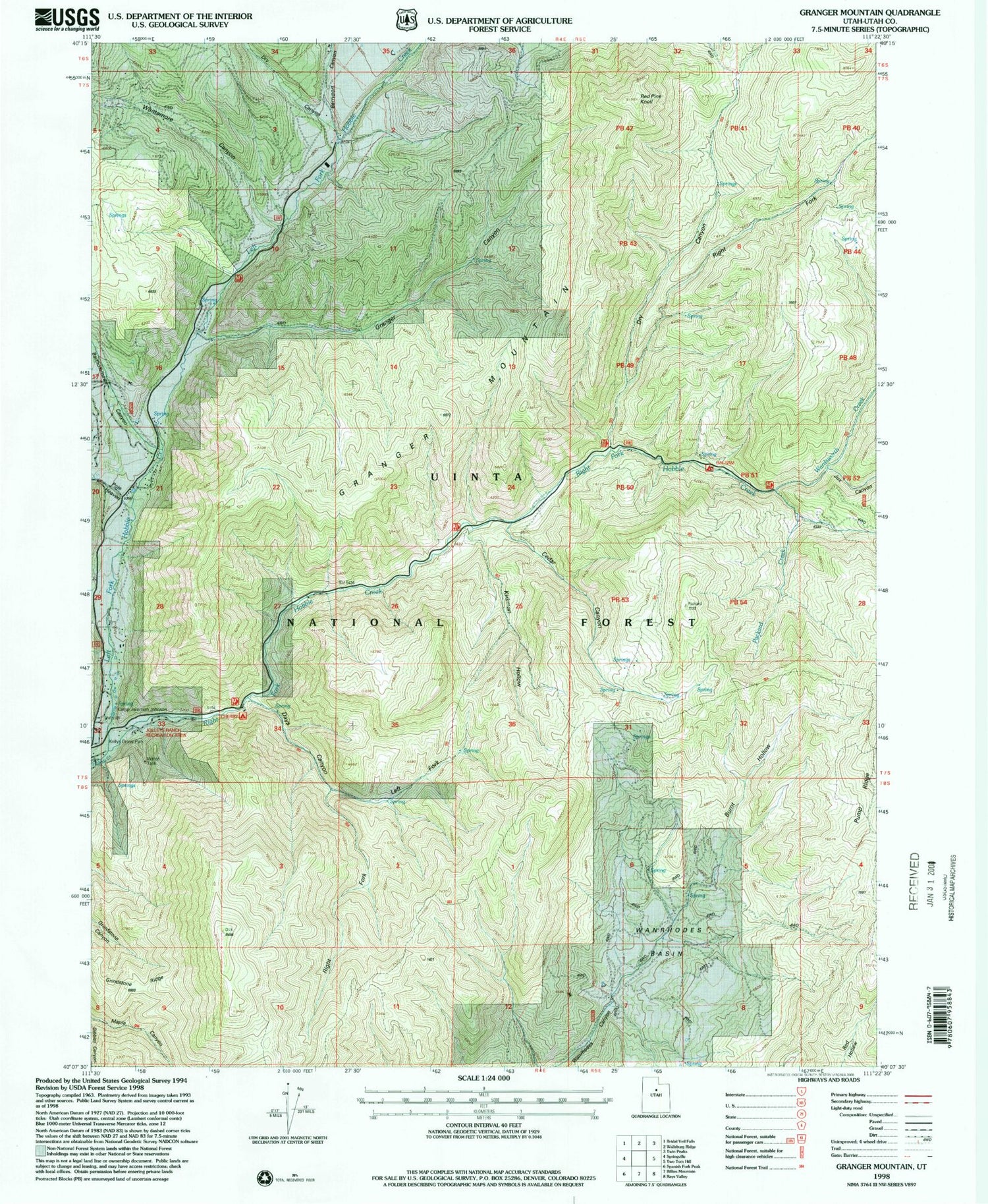
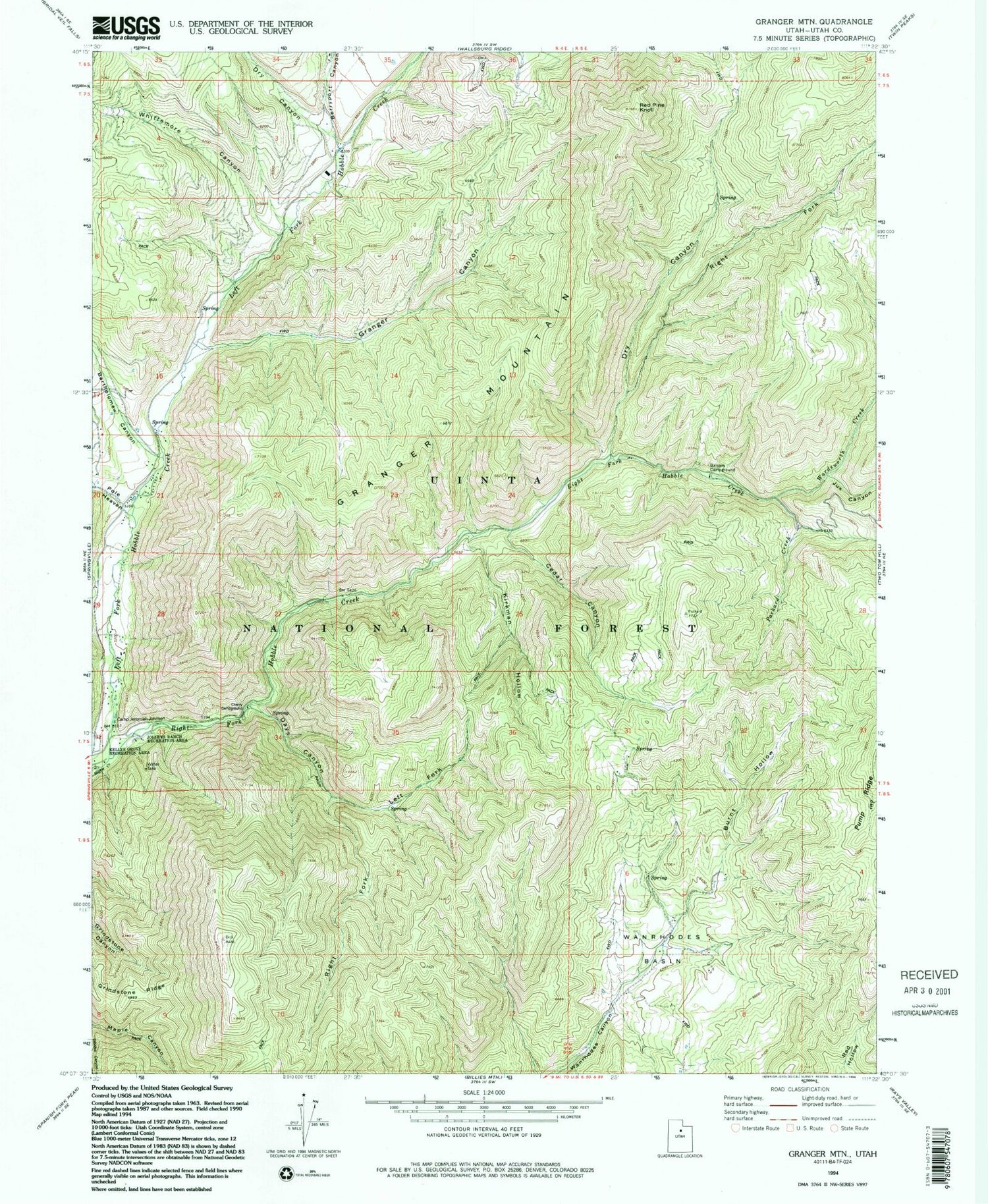
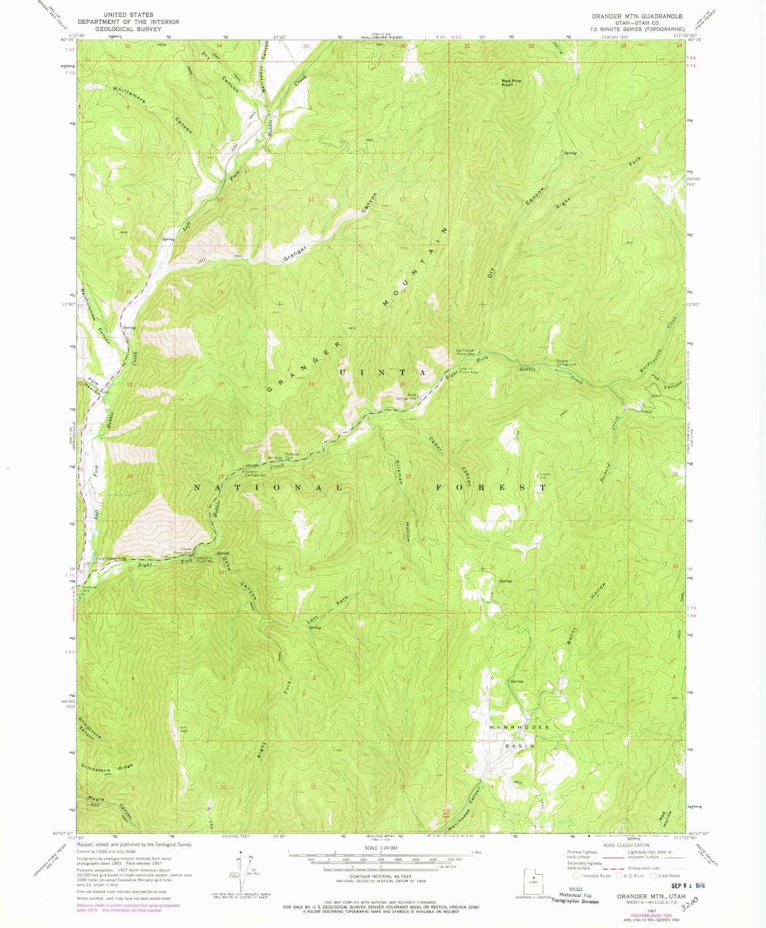
Historical USGS topographic quad map of Granger Mountain in the state of Utah. Typical map scale is 1:24,000, but may vary for certain years, if available. Print size: 24" x 27"
This quadrangle is in the following counties: Utah.
The map contains contour lines, roads, rivers, towns, and lakes. Printed on high-quality waterproof paper with UV fade-resistant inks, and shipped rolled.
Contains the following named places: Burnt Hollow, Camp Hobble Creek, Cedar Canyon, Days Canyon, Granger Canyon, Granger Mountain, Hobble Creek Guard Station, Kirkman Hollow, Left Fork Days Canyon, Packard Creek, Red Pine Knoll, Right Fork Days Canyon, Wanrhodes Basin, Balsam Campground, Cherry Picnic Area, Dry Canyon Picnic Area, Kolob Campground, Lone Fir Picnic Area, Bartholomew Canyon, Berryport Canyon, Dry Canyon, Jux Canyon, Pole Heaven, Right Fork Dry Canyon, Wardsworth Creek, Whittemore Canyon, Sulphur Campground, Birch Picnic Area, Uinta National Forest, Dry Canyon, Hobble Creek Census Designated Place, Burnt Hollow, Camp Hobble Creek, Cedar Canyon, Days Canyon, Granger Canyon, Granger Mountain, Hobble Creek Guard Station, Kirkman Hollow, Left Fork Days Canyon, Packard Creek, Red Pine Knoll, Right Fork Days Canyon, Wanrhodes Basin, Balsam Campground, Cherry Picnic Area, Dry Canyon Picnic Area, Kolob Campground, Lone Fir Picnic Area, Bartholomew Canyon, Berryport Canyon, Dry Canyon, Jux Canyon, Pole Heaven, Right Fork Dry Canyon, Wardsworth Creek, Whittemore Canyon, Sulphur Campground, Birch Picnic Area, Uinta National Forest, Dry Canyon, Hobble Creek Census Designated Place