
MyTopo
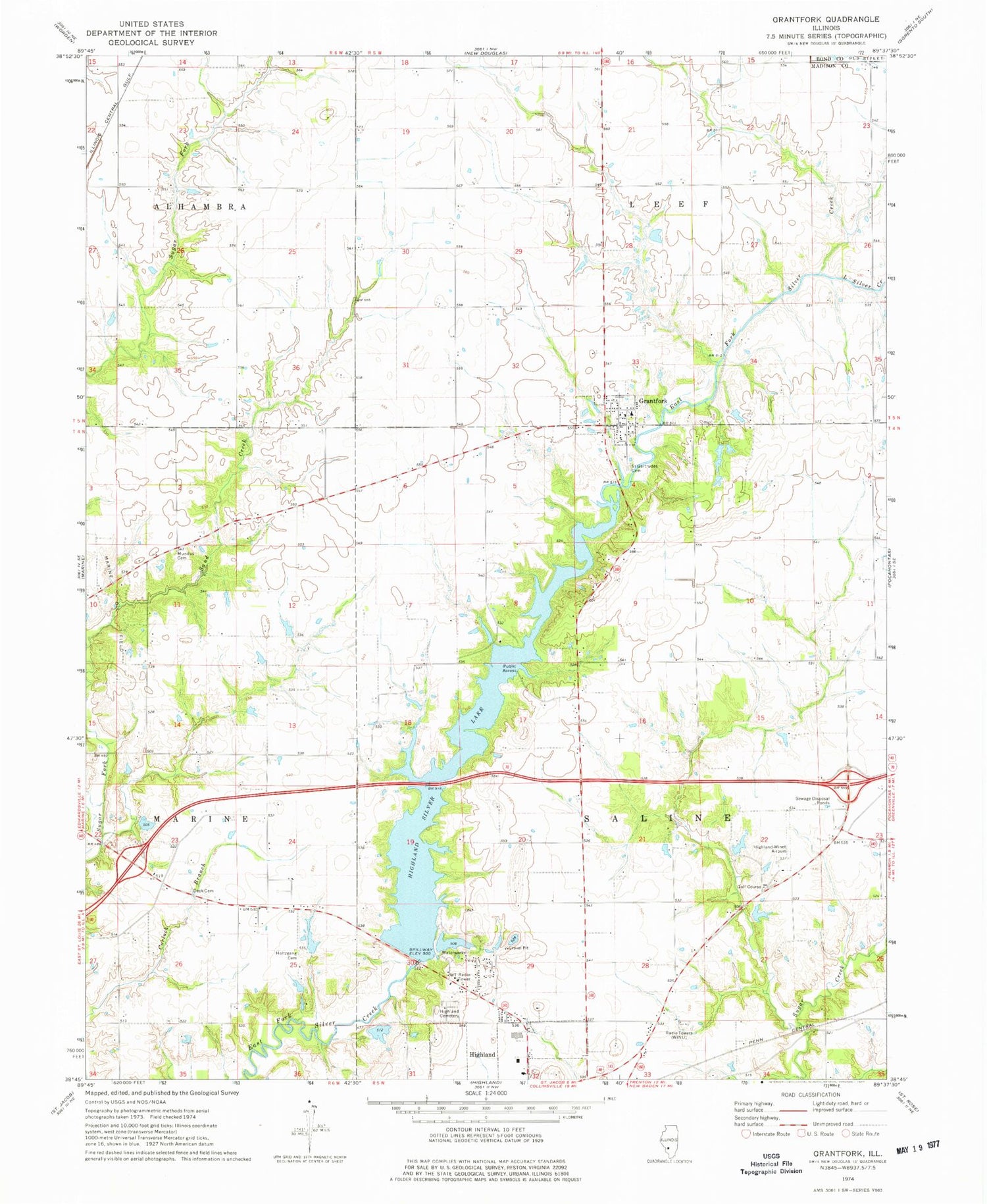
Classic USGS Grantfork Illinois 7.5'x7.5' Topo Map
Couldn't load pickup availability
Historical USGS topographic quad map of Grantfork in the state of Illinois. Map scale may vary for some years, but is generally around 1:24,000. Print size is approximately 24" x 27"
This quadrangle is in the following counties: Bond, Madison.
The map contains contour lines, roads, rivers, towns, and lakes. Printed on high-quality waterproof paper with UV fade-resistant inks, and shipped rolled.
Contains the following named places: Case School, Deck Cemetery, Fairview School, Giger Cemetery, Giger School, Grantfork, Grantfork Elementary School, Grantfork United Church of Christ Cemetery, Grantfork Volunteer Fire Department, Highland Family Cemetery, Highland High School, Highland Silver Lake, Highland Sportsman Club Lake Dam, Highland Sportsmans Club Lake, Highland Water Treatment Plant, Highland-Winet Airport, Kaufman School, Little Silver Creek, Marine Oil Field, Mills Apple Farm, Mundis Cemetery, Old City Reservoir, Old City Reservoir Dam, Purcell School, Rayburn Lake, Rayburn Lake Dam, Rudy School, Saint Gertrude Catholic Cemetery, Saint Josephs Hospital, Sand Creek, Silver Lake, Silver Lake Dam, Steinkoenig School, Tontz School, Township of Leef, Township of Saline, Village of Grantfork, Wider Range School, WINU-AM (Highland), ZIP Code: 62249


