MyTopo
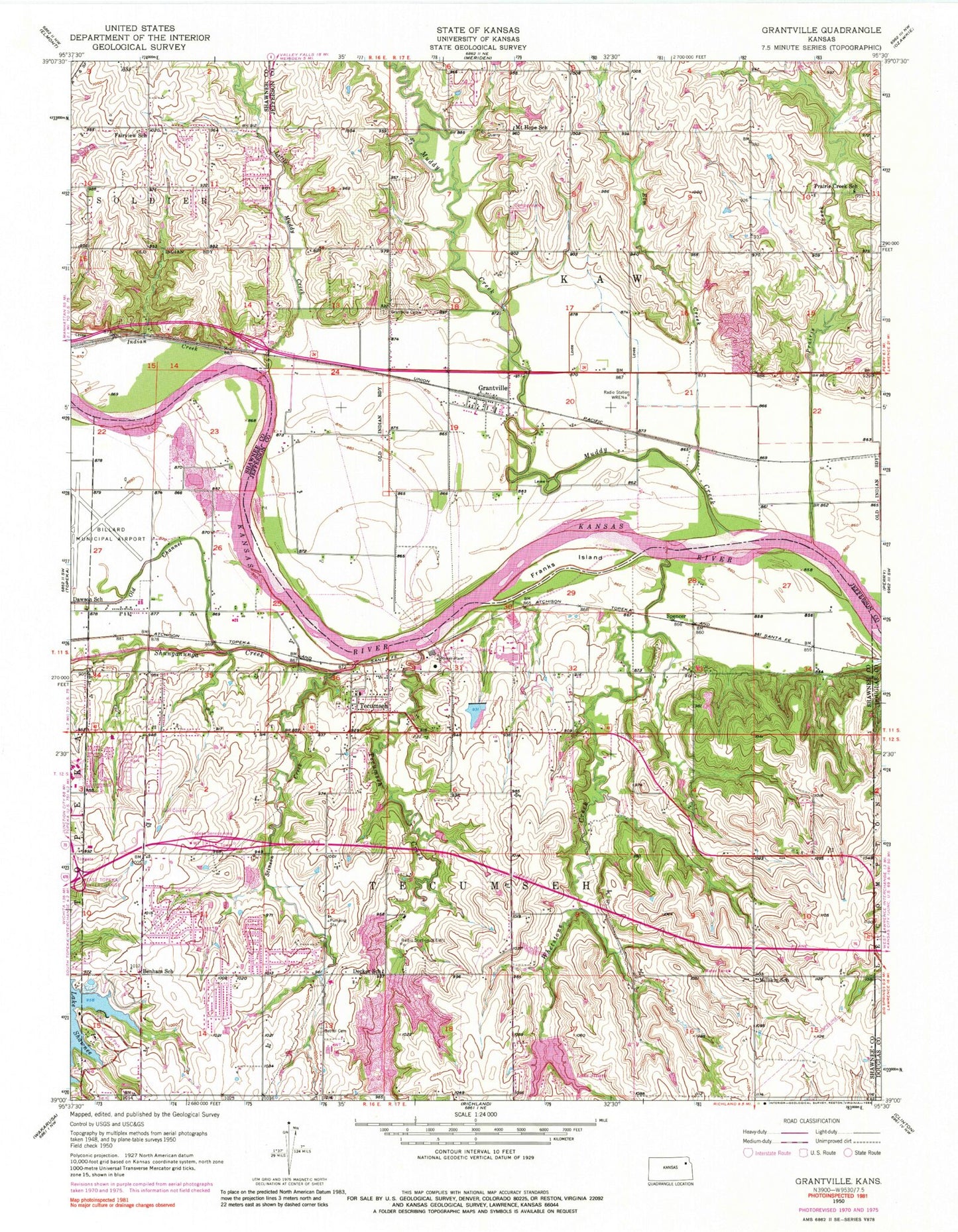
Classic USGS Grantville Kansas 7.5'x7.5' Topo Map
Couldn't load pickup availability
Historical USGS topographic quad map of Grantville in the state of Kansas. Map scale may vary for some years, but is generally around 1:24,000. Print size is approximately 24" x 27"
This quadrangle is in the following counties: Douglas, Jefferson, Shawnee.
The map contains contour lines, roads, rivers, towns, and lakes. Printed on high-quality waterproof paper with UV fade-resistant inks, and shipped rolled.
Contains the following named places: Benham School, Bethel Cemetery, Countryside Home Park Mobile Home Park, Dawson School, Decker School, East Side Baptist Church, Elm Creek, England Mobile Home Estates, Franks Island, Grace Bible Church, Grantville, Grantville Cemetery, Grantville Census Designated Place, Grantville Early Childhood Center, Grantville Post Office, Grantville United Methodist Church, Highland Heights Christian Church, Indian Creek, Jefferson County Fire Department 1 Kaw Township Grantville Station, KFKU-AM (Lawrence), KMAJ - AM (Topeka), KSKX-AM (Topeka), Lake Jivaro, Lake Shawnee Campground, Lakeview Church of the Nazarene, Little Muddy Creek, Millikin School, Mount Hope School, Muddy Creek, North Fairview Elementary School, North Ridge Mobile Home Park, Old Channel Shunganunga Creek, Old Grantville Cemetery, Prairie Creek, Prairie Creek School, Rees Fruit Farm, S and J Estates Mobile Home Park, Shawnee County Parks Police Department, Shawnee Heights Elementary School, Shawnee Heights Fire Station 21, Shunganunga Creek, Spencer, Stinson Creek, Tecumseh, Tecumseh Census Designated Place, Tecumseh Creek, Tecumseh North Elementary School, Tecumseh Post Office, Tecumseh South Elementary School, Tecumseh United Methodist Church, Topeka Correctional Facility, Topeka Fire Station 2, Topeka Service Area, Township of Kaw, Township of Tecumseh, Walnut View Christian Church, Whetstone Creek, WREN-AM (Topeka), ZIP Codes: 66429, 66542, 66616


