MyTopo
Classic USGS Grasmere Reservoir Idaho 7.5'x7.5' Topo Map
Regular price
$16.95
Regular price
Sale price
$16.95
Unit price
per
Couldn't load pickup availability
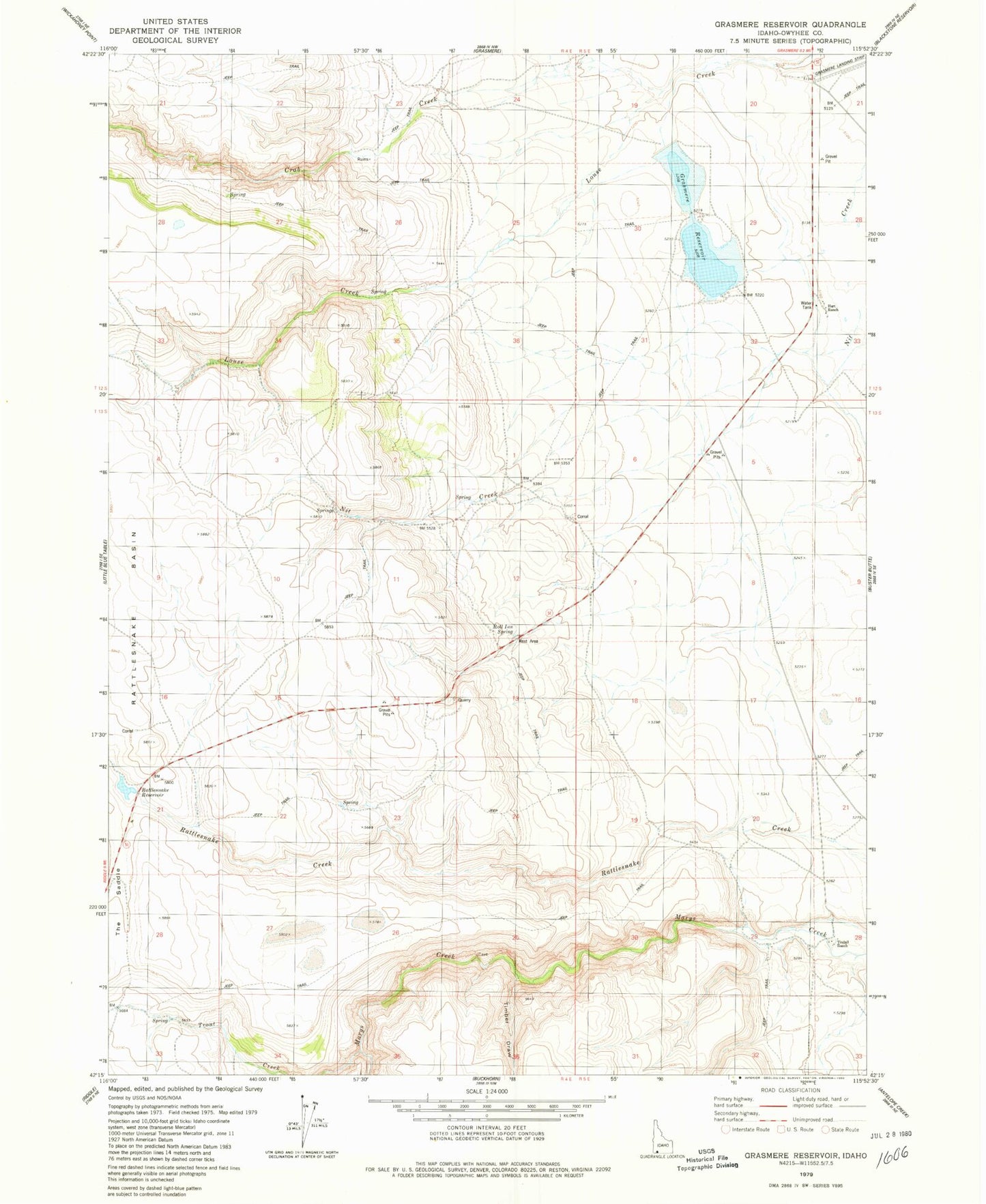
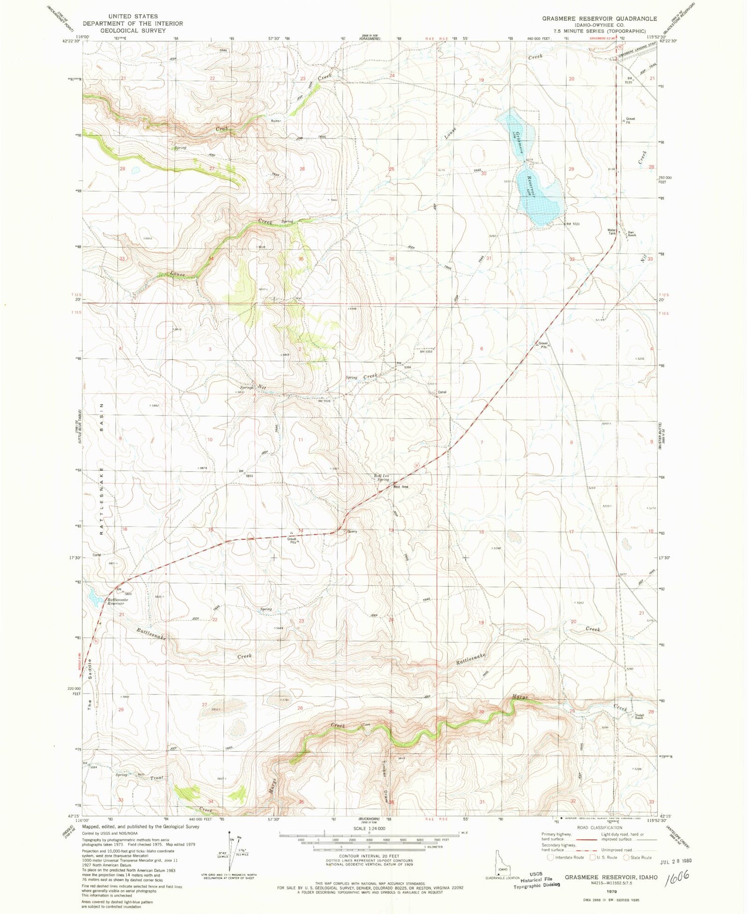
Historical USGS topographic quad map of Grasmere Reservoir in the state of Idaho. Map scale may vary for some years, but is generally around 1:24,000. Print size is approximately 24" x 27"
This quadrangle is in the following counties: Owyhee.
The map contains contour lines, roads, rivers, towns, and lakes. Printed on high-quality waterproof paper with UV fade-resistant inks, and shipped rolled.
Contains the following named places: China Creek, Crab Creek, Grasmere Airport, Grasmere Dam, Grasmere Reservoir, Hart Ranch, Heifer Springs Creek, Nanny Creek, Rattlesnake Basin, Rattlesnake Creek Dam, Rattlesnake Reservoir, Roll Inn Spring, Timber Draw, Tindall, Tindall Ranch, Trout Creek