MyTopo
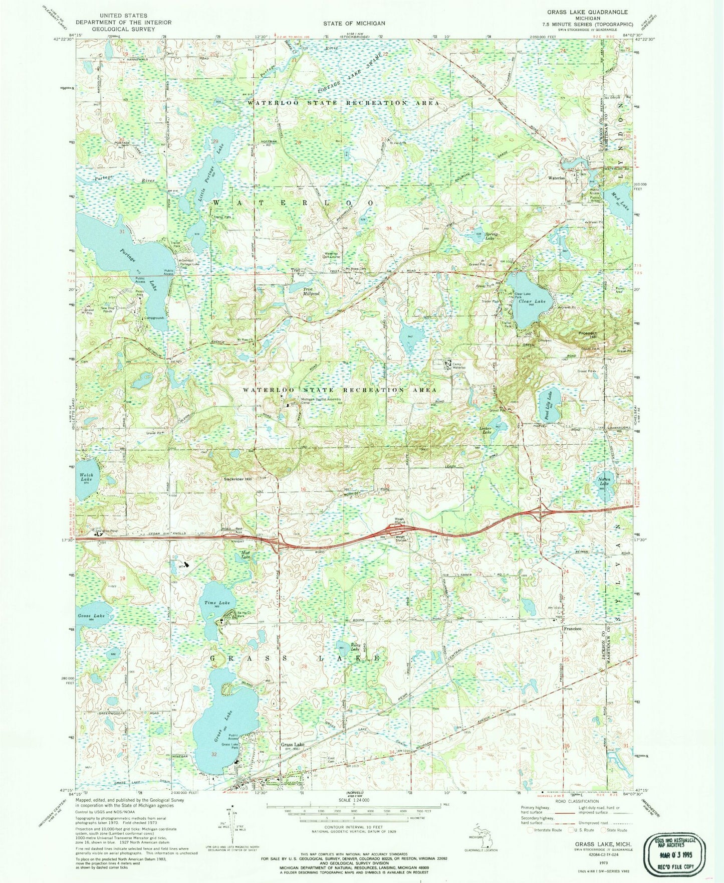
Classic USGS Grass Lake Michigan 7.5'x7.5' Topo Map
Couldn't load pickup availability
Historical USGS topographic quad map of Grass Lake in the state of Michigan. Typical map scale is 1:24,000, but may vary for certain years, if available. Print size: 24" x 27"
This quadrangle is in the following counties: Jackson, Washtenaw.
The map contains contour lines, roads, rivers, towns, and lakes. Printed on high-quality waterproof paper with UV fade-resistant inks, and shipped rolled.
Contains the following named places: Camp Waterloo, Clear Lake, Clear Lake Park, Oakwood Cemetery, Fa-Ho-Lo Park, Francisco, Grass Lake, Grass Lake, Grass Lake Drain, Grass Lake Park, Honey Creek, Little Portage Lake, Locker Lake, Michigan Baptist Assembly Camp, Mount Hope Cemetery, Mount Hope Church, Mud Lake, Mud Lake, Notten Lake, Pond Lily Lake, Portage Lake, Portage Lake Park, Prospect Hill, Riley Lake, Sackrider Hill, Saint Jacob Church, Spring Lake, Tims Lake, Trist Millpond, Waterloo, Waterloo State Recreation Area, Welch Lake, Trist, Waterloo Golf Course, Township of Waterloo, Village of Grass Lake, Grass Lake Rest Area, Michigan Central Railroad Depot Historical Marker, Grass Lake Historical Marker, Jackson Area Historical Marker, Francisco Post Office (historical), Vinings Trailer Park, Grass Lake Assembly of God Church, Family Worship Center, Grass Lake United Methodist Church, Federated Church of Grass Lakes, Grass Lake Baptist Church, Grass Lake Station (historical), Grass Lake Post Office, Grass Lake Police Department, Grass Lake Medical Center, Grass Lake Fire Department, Fa-Ho-Lo Park, Jackson District Library-Grass Lake Branch, Calderone Farms Golf Club, Holiday Campgrounds, Waterloo Methodist Church, Four Lakes Family Campground, Francisco Station (historical), Waterloo Post Office (historical), Trist Post Office (historical), Miles Cemetery, Mount Pleasant Cemetery, Saint John's Cemetery, Mount Hope Cemetery, German Lutheran Cemetery, Moss Cemetery, Grass Lake Charter Township Fire Department, Loveland Road Cemetery, Grass Lake Pit


