

MyTopo
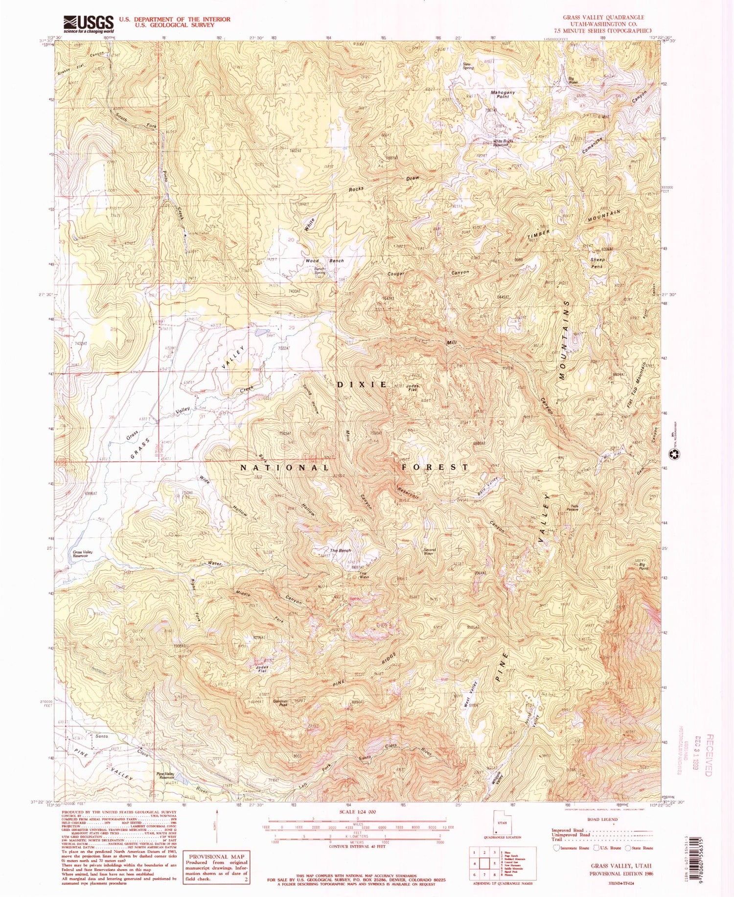
Classic USGS Grass Valley Utah 7.5'x7.5' Topo Map
Couldn't load pickup availability
Historical USGS topographic quad map of Grass Valley in the state of Utah. Typical map scale is 1:24,000, but may vary for certain years, if available. Print size: 24" x 27"
This quadrangle is in the following counties: Washington.
The map contains contour lines, roads, rivers, towns, and lakes. Printed on high-quality waterproof paper with UV fade-resistant inks, and shipped rolled.
Contains the following named places: Bare Valley, Wide Hollow, Bench Spring, Big Water, Cougar Canyon, First Water, Gardner Peak, Gardner Ranch, Jodes Flat, Left Fork Santa Clara River, Mahogany Point, Main Canyon, Middle Fork Water Canyon, Mill Canyon, Mill Flat, Grass Valley Reservoir, North Valley, Pine Ridge, Rencher Ranch, Reservoir Canyon, Right Fork Water Canyon, Second Water, Sheep Pens, Slew Spring, Spring Hollow, Teds Pasture, The Bench, Timber Mountain, Water Canyon, West Valley, Whipple Valley, White Rocks Draw, White Rocks Reservoir, Wood Bench, Pine Valley Reservoir, Pine Valley Reservoir Dam, Grass Valley Dam, Jodes Flat, Bark Hollow, Big Point, Comanche Canyon, Flat Top Mountain, Grass Valley, Grass Valley Trail, Grassy Flat Canyon, Hop Canyon, Middle Fork Santa Clara River, Nay Canyon, Pine Valley Mountains, Squaw Canyon, Gardner Peak Trail, Pines Campground, Upper Pines Campground, Bens Pasture, Water Canyon Trail, Dry Flat, White Rocks Trail, Mill Canyon Trailhead, Reservoir Canyon Trail, Pine Valley Forest Service Facility, Pine Valley Mountain Wilderness, Juniper Park Campground, Lower Pines Campground, Pine Valley Recreation Area, Ponderosa Campground, Sheep Pen Spring, Second Water Spring, First Water Spring, Old Pine Valley Cemetery


