MyTopo
Classic USGS Grassy Hills Idaho 7.5'x7.5' Topo Map
Couldn't load pickup availability
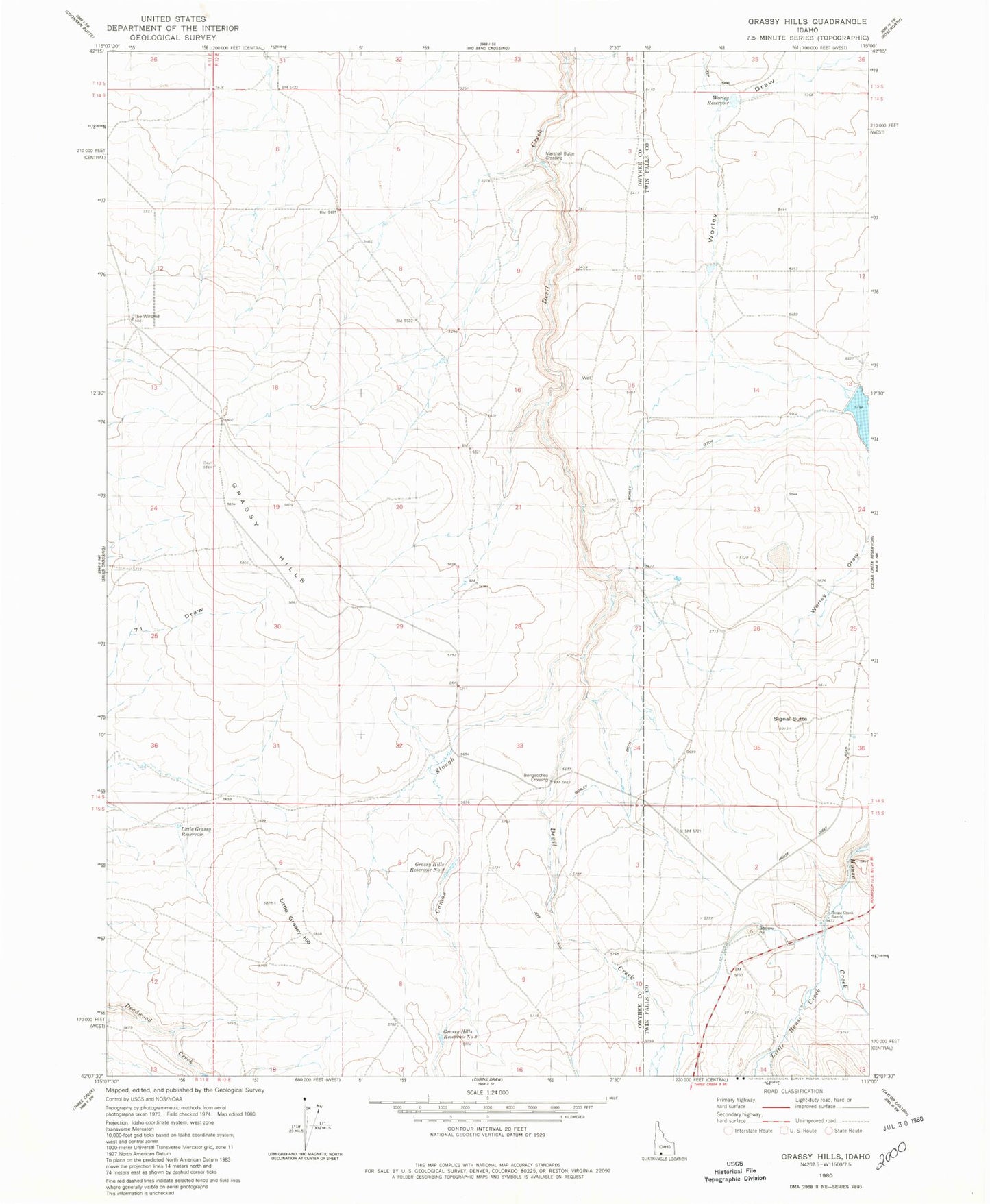
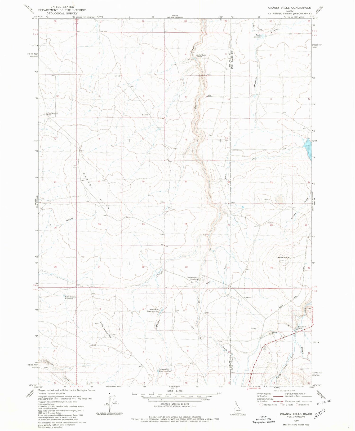
Historical USGS topographic quad map of Grassy Hills in the state of Idaho. Map scale may vary for some years, but is generally around 1:24,000. Print size is approximately 24" x 27"
This quadrangle is in the following counties: Owyhee, Twin Falls.
The map contains contour lines, roads, rivers, towns, and lakes. Printed on high-quality waterproof paper with UV fade-resistant inks, and shipped rolled.
Contains the following named places: Bengeochea Crossing, Camas Slough, Grassy Hills, Grassy Hills Reservoir Number Three, Grassy Hills Reservoir Number Two, Heil Dam, House Creek Ranch, Little Grassy Hill, Little Grassy Reservoir, Little House Creek, Marshall Butte Crossing, Signal Butte, The Windmill, Worley Ditch, Worley Reservoir, ZIP Code: 83302