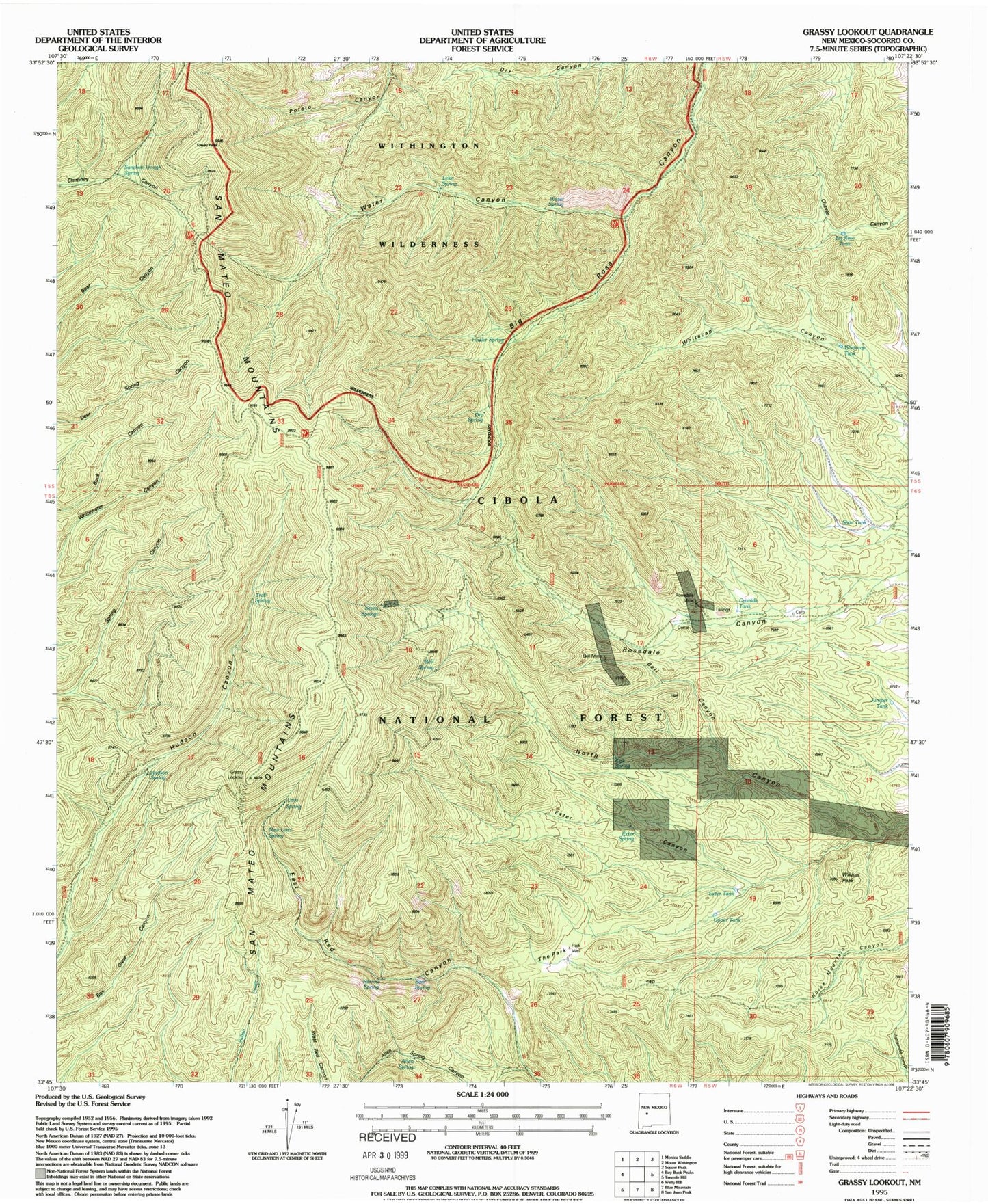
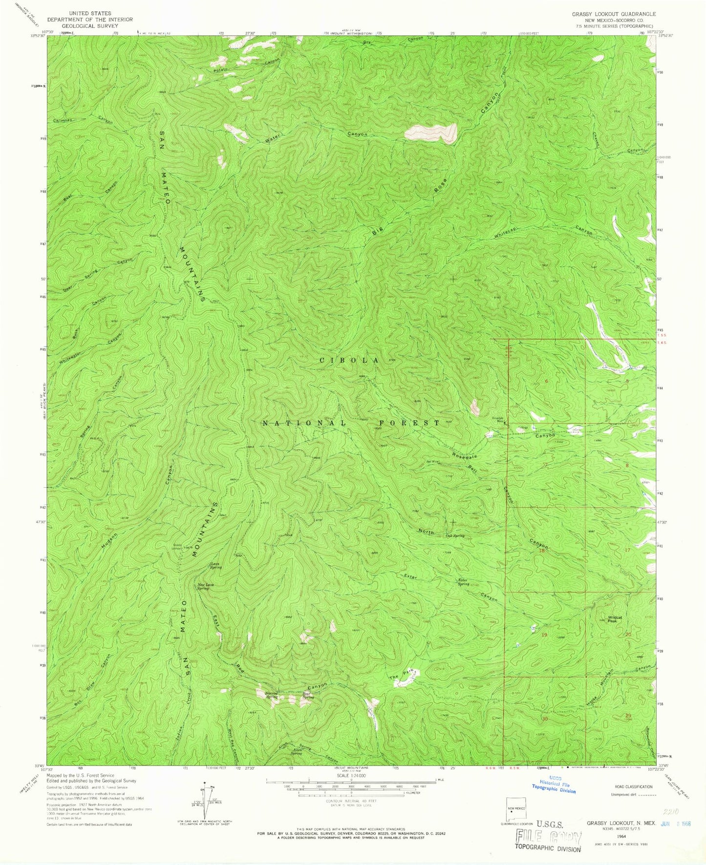
MyTopo
Classic USGS Grassy Lookout New Mexico 7.5'x7.5' Topo Map
Couldn't load pickup availability
Historical USGS topographic quad map of Grassy Lookout in the state of New Mexico. Map scale may vary for some years, but is generally around 1:24,000. Print size is approximately 24" x 27"
This quadrangle is in the following counties: Socorro.
The map contains contour lines, roads, rivers, towns, and lakes. Printed on high-quality waterproof paper with UV fade-resistant inks, and shipped rolled.
Contains the following named places: Allen Spring, Bear Spring, Bell Canyon, Bell Mine, Bell Spring, Big Rosa Tank, Cyanide Tank, Dry Spring, Exter Canyon, Exter Spring, Exter Tank, Fowler Spring, Grassy Lookout, Hudson Spring, Juniper Tank, Lane Prospect, Lava Spring, Leke Spring, Narrow Spring, New Golden Bell Mine, New Lava Spring, Oak Spring, Park Well, Robb Prospect, Rosedale, Rosedale Cemetery, Rosedale Mine, Sanchez Trough Spring, Seven Spring, Shoe Tank, The Park, Tower Peak, Trail Spring, Upper Tank, Water Canyon, Water Spring, Whitecap Tank, Wildcat Peak