MyTopo
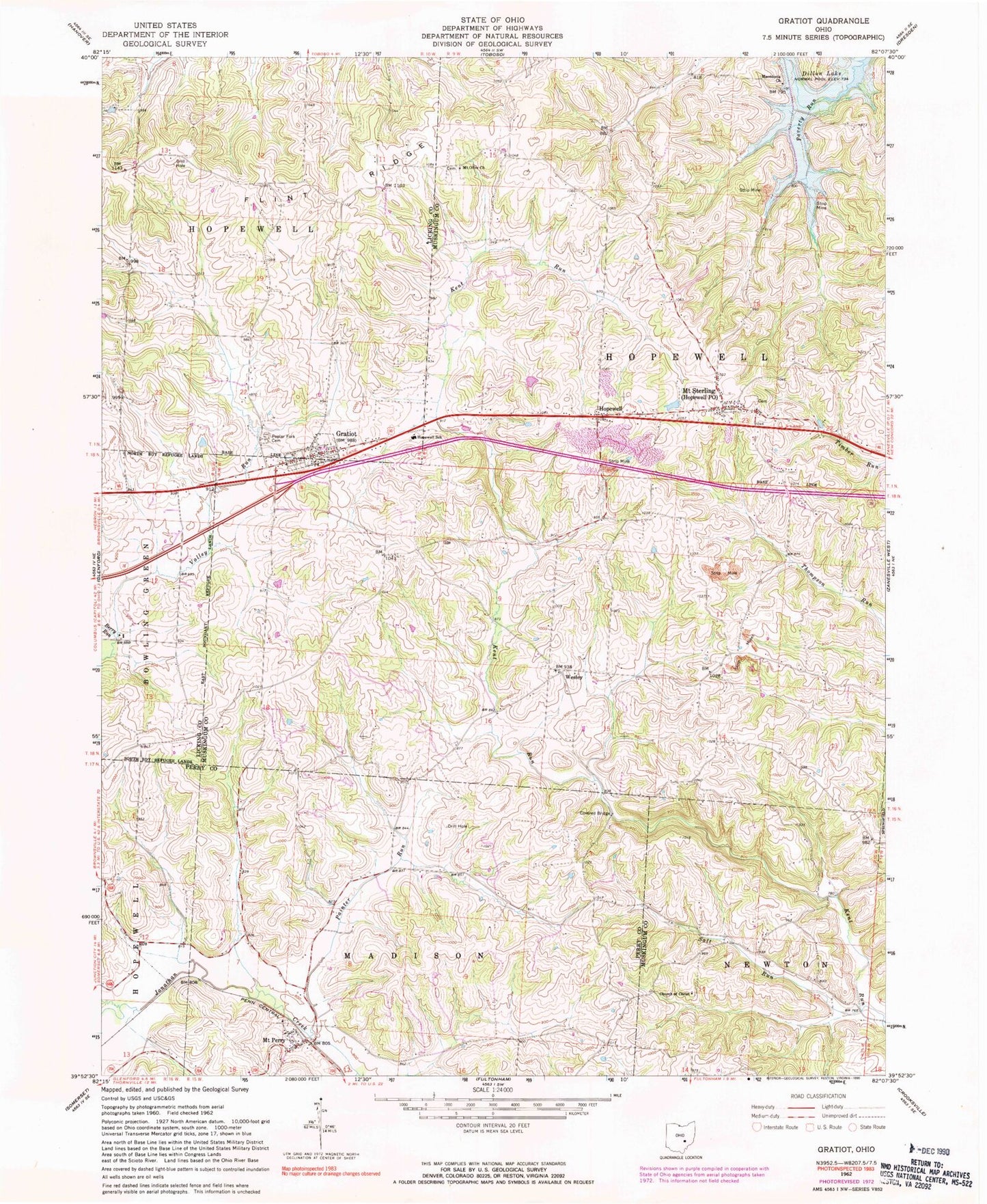
Classic USGS Gratiot Ohio 7.5'x7.5' Topo Map
Couldn't load pickup availability
Historical USGS topographic quad map of Gratiot in the state of Ohio. Map scale may vary for some years, but is generally around 1:24,000. Print size is approximately 24" x 27"
This quadrangle is in the following counties: Licking, Muskingum, Perry.
The map contains contour lines, roads, rivers, towns, and lakes. Printed on high-quality waterproof paper with UV fade-resistant inks, and shipped rolled.
Contains the following named places: Asbury Chapel, Asbury School, Berry Run, Brushy Knob School, Church of Christ, Dogwood School, George School, Gratiot, Gratiot Post Office, Gratiot United Methodist Church, Hopewell, Hopewell Elementary School, Hopewell Post Office, Hopewell Union Church, Humphrey School, Ireland School, Jacks Hollow Bridge, Macedonia United Brethren Church, Mount Olive Lutheran Cemetery, Mount Olive United Brethren Church, Mount Perry, Mount Perry Cemetery, Mount Perry Post Office, Mount Sterling, Mount Sterling Cemetery, Mount Sterling Methodist Church, National Trail Volunteer Fire Department, Old Presbyterian Cemetery, Opera, Opera Post Office, Painter Run, Poplar Fork Cemetery, Porter Airport, Porter Lake, Porter Lake Dam, Poverty Run School, Salt Run, Township of Hopewell, Village of Gratiot, Wesley, Wise School, ZIP Codes: 43740, 43746, 43760