MyTopo
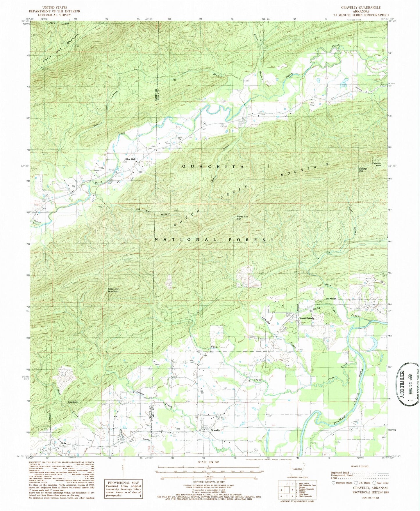
Classic USGS Gravelly Arkansas 7.5'x7.5' Topo Map
Couldn't load pickup availability
Historical USGS topographic quad map of Gravelly in the state of Arkansas. Map scale may vary for some years, but is generally around 1:24,000. Print size is approximately 24" x 27"
This quadrangle is in the following counties: Scott, Yell.
The map contains contour lines, roads, rivers, towns, and lakes. Printed on high-quality waterproof paper with UV fade-resistant inks, and shipped rolled.
Contains the following named places: Blue Ball, Blue Ball Volunteer Fire Station, Briscoe Creek, Callahan Gap, Callahan Knob, Cane Creek, Cedar Branch, Cedar Creek, Chop Off Mountain, Cudd Creek, Dutch Creek Mountain, Dutch Creek Mountain Scenic Area, Egypt Cemetery, Eli Branch, Gravelly, Gravelly Post Office, Honey Cut Gap, Lofland Creek, Mount Pleasant Church, Mount Vernon Church, Mulberry Church, Nola, Oil Well Hollow, Park Creek, Parks Cemetery, Pollard Branch, Red Hill Cemetery, Rock Creek, Rocky Ford School, Sinco Branch, Tate Town Church, Township of Dutch Creek, Township of Gravelly Hill, Township of Jones, West Fourche Fire Department, Young Gravelly, Young Gravelly Cemetery, ZIP Code: 72838