MyTopo
Classic USGS Gravely Mountain Montana 7.5'x7.5' Topo Map
Regular price
$16.95
Regular price
Sale price
$16.95
Unit price
per
Couldn't load pickup availability
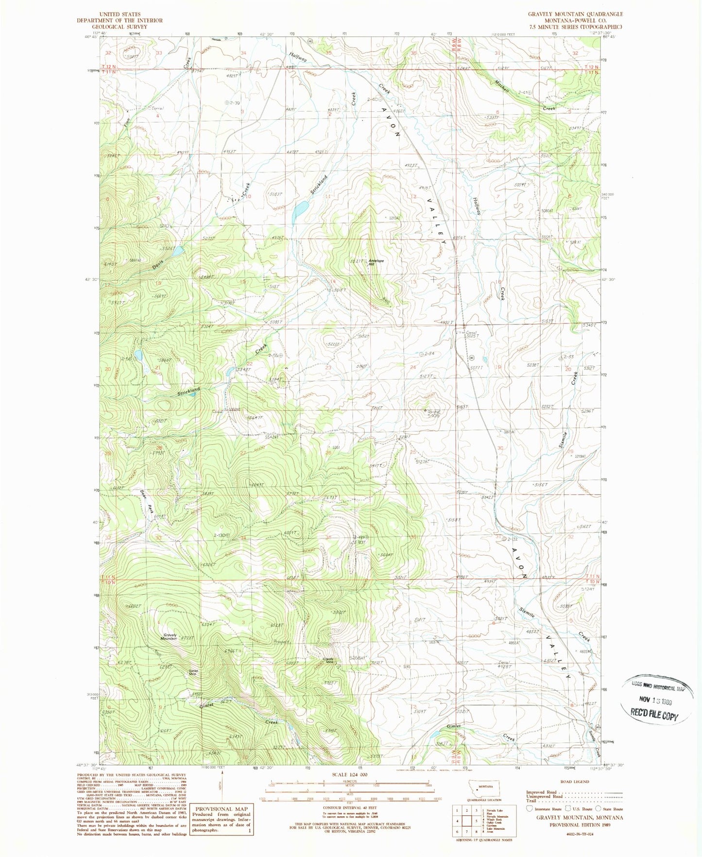
Historical USGS topographic quad map of Gravely Mountain in the state of Montana. Map scale may vary for some years, but is generally around 1:24,000. Print size is approximately 24" x 27"
This quadrangle is in the following counties: Powell.
The map contains contour lines, roads, rivers, towns, and lakes. Printed on high-quality waterproof paper with UV fade-resistant inks, and shipped rolled.
Contains the following named places: 10N08W06AADD01 Well, 11N09W10CACA01 Well, Antelope Hill, Davis Creek, Deer Park, Dupont Number 1 Dam, Dupont Number 2 Dam, Gimlet Mine, Gravely Mine, Gravely Mountain, Halfway House, McKay Creek, Parker Reservoir Dam, Priced Name Dam, Strickland Creek