MyTopo
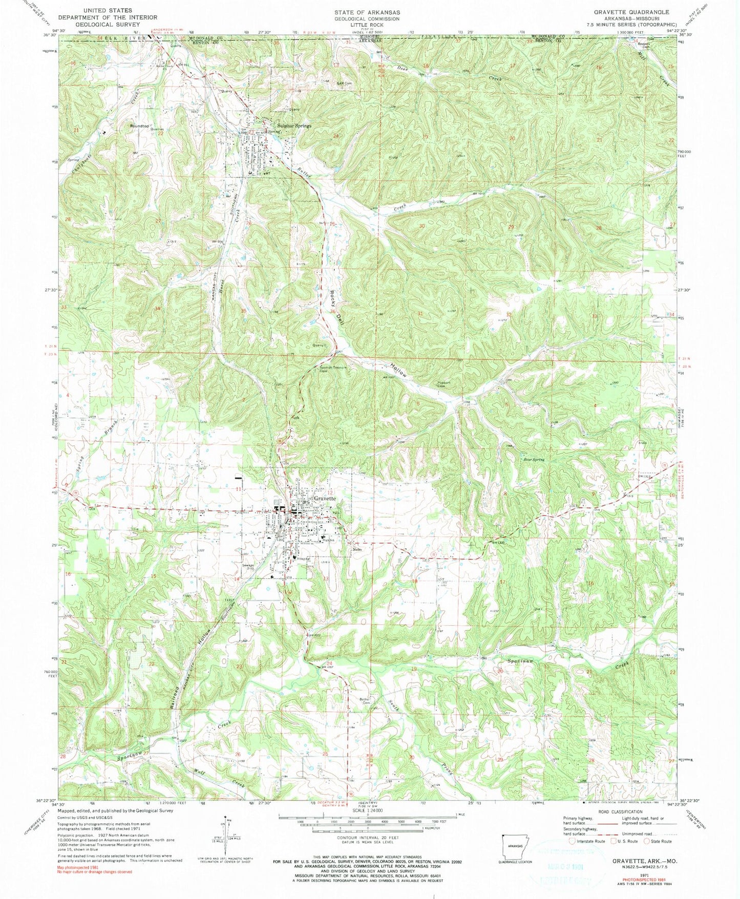
Classic USGS Gravette Arkansas 7.5'x7.5' Topo Map
Couldn't load pickup availability
Historical USGS topographic quad map of Gravette in the states of Arkansas, Missouri. Map scale may vary for some years, but is generally around 1:24,000. Print size is approximately 24" x 27"
This quadrangle is in the following counties: Benton, McDonald.
The map contains contour lines, roads, rivers, towns, and lakes. Printed on high-quality waterproof paper with UV fade-resistant inks, and shipped rolled.
Contains the following named places: Bear Spring, Beavers Cemetery, Bella Vista Field, Bethel Cemetery, Bethel Church, Brown Military Academy of the Ozarks, Butler Creek Baptist Church, Butler Creek Bridge, Butler Creek Cemetery, Butler Creek School, Circle L Ranch, City of Sulphur Springs, Cottage Grove School, Dorsey, Eagle Rock Farms, Eldred Farms, Field Kindley Memorial Park, Gallatin, Glenn Duffy Elementary School, Grand Army of the Republic Cemetery, Gravette, Gravette Fire Department, Gravette Fire Department Ambulance, Gravette High School, Gravette Middle School, Gravette Police Department, Gravette Post Office, Gravette Upper Elementary School, Hillcrest Cemetery, Holts Mill, Horse Creek, Nebo, Ozarks Community Hospital of Gravette, Pattons Mill, Pond, R B Farms, Railroad Hollow, Rattlesnake Hollow, Rocky Dell Hollow, Rocky Dell School, Round Top, Roundtop, Seilers Branch, South Prong Spavinaw Creek, Spavinaw Creek Bridge, Sulphur Springs, Sulphur Springs City Park, Sulphur Springs Fire Station, Sulphur Springs High School, Sulphur Springs Police Department, Sulphur Springs Post Office, Sycamore School, Township 11, Township of Sulphur Springs, Township of Wallace, Whitman Farm, Wolf Creek, ZIP Codes: 72736, 72768