MyTopo
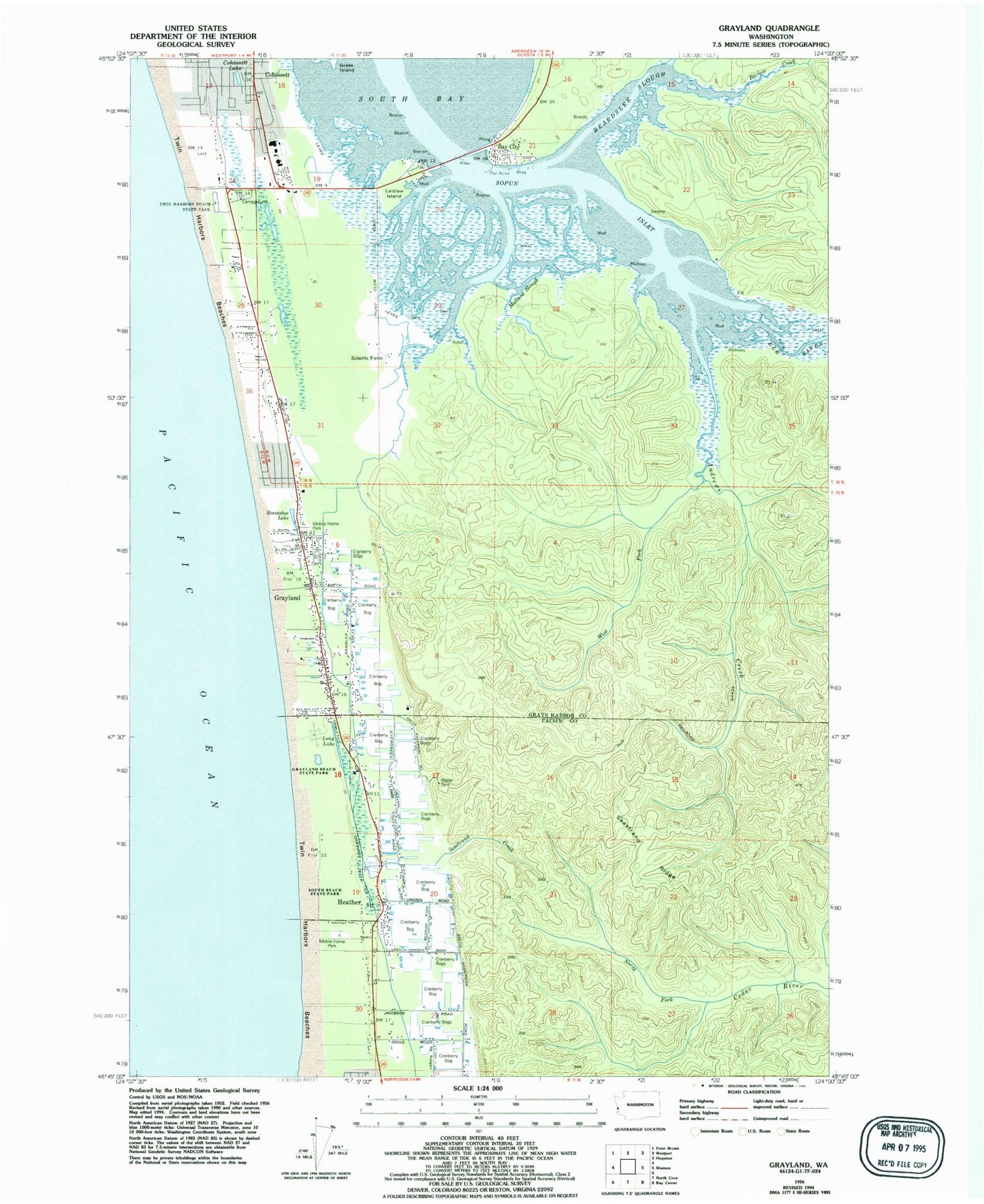
Classic USGS Grayland Washington 7.5'x7.5' Topo Map
Couldn't load pickup availability
Historical USGS topographic quad map of Grayland in the state of Washington. Map scale may vary for some years, but is generally around 1:24,000. Print size is approximately 24" x 27"
This quadrangle is in the following counties: Grays Harbor, Pacific.
The map contains contour lines, roads, rivers, towns, and lakes. Printed on high-quality waterproof paper with UV fade-resistant inks, and shipped rolled.
Contains the following named places: Andrews Creek, Barlow Creek, Bay City, Beardslee Slough, Benn, Coastal Community Church, Cohassett, Cohassett Beach, Cohassett Beach Census Designated Place, Cohassett Lake, Dempsey Creek, Drainage Ditch Number 1, Elk River, Furford Cranberry Museum, Grayland, Grayland Access State Park, Grayland Beach State Park, Grayland Census Designated Place, Grayland Intergalactic Airport, Grayland Post Office, Grays Harbor Fire District 11 Grayland Fire Department, Heather, Horseshoe Lake, Kenanna Recreational Vehicle Park, Laidlaw Island, Laidlow, Long Lake, Lutheran Church of Twin Harbors, Mallard Slough, North Fork Cedar River, Ocosta Elementary School, Ocosta Junior and Senior High School, Ocosta School District 172 Office, Pacific County Fire District 5 North Cove Tokeland Shoalwater Bay Volunteer Fire Station 1, Roberts Farm, Saint Paul's Catholic Church, Seastrand Creek, Seastrand Ridge, Sopun Inlet, South Beach Christian Center, South Beach Christian Daycare Center, South Beach State Park, The Church of Jesus Christ of Latter Day Saints, Twin Harbors Beach State Park, Twin Harbors Beaches, West Fork Andrews Creek, Westport Division, ZIP Code: 98547