MyTopo
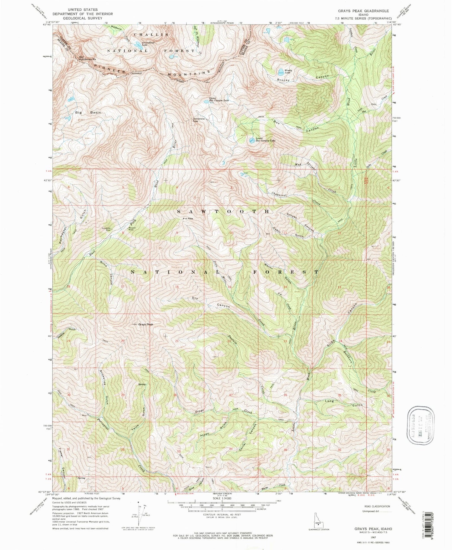
Classic USGS Grays Peak Idaho 7.5'x7.5' Topo Map
Couldn't load pickup availability
Historical USGS topographic quad map of Grays Peak in the state of Idaho. Typical map scale is 1:24,000, but may vary for certain years, if available. Print size: 24" x 27"
This quadrangle is in the following counties: Blaine, Custer.
The map contains contour lines, roads, rivers, towns, and lakes. Printed on high-quality waterproof paper with UV fade-resistant inks, and shipped rolled.
Contains the following named places: Pasture Creek, Arrowhead Lake, Aspen Gulch, Baron Gulch, Big Basin, Blind Canyon, Box Canyon, Brocky Canyon, Buckhorn Creek, Burks Creek, Cabin Gulch, Chaparral Creek, Corral Canyon, Dry Canyon, Grays Creek, Grays Peak, Iron Mine Creek, Johnstone Pass, Laidlaw Creek, Long Gulch, Lower Box Canyon Lake, Mandolin Creek, Mascot Mine, Mud Springs Creek, Old Hyndman Peak, P K Pass, Pot Creek, Schuss Canyon, Slide Canyon, Snowslide Gulch, Soda Creek, Sunshine Mine, T P Creek, Talus Gulch, Upper Box Canyon Lake, Windy Lake