MyTopo
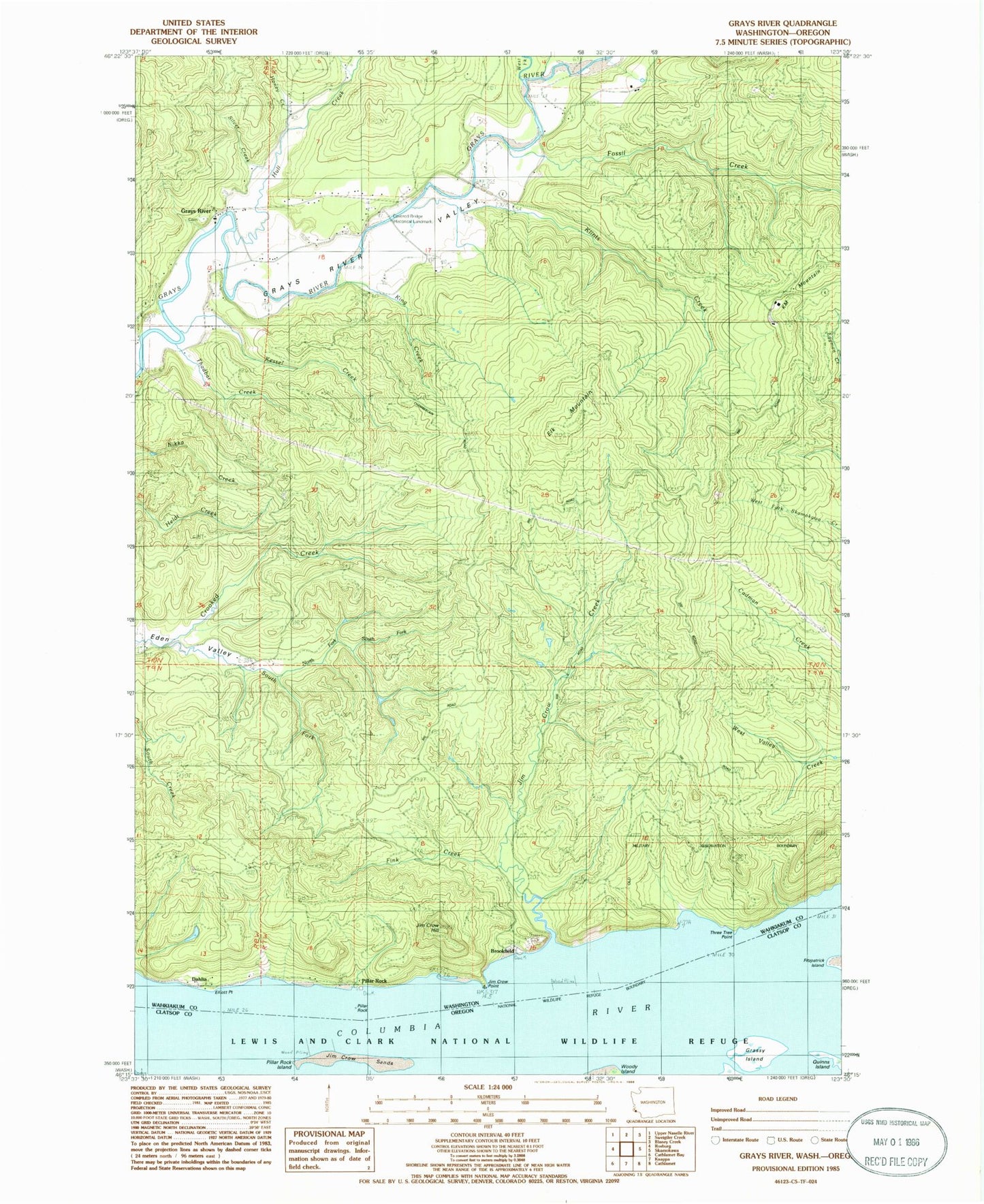
Classic USGS Grays River Washington 7.5'x7.5' Topo Map
Couldn't load pickup availability
Historical USGS topographic quad map of Grays River in the states of Washington, Oregon. Map scale may vary for some years, but is generally around 1:24,000. Print size is approximately 24" x 27"
This quadrangle is in the following counties: Clatsop, Wahkiakum.
The map contains contour lines, roads, rivers, towns, and lakes. Printed on high-quality waterproof paper with UV fade-resistant inks, and shipped rolled.
Contains the following named places: Altoona Census Designated Place, Beare Hill, Brookfield, Brookfield Point, Dahlia, Elk Mountain, Elliot School, Elliott Point, Fall Creek, Fink Creek, Fossil Creek, Grassy Island, Grays River, Grays River Bridge, Grays River Census Designated Place, Grays River Covered Bridge, Grays River Division, Grays River Methodist Church, Harlows Creek, Honey Creek, Hull Creek, Kessel Creek, King Creek, Klints Creek, KM Mountain, North Fork South Fork Crooked Creek, Pillar Rock, Pillar Rock Cannery, Pillar Rock Dam Number One, Pillar Rock Dam Number Two, Pillar Rock Island, Pillar Rock Lower Range, Pillar Rock Upper Range, Silver Creek, South Fork Crooked Creek, Thadbar Creek, Three Tree Point, Wahkiakum Fire District 3 Grays River Fire Department, Welch Island Reach, West Fork Grays River, ZIP Code: 98643