MyTopo
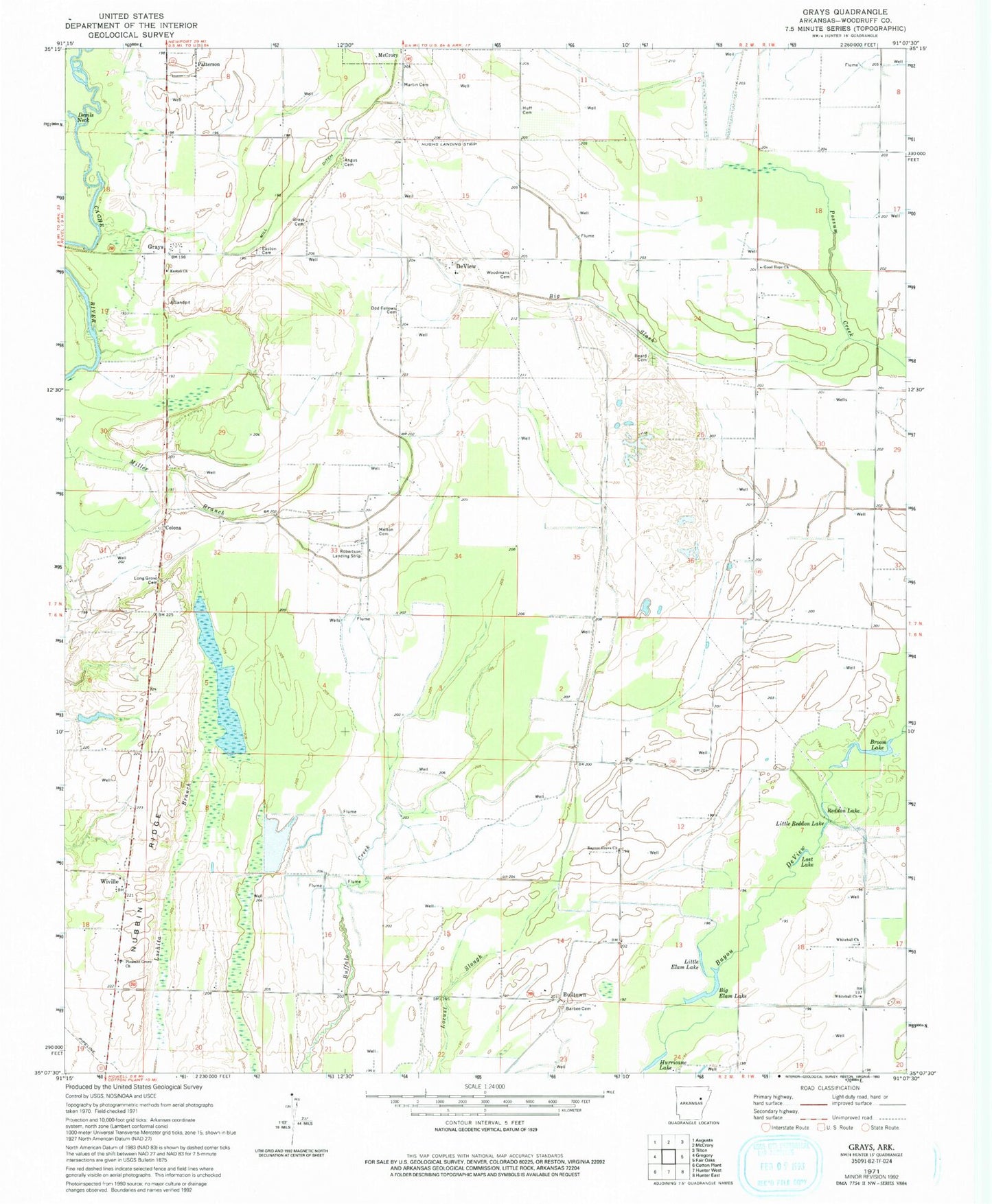
Classic USGS Grays Arkansas 7.5'x7.5' Topo Map
Couldn't load pickup availability
Historical USGS topographic quad map of Grays in the state of Arkansas. Map scale may vary for some years, but is generally around 1:24,000. Print size is approximately 24" x 27"
This quadrangle is in the following counties: Woodruff.
The map contains contour lines, roads, rivers, towns, and lakes. Printed on high-quality waterproof paper with UV fade-resistant inks, and shipped rolled.
Contains the following named places: Angus Cemetery, Barbee Cemetery, Beard Cemetery, Beard School, Big Elam Lake, Big Slash, Broom Lake, Bulltown, Colona, DeView, DeView United Methodist Church, Devils Neck, Easton Cemetery, Easton Church, Good Hope Baptist Church, Gray Cemetery, Grays, Harris Church, Huff Cemetery, Hughes Landing Strip, Hurricane Lake, Little Elam Lake, Little Reddon Lake, Long Grove Cemetery, Long Grove Church, Loshita Branch, Lost Lake, Martin Cemetery, Melton Cemetery, Mill Ditch, Nubbin Ridge, Pleasant Grove Baptist Church, Raynor Grove Church, Reddon Lake, Robertson Airport, Tip, Township of Cache, Township of De View, Whitehall Cemetery, Whitehall Church, Wiville, Woodmans Cemetery, Woodruff County, ZIP Code: 72101