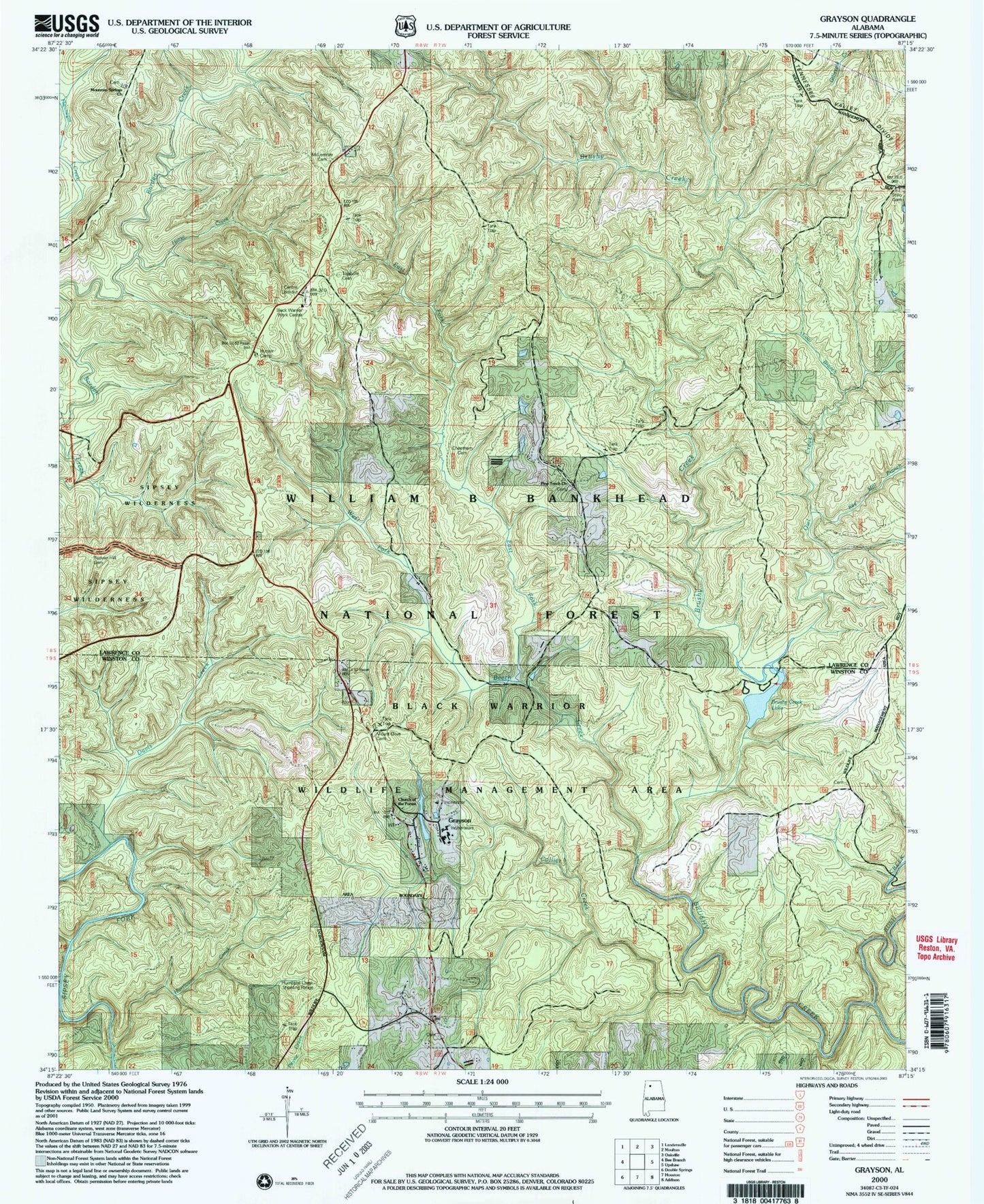
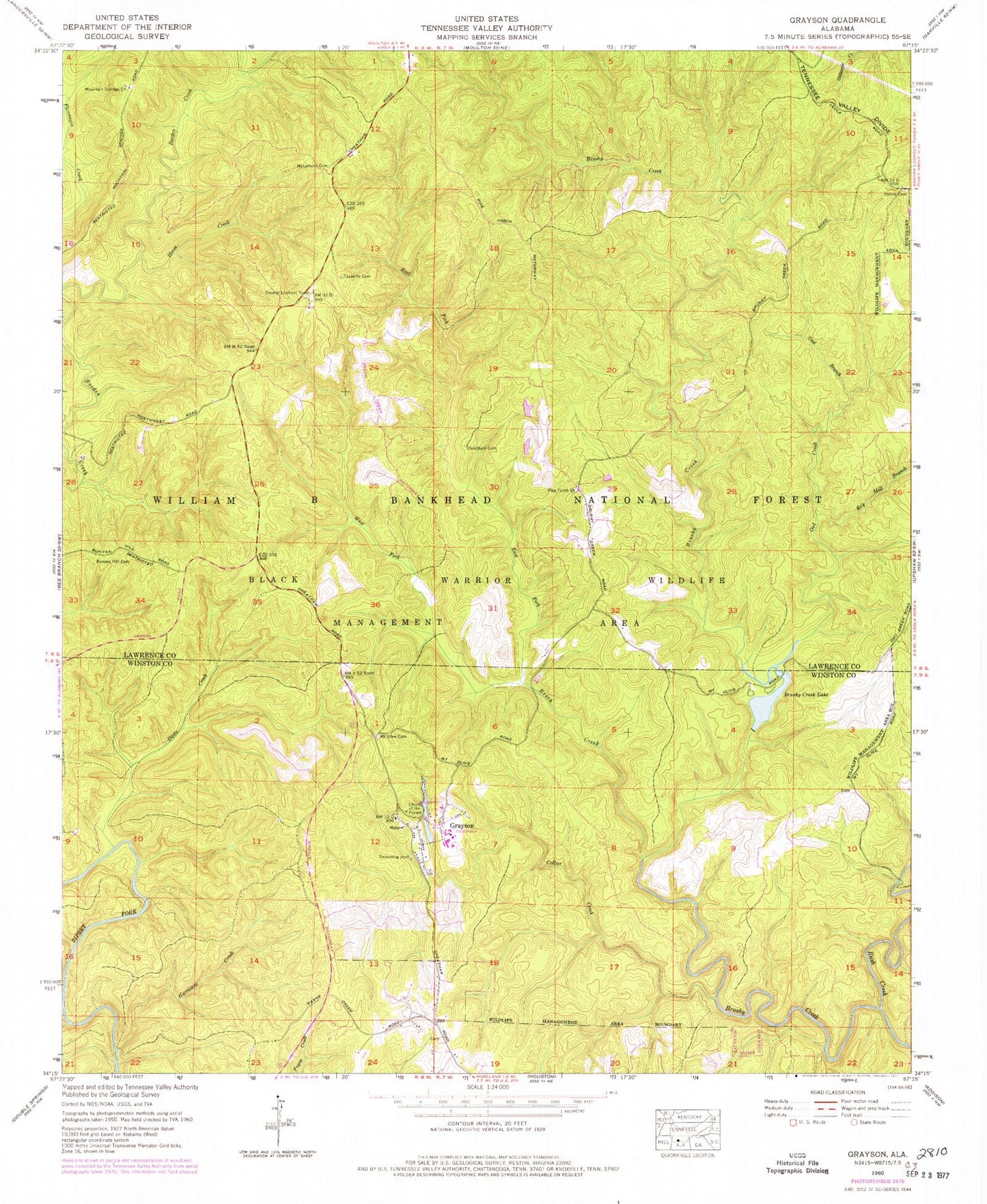
MyTopo
Classic USGS Grayson Alabama 7.5'x7.5' Topo Map
Couldn't load pickup availability
Historical USGS topographic quad map of Grayson in the state of Alabama. Typical map scale is 1:24,000, but may vary for certain years, if available. Print size: 24" x 27"
This quadrangle is in the following counties: Lawrence, Winston.
The map contains contour lines, roads, rivers, towns, and lakes. Printed on high-quality waterproof paper with UV fade-resistant inks, and shipped rolled.
Contains the following named places: Beech Creek, Black Warrior Wildlife Management Area, Brushy Creek Lake, Bunyan Hill Cemetery, Stiles Cemetery, Church of the Forest, Coal Branch, Collier Creek, Davis Creek, East Fork Beech Creek, Grayson, Horse Creek, Hurricane Creek, Key Mill Branch, McLemore Cemetery, Montgomery Creek, Mount Olive Cemetery, Mountain Springs Church, Owl Creek, Pine Torch Church, Rush Creek, Shiloh Cemetery, Tapsville Cemetery, West Fork Beech Creek, Grayson Lake, Grayson Lake Dam, Brushy Creek Lake Dam, Fairview Church (historical), Hepsidam, Peters Mill (historical), Pine Torch School (historical), Poplar Springs School (historical), Gum Pond (historical), Hunter Camp, Black Warrior Work Center, Hurricane Creek Shooting Range, Shiloh Church, Central Lookout Tower, Brushy Creek Recreational Area, Owl Post Office (historical), Oplee Post Office (historical), Ellaville, Ellaville Post Office (historical), Grayson Post Office (historical), Collier Creek Post Office (historical), Collier Creek Canyon, McDougal Hunter Camp, McDougal Ridge, Lloyds Canyon, Lloyds Creek, Paines Mill (historical), Holmes Chapel School (historical), Mount Olive School (historical), Holmes Chapel Cemetery, Morgan Cemetery