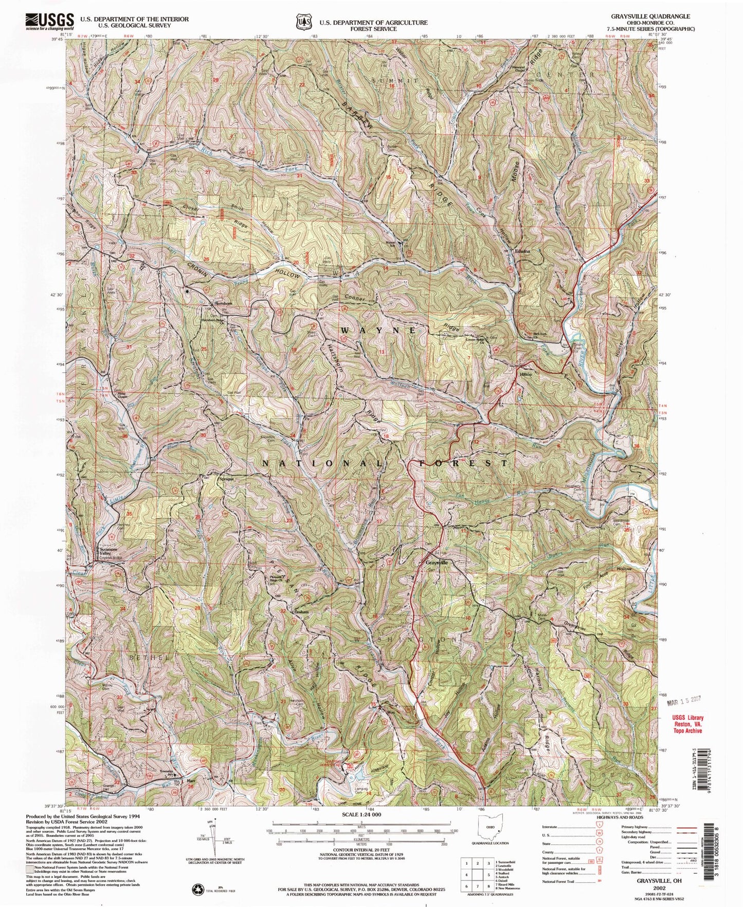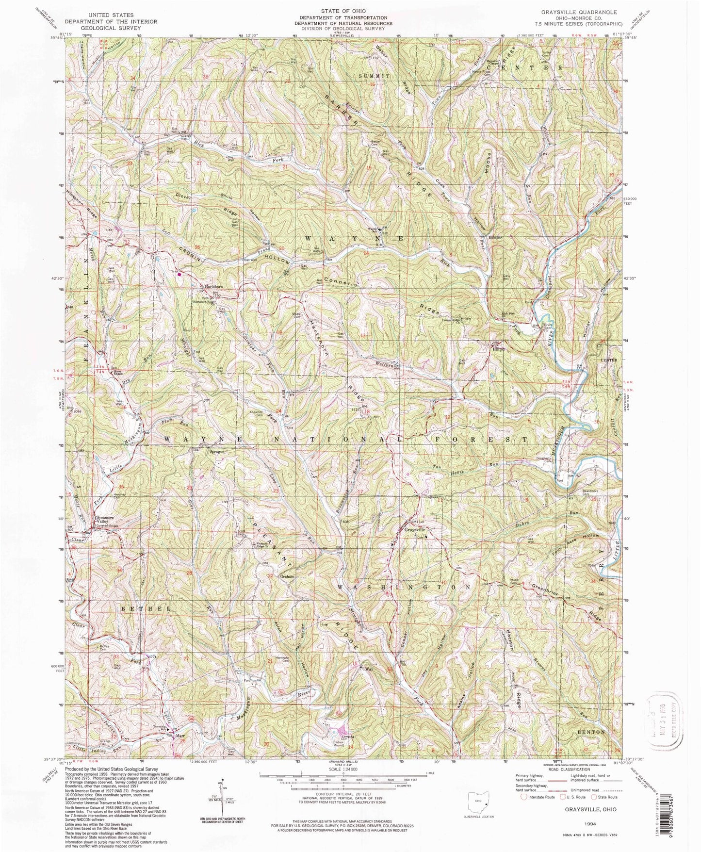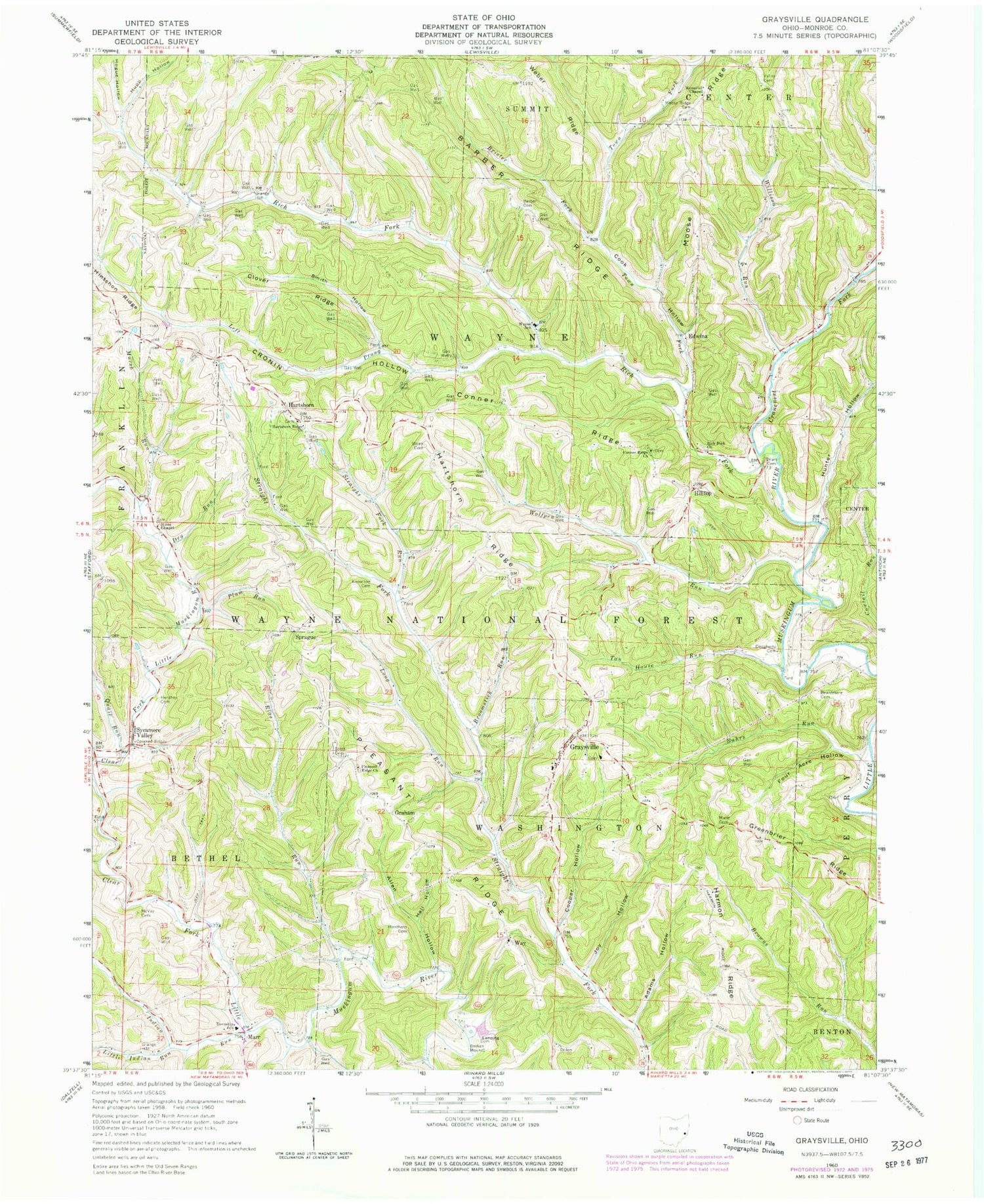
MyTopo
Classic USGS Graysville Ohio 7.5'x7.5' Topo Map
Couldn't load pickup availability
Historical USGS topographic quad map of Graysville in the state of Ohio. Map scale may vary for some years, but is generally around 1:24,000. Print size is approximately 24" x 27"
This quadrangle is in the following counties: Monroe.
The map contains contour lines, roads, rivers, towns, and lakes. Printed on high-quality waterproof paper with UV fade-resistant inks, and shipped rolled.
Contains the following named places: Adams Hollow, Allen Hollow, Barber Cemetery, Barber Ridge, Beardmore Cemetery, Bethel Elementary School, Bethel Township Volunteer Fire Department, Brister Fork, Broomstick Run, Buhrs Run, Clover Ridge, Conner Ridge, Conners Ridge Cemetery, Connor Ridge Methodist Church, Cook Hollow, Cooper Hollow, Cranenest Fork, Cronin Hollow, Dougherty Cemetery, Drum Cemetery, Dry Run, Edwina, Edwina Post Office, Four Acre Hollow, Graham, Graham Post Office, Grange Hall, Graysville, Graysville Baptist Church, Graysville Cemetery, Graysville Christian Church, Graysville Christian Church Cemetery, Graysville Elementary School, Graysville Volunteer Fire Department, Greenbrier Ridge, Hall Hollow, Harmon Ridge, Hartshorn, Hartshorn Post Office, Hartshorn Ridge, Hartshorn Ridge Cemetery, Hartshorn Ridge Church, Henthorn Cemetery, Hershey Cemetery, Hilltop, Hines Chapel, Hines Chapel Cemetery, Hintshon Ridge, Hogue Hollow, Hunter Hollow, Hupp Hollow, Indian Run, Joy Hollow, Knowlton Cemetery, Lamping Cemetery, Lamping Homestead Picnic Area, Lamping Homestead Picnic Grounds Pond, Lamping Homestead Recreation Area, Lamping Trail, Left Prong Rich Fork, Little Indian Run, Long Run, Mann Cemetery, Marr, Marr Post Office, McVay Cemetery, Memorial Chapel, Monroe County Emergency Medical Services Squad 6 Bethel and Graysville, Moose Ridge Cemetery, Mursh Run, Pleasant Ridge, Pleasant Ridge Cemetery, Pleasant Ridge Church, Plum Run, Quail Run, Rias Run, Rich Fork, Rich Fork Church, Scott Cemetery, Sloan Cemetery, Smith Hollow, Sprague, Sprague Post Office, Straight Fork Run, Sycamore Valley, Sycamore Valley Post Office, Tan House Run, Town Fork, Township of Bethel, Township of Washington, Township of Wayne, Valley Cemetery, Village of Graysville, Way, Way Post Office, Wayne School, Weber Ridge, Willison Run, Wolfpen Run, ZIP Code: 45734