MyTopo
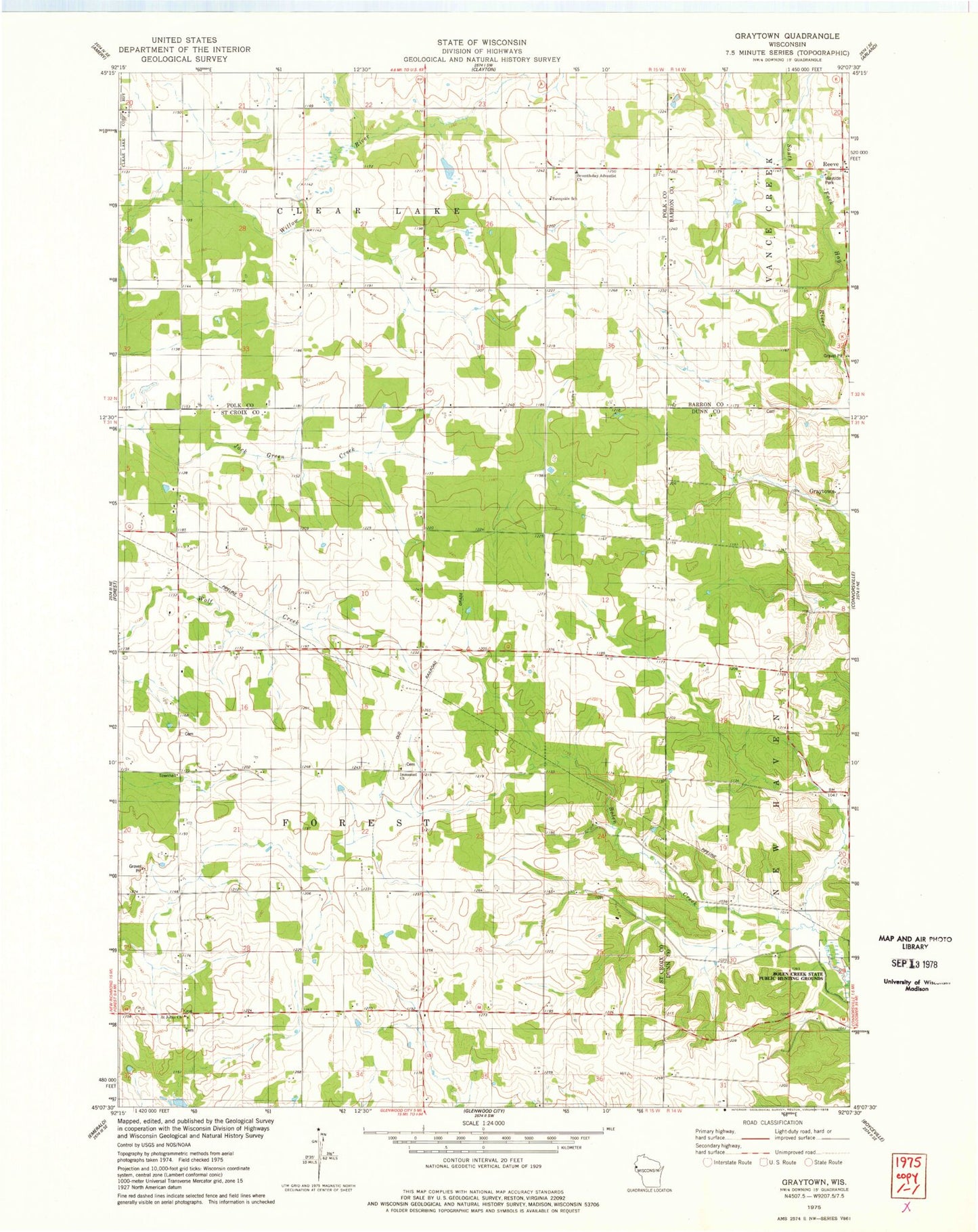
Classic USGS Graytown Wisconsin 7.5'x7.5' Topo Map
Couldn't load pickup availability
Historical USGS topographic quad map of Graytown in the state of Wisconsin. Map scale may vary for some years, but is generally around 1:24,000. Print size is approximately 24" x 27"
This quadrangle is in the following counties: Barron, Dunn, Polk, St. Croix.
The map contains contour lines, roads, rivers, towns, and lakes. Printed on high-quality waterproof paper with UV fade-resistant inks, and shipped rolled.
Contains the following named places: Bolen Creek State Public Hunting Grounds, Camp Fourteen School, D and D Dairy, Forest Townhall, Graytown, Hilson School, Immanuel Church, Reeve, Reeve School, Saint Johns Church, Seventh Day Adventist Church, Sunnydale School, Sunnyside School, Tellijohn Dairy, Town of Forest, White Birch School, Woodland School, ZIP Code: 54005