MyTopo
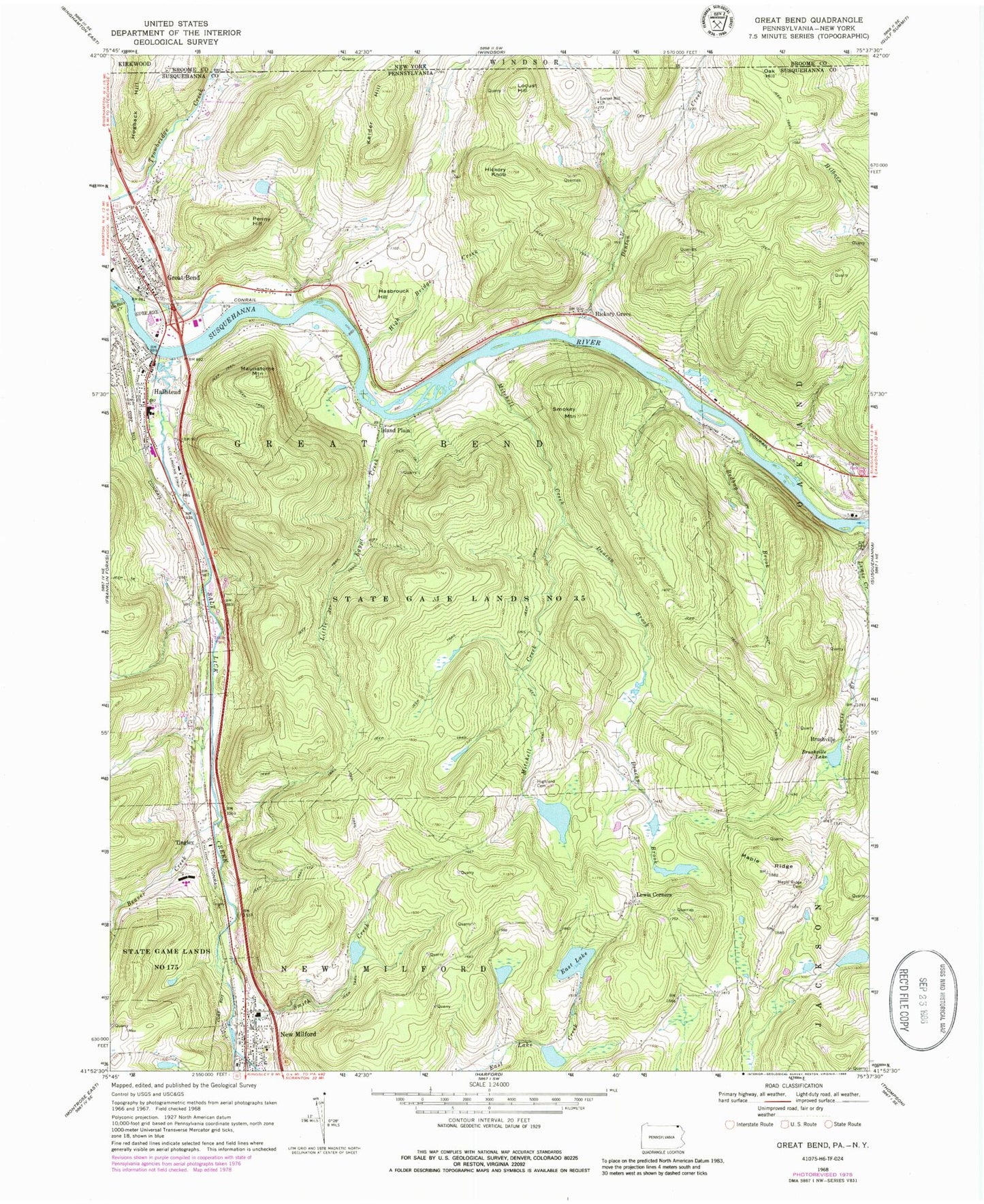
Classic USGS Great Bend Pennsylvania 7.5'x7.5' Topo Map
Couldn't load pickup availability
Historical USGS topographic quad map of Great Bend in the states of Pennsylvania, New York. Typical map scale is 1:24,000, but may vary for certain years, if available. Print size: 24" x 27"
This quadrangle is in the following counties: Broome, Susquehanna.
The map contains contour lines, roads, rivers, towns, and lakes. Printed on high-quality waterproof paper with UV fade-resistant inks, and shipped rolled.
Contains the following named places: Beaver Creek, Bedbug Brook, Brushville, Brushville Lake, Deacon Brook, DuBois Creek, East Lake, Great Bend, Hasbrouck Hill, Hickory Grove, Hickory Knob, High Bridge Creek, Highland Cemetery, Hogback Hill, Island Plain, Kelder Hill, Lewis Corners, Little Egypt Creek, Locust Hill, Locust Hill Church, Maple Ridge, Maple Ridge Cemetery, Maunatome Mountain, Meylert Creek, Mitchell Creek, Penny Hill, Salt Lick Creek, Smith Creek, Smokey Mountain, State Game Lands Number 175, Tingley, Hallstead, Oak Hill, Hallstead Airport (historical), Fulles Lake Dam, Fullers Lake, Dranchak Dam, Woodbridge Island, Beaver Creek, Maple Ridge School, Brushville School (historical), Susquehanna Boy Scout Camp, Highland School (historical), Kinney Johnson School, Oak Hill School, East Great Bend School (historical), State Game Lands Number 35, McKinney Airport (historical), Borough of Great Bend, Borough of Hallstead, Borough of New Milford, Township of Great Bend, Hallstead Fire Department, Great Bend Hose Company 1, Columbia Hose Company 1, Great Bend Hallstead Volunteer Ambulance, Great Bend Post Office, Hallstead Post Office, Denton Creek