
MyTopo
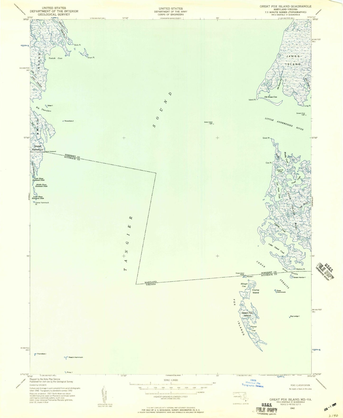
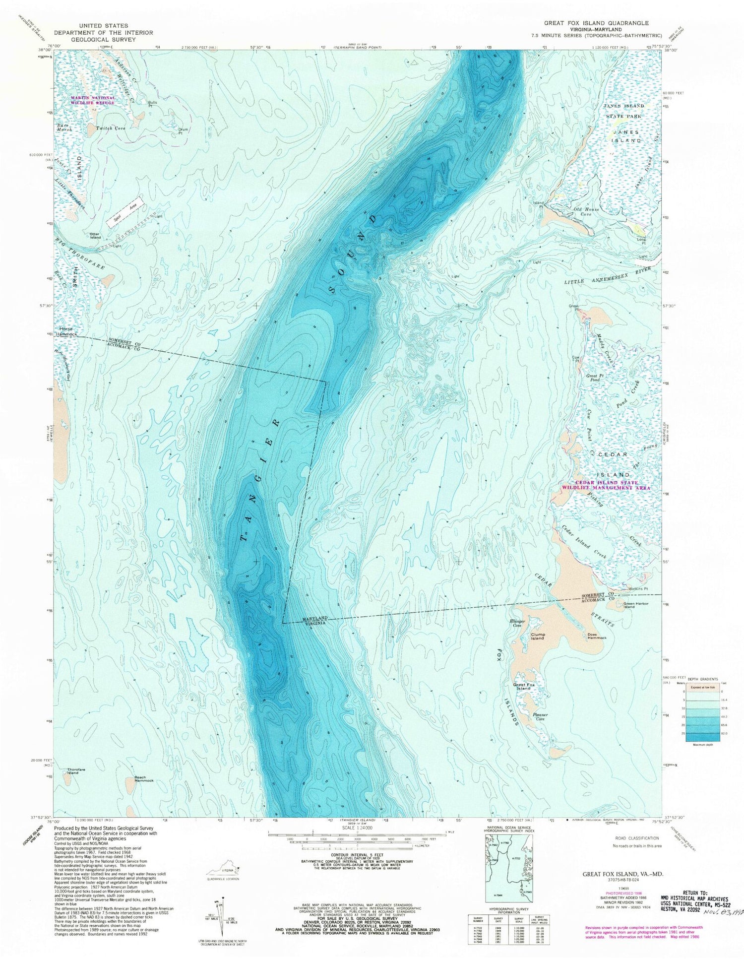
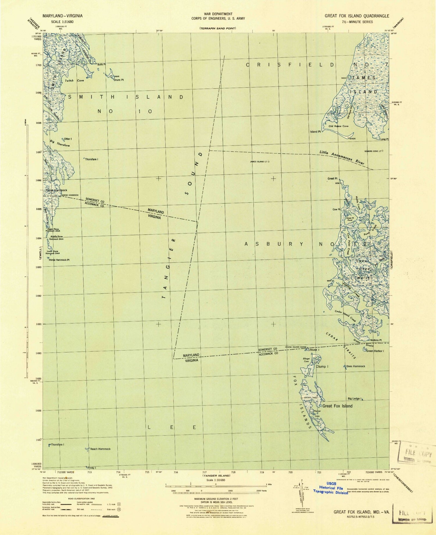
Classic USGS Great Fox Island Virginia 7.5'x7.5' Topo Map
Couldn't load pickup availability
Historical USGS topographic quad map of Great Fox Island in the states of Virginia, Maryland. Map scale may vary for some years, but is generally around 1:24,000. Print size is approximately 24" x 27"
This quadrangle is in the following counties: Accomack, Somerset.
The map contains contour lines, roads, rivers, towns, and lakes. Printed on high-quality waterproof paper with UV fade-resistant inks, and shipped rolled.
Contains the following named places: Anderson Creek, Bulls Point, Cedar Island, Cedar Island Creek, Cedar Island State Wildlife Management Area, Cedar Straits, Clump Island, Cow Point, Cow Point Creek, District 7 Crisfield, Does Hammock, Drum Point, Ellinger Cove, Fishing Creek, Fox Islands, Great Fox Island, Great Point, Great Point Pond, Green Harbor Island, Green Straits, Horse Hammock, Horse Hammock Gut, Horse Hammock Point, House Island, Island Point, Janes Island Gut, Janes Island Light, Little Annemessex River, Little Thorofare, Long Point, Muddy Creek, Old House Cove, Otter Island, Planner Cove, Pond Creek, Reach Hammock, Rock Creek, Somers Cove Lighthouse, Thorofare Island, Twitch Cove, Watkins Point, Watkins Pointe, Wellridge Creek, Yorkshire Island