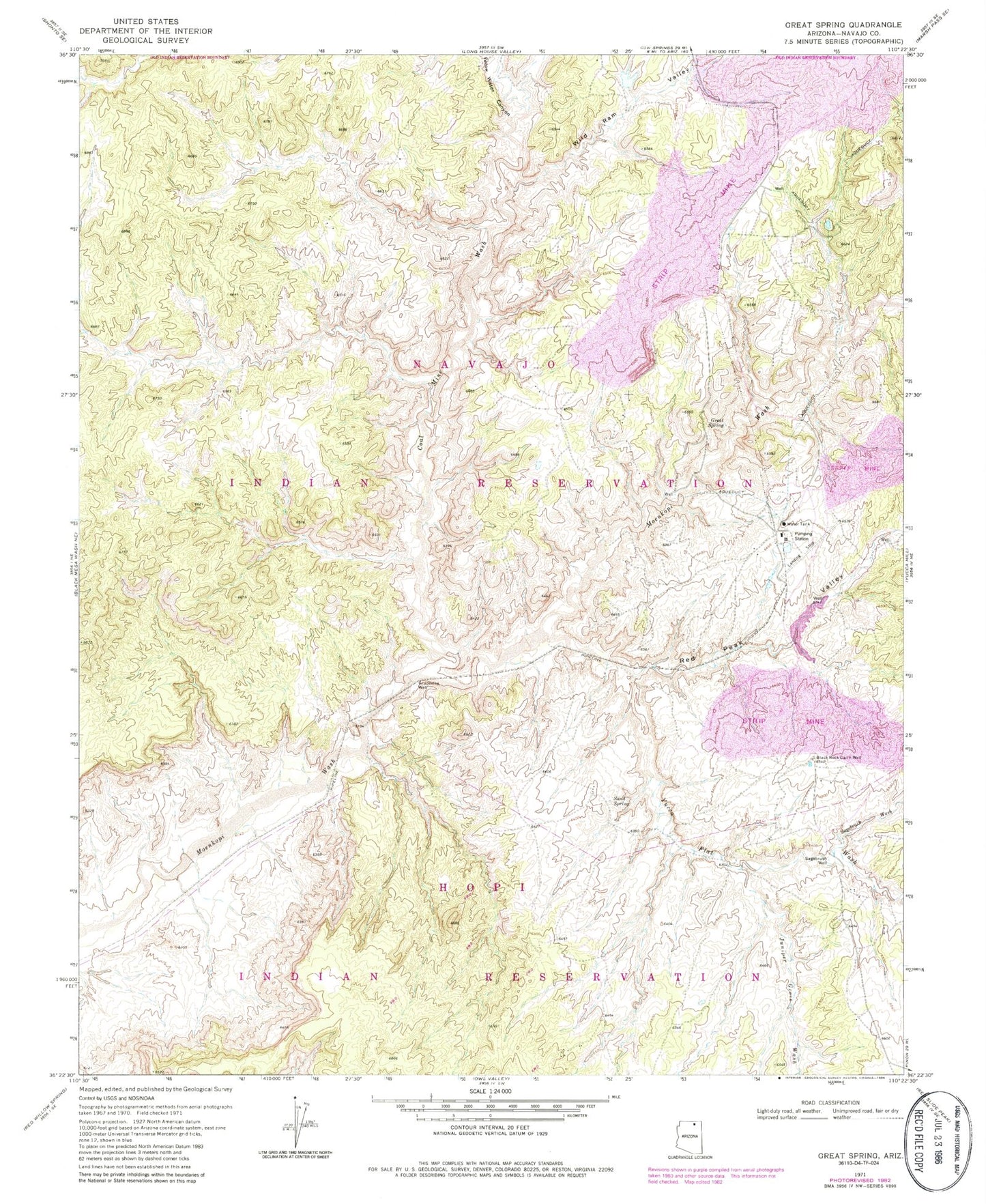
MyTopo
Classic USGS Great Spring Arizona 7.5'x7.5' Topo Map
Regular price
$16.95
Regular price
Sale price
$16.95
Unit price
per
Couldn't load pickup availability
Historical USGS topographic quad map of Great Spring in the state of Arizona. Map scale may vary for some years, but is generally around 1:24,000. Print size is approximately 24" x 27"
This quadrangle is in the following counties: Navajo.
The map contains contour lines, roads, rivers, towns, and lakes. Printed on high-quality waterproof paper with UV fade-resistant inks, and shipped rolled.
Contains the following named places: Black Mesa Pipeline Landing Strip, Black Rock Cairn Well, Coal Mine Wash, Grapevine Well, Great Spring, Juniper Grove Wash, Peabody Bedard Field, Red Peak Valley, Sagebrush Wash, Sagebrush Well, Sand Spring, Wild Ram Valley, Yellow Water Canyon, Yucca Flat Wash