
MyTopo
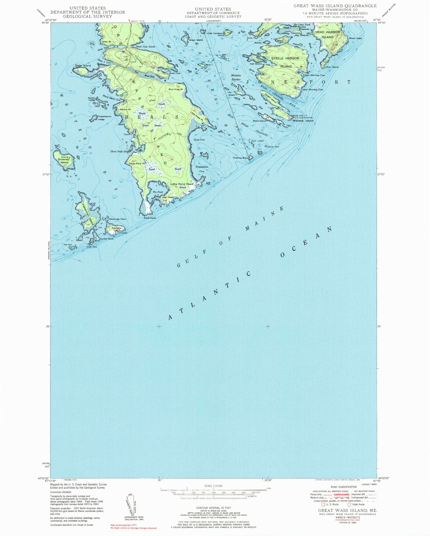
Classic USGS Great Wass Island Maine 7.5'x7.5' Topo Map
Couldn't load pickup availability
Historical USGS topographic quad map of Great Wass Island in the state of Maine. Typical map scale is 1:24,000, but may vary for certain years, if available. Print size: 24" x 27"
This quadrangle is in the following counties: Washington.
The map contains contour lines, roads, rivers, towns, and lakes. Printed on high-quality waterproof paper with UV fade-resistant inks, and shipped rolled.
Contains the following named places: Alley Point, Big Peabody Island, Black Duck Cove, Black Head, Black Island, Black Ledges, Brim Cove, Browney Island, Calf Island, Cape Cove, Channel Rock, Crow Island, Crow Point, Crumple Island, Curlew Rock, Deep Cove, Eastern Bay, Fisherman Island, Great Wass Island, Green Island, Green Island, Green Rock, Hall Cove, Hall Island, Head Harbor, Knight Island, Little Cape Point, Little Hardwood Island, Little Peabody Island, Little Pond Head, Lower Herring Cove, Main Channel Way, Man Island, Mannings Farm, Mash Island, Mink Island, Mistake Harbor, Mistake Island, Money Island, Mud Hole, Mud Hole Channel, Mud Hole Point, Norton Ledge, Norton Point, Pond Point, Popplestone Cove, Popplestone Ledge, Red Head, Sand Cove, Sand Cove North, Seal Rock, Slate Island, Slate Island Cove, The Cows Yard, The Pond, Three Falls Harbor, Three Falls Point, Upper Herring Cove, Water Island, Folkingham Cove, Freeman Rock, Steele Harbor Island, Town of Beals, Great Wass Island Preserve, Moose Peak Light, Mud Hole Trail


