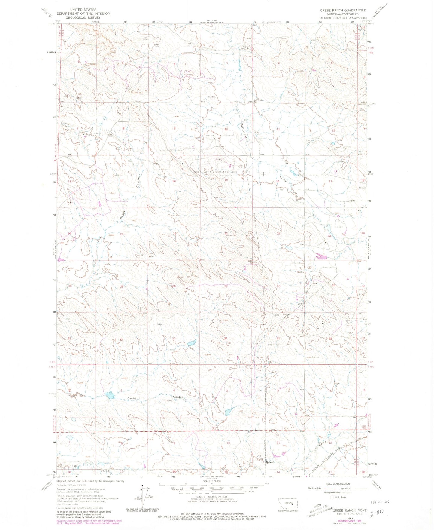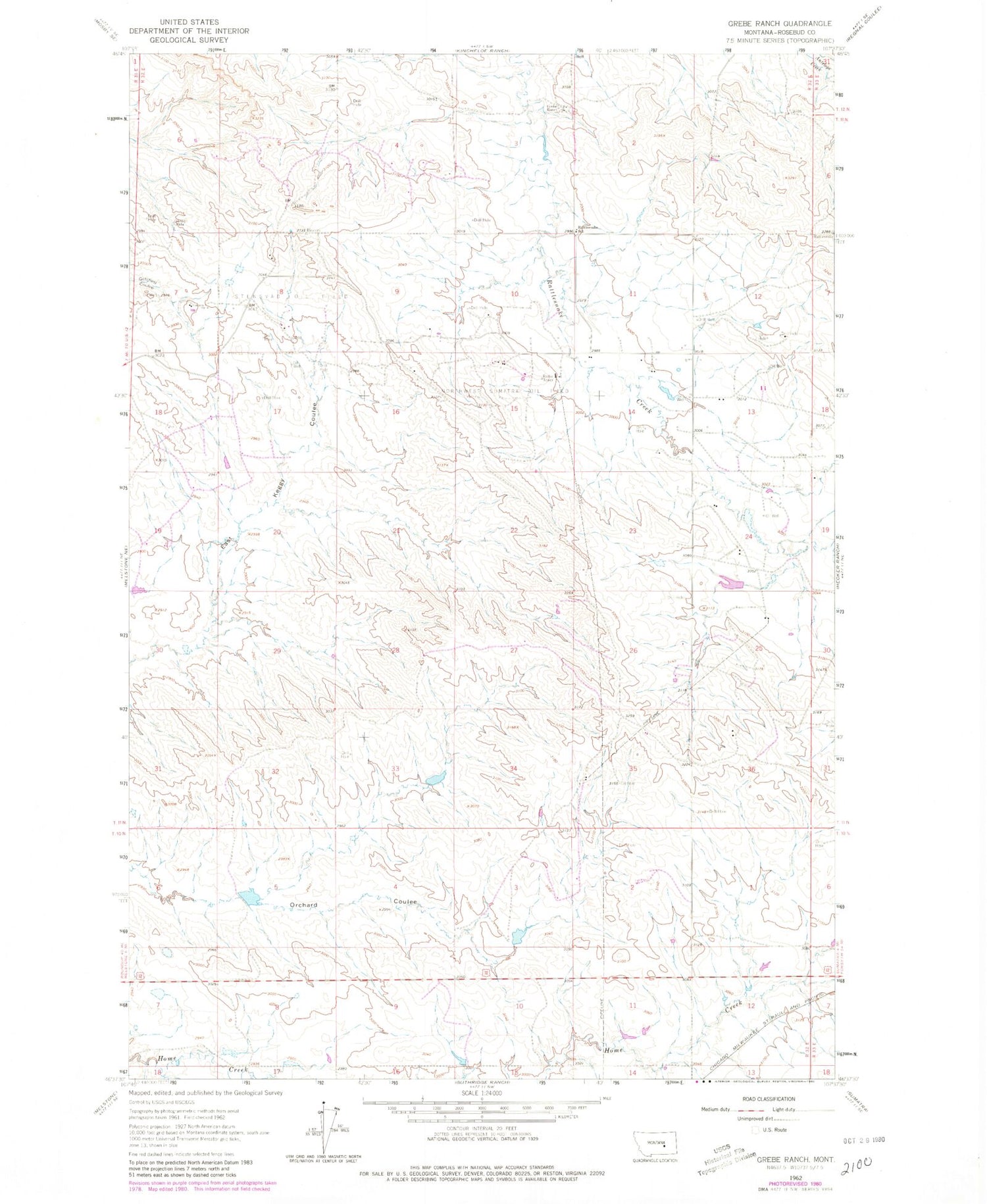
MyTopo
Classic USGS Grebe Ranch Montana 7.5'x7.5' Topo Map
Regular price
$16.95
Regular price
Sale price
$16.95
Unit price
per
Couldn't load pickup availability
Historical USGS topographic quad map of Grebe Ranch in the state of Montana. Map scale may vary for some years, but is generally around 1:24,000. Print size is approximately 24" x 27"
This quadrangle is in the following counties: Rosebud.
The map contains contour lines, roads, rivers, towns, and lakes. Printed on high-quality waterproof paper with UV fade-resistant inks, and shipped rolled.
Contains the following named places: 11N32E15ABAC01 Well, 11N32E24AD__01 Well, 11N32E24ADCD01 Well, 59054, BS Kincheloe Number 5 Dam, BS Kincheloe Number 7 Dam, Grebe Ranch, Northwest Sumatra Oil Field, Rattlesnake School