MyTopo
Classic USGS Greeley Missouri 7.5'x7.5' Topo Map
Couldn't load pickup availability
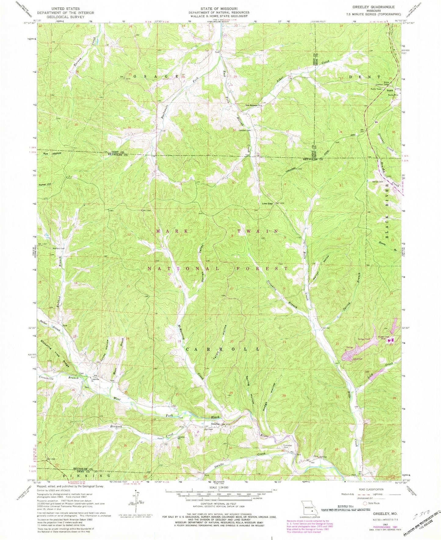
Historical USGS topographic quad map of Greeley in the state of Missouri. Map scale may vary for some years, but is generally around 1:24,000. Print size is approximately 24" x 27"
This quadrangle is in the following counties: Dent, Iron, Reynolds.
The map contains contour lines, roads, rivers, towns, and lakes. Printed on high-quality waterproof paper with UV fade-resistant inks, and shipped rolled.
Contains the following named places: Asher Creek, Barton Cemetery, Bills Creek School, Brushy Creek Mill Reservoir Dam, Brushy Creek Mine, Brushy Creek Mine Water Clarification Dam, Brushy Creek Mine Water Lake, Brushy Creek Tailings Dam, Bucksnort Fork, Buick, Buick Lookout Tower, Buick School, Callahan Cemetery, Camden Cemetery, Crossville Branch, Crossville Church, Elm Spring School, Greeley, Greeley Church, Greeley School, Henpeck Creek, Hodge Hollow, Jones Hollow, Lick Creek, Low Gap, McMurtrey Creek, McMurtrey School, Moore Branch, New Harmony Church, New Zion Church, Number 48 Lake, Parker Branch, Radford Branch, Radford Cemetery, Smalls Creek, Spring Branch, Spring Hollow, Stricklin Branch, Sugar Creek, Tarpit Hollow, Walnut Hollow, Warren Valley, ZIP Code: 65440