MyTopo
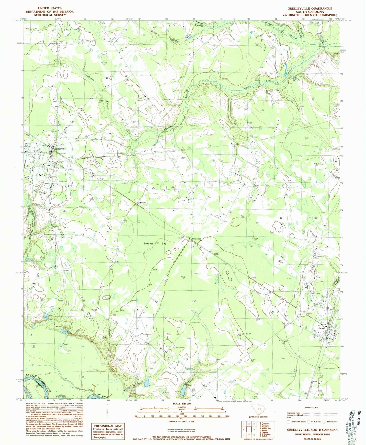
Classic USGS Greeleyville South Carolina 7.5'x7.5' Topo Map
Couldn't load pickup availability
Historical USGS topographic quad map of Greeleyville in the state of South Carolina. Map scale may vary for some years, but is generally around 1:24,000. Print size is approximately 24" x 27"
This quadrangle is in the following counties: Berkeley, Williamsburg.
The map contains contour lines, roads, rivers, towns, and lakes. Printed on high-quality waterproof paper with UV fade-resistant inks, and shipped rolled.
Contains the following named places: Antioch Church, Bennett Swamp, Bethel Church, Bethel School, Burgess Bay, C E Murray High School, Campbell Branch, Chaney Swamp, Dickey Chapel, Edwards, Federal Correctional Institution Williamsburg, Goins School, Greeleyville, Greeleyville Church, Greeleyville Division, Greeleyville Elementary School, Greeleyville Police Department, Greeleyville Post Office, Greeleyville Town Hall, Heineman, Heineman School, Holliman Swamp, Lane, Lane Fire Tower, Lane Post Office, Laws Swamp Church, Long Lands Plantation, Longlands Hope Swamp Pond, Longlands House Pond, Mount Hope Cemetery, Mount Hope Church, Mount Zion Church, Mount Zion School, Mulberry Branch, New Market, Richmond Cemetery, Richmond Church, Rock Hill Church, Rocky Ford Swamp, Saint Agey Church, Shanty Branch, South Carolina Noname 45005 D-3081 Dam, South Carolina Noname 45009 D-3082 Dam, Spring Hill Church, Town of Greeleyville, Town of Lane, Trinity Baptist Church, Union Church, Union School, Walnut Branch, Webber Pond, Webber Pond Dam D-3083, WHLZ-FM (Manning), Williamsburg County Fire Department Station 7, Williamsburg County Volunteer Fire Department