MyTopo
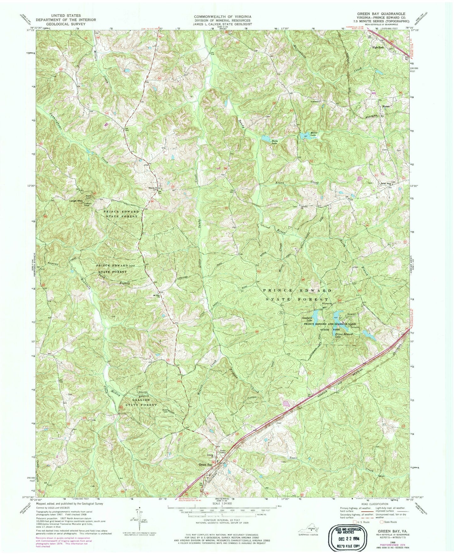
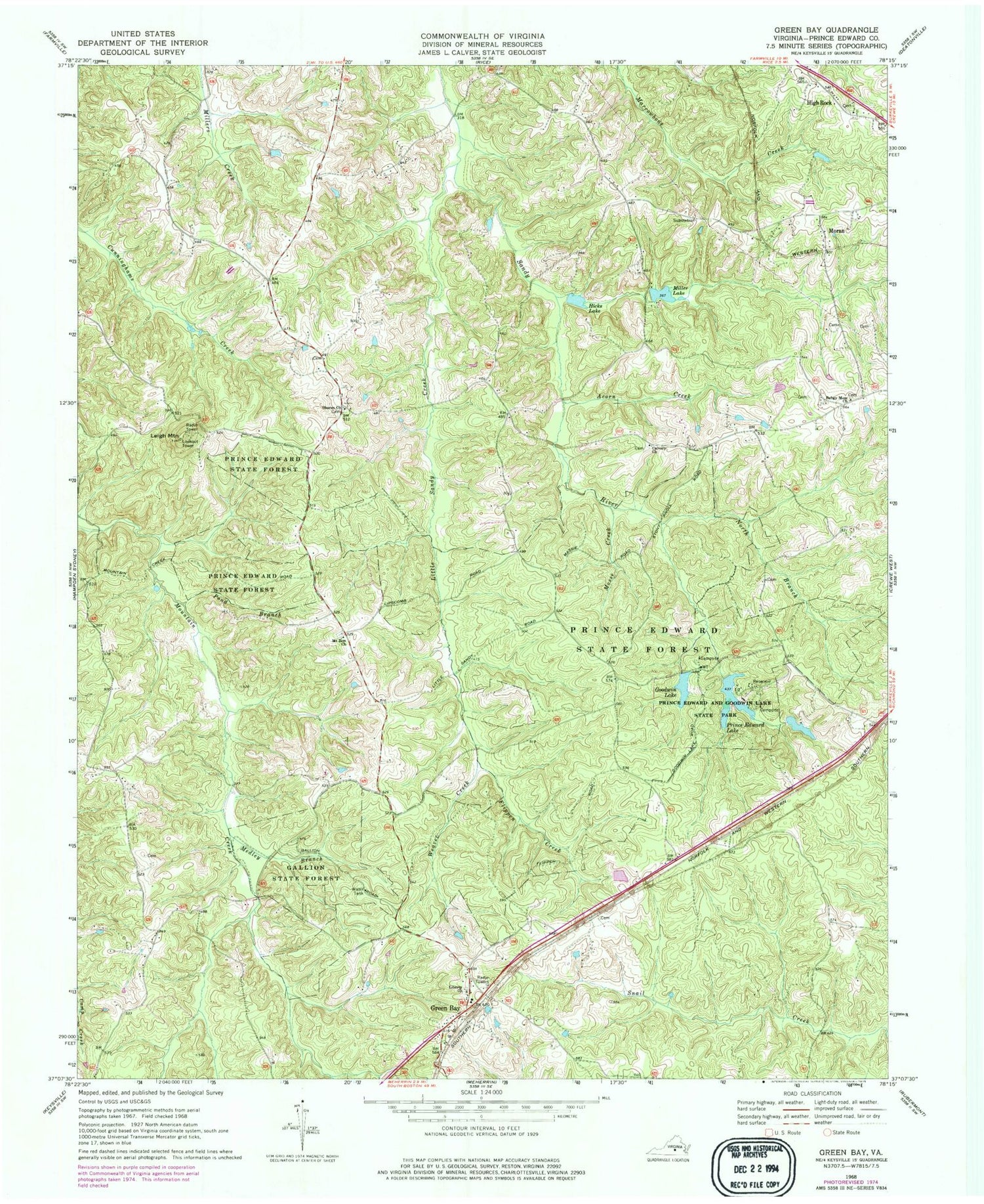
Classic USGS Green Bay Virginia 7.5'x7.5' Topo Map
Couldn't load pickup availability
Historical USGS topographic quad map of Green Bay in the state of Virginia. Map scale may vary for some years, but is generally around 1:24,000. Print size is approximately 24" x 27"
This quadrangle is in the following counties: Prince Edward.
The map contains contour lines, roads, rivers, towns, and lakes. Printed on high-quality waterproof paper with UV fade-resistant inks, and shipped rolled.
Contains the following named places: Acorn Creek, Bagby Memorial Cemetery, Borum Dam, Calvary Church, District 301, Flippen Creek, Gallion State Forest, Goodwin Dam, Goodwin Lake, Green Bay, Green Bay High School, Green Bay Post Office, Hicks Lake, High Rock, High Rock Baptist Church, Leigh Mountain, Liberty Cemetery, Liberty Church, Little Sandy Creek, Medley Branch, Miller Lake, Miller Lake Dam, Moores Dam, Moores Lake, Moran, Mosse Creek, Mount Leigh School, Mount Zion Baptist Church, Mount Zion Cemetery, North Branch Sandy River, Pond Branch, Prince Edward Dam, Prince Edward Lake, Prince Edward State Forest, Sharon Cemetery, Sharon Church, Twin Lakes, Twin Lakes State Park, Weaver Creek, ZIP Code: 23942