MyTopo
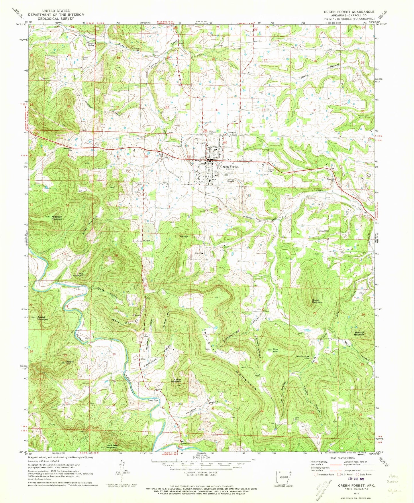
Classic USGS Green Forest Arkansas 7.5'x7.5' Topo Map
Couldn't load pickup availability
Historical USGS topographic quad map of Green Forest in the state of Arkansas. Map scale may vary for some years, but is generally around 1:24,000. Print size is approximately 24" x 27"
This quadrangle is in the following counties: Carroll.
The map contains contour lines, roads, rivers, towns, and lakes. Printed on high-quality waterproof paper with UV fade-resistant inks, and shipped rolled.
Contains the following named places: Anderson Mountain, Blacklick Mountain, Bradshaw Mountain, Brasswell Spring, Braswell Branch, Braswell Spring, Braswell Springs School, Brawley Hollow, Bunch Canyon, Burris Cemetery, City of Green Forest, Collier Mountain, Crystal Mountain, Devils Pocket, First Baptist Church, Glenwood Cemetery, Green Forest, Green Forest Elementary School, Green Forest High School, Green Forest Police Department, Green Forest Post Office, Green Forest Volunteer Fire Department, Green Forrest Intermediate School, Hoppins Hollow, Jackson Mountain, Jennings Gap, Lone Tree Mountain, Mack Hollow, Mack Mountain, Mead Hollow, Mill Mountain, Miller Mountain, Mountain View Cemetery, New Town, Norris Cemetery, Norton, Paxton Hollow, Pickens Cemetery, Pinnacle, Potato Hill, Round Mountain, Rule, Rule Cemetery, Rule School, Saint John's Emergency Medical Service Carroll County, Schriborough Canyon, Sims Point, Spicewood Hollow, Township of Hickory, Township of Liberty, Trinity Free Will Baptist Church, Union Church, Ward Cemetery, Ward Church, Zion Hill Cemetery, Zion Hill Church, ZIP Code: 72638