
MyTopo
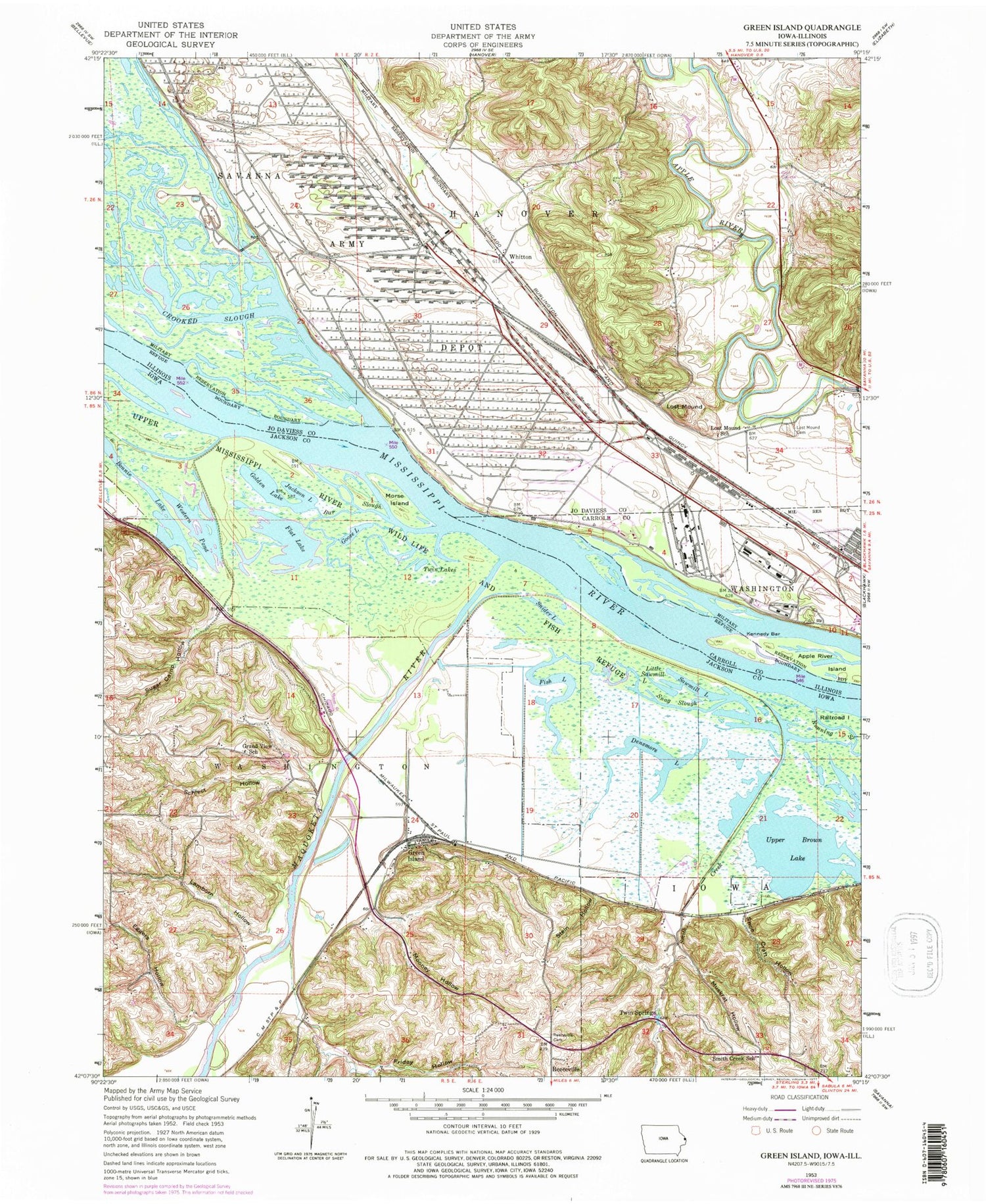
Classic USGS Green Island Iowa 7.5'x7.5' Topo Map
Couldn't load pickup availability
Historical USGS topographic quad map of Green Island in the states of Iowa, Illinois. Map scale may vary for some years, but is generally around 1:24,000. Print size is approximately 24" x 27"
This quadrangle is in the following counties: Carroll, Jackson, Jo Daviess.
The map contains contour lines, roads, rivers, towns, and lakes. Printed on high-quality waterproof paper with UV fade-resistant inks, and shipped rolled.
Contains the following named places: Apple River Island, Bar Slough, Blakes Lake, Bonnie Lake, Bowman Island, Bowman Slough, Brickhouse Slough, Brinksburg, Crooked Slough, Densmore Lake, Eggers Hollow, Fish Lake, Flat Lake, Friday Hollow, Golden Lake, Goose Lake, Grand View School, Green Island, Green Island Post Office, Green Island Wildlife Management Area, Hanover Bluff Nature Preserve, Island Number 254, Island Number 256, Jackson Lake, Kennedy Bar, Lamborn Hollow, Little Sawmill Lake, Lost Mound, Lost Mound Cemetery, Lost Mound School, Maquoketa River, Mooney Hollow, Morse Island, Muskrat Hollow, Nobis School, Reeceville, Reeseville Cemetery, Savanna Army Depot, Sawmill Lake, Schlect Hollow, Shoe Craft Hollow, Smith Creek, Smith Creek School, Snag Slough, Snider Lake, Storybrook Country Club, Sugar Camp Hollow, Township of Hanover, Township of Washington, Twin Lakes, Twin Springs, Upper Brown Lake, Western Pond, Whitton


