
MyTopo
Classic USGS Green Lake Maine 7.5'x7.5' Topo Map
Couldn't load pickup availability
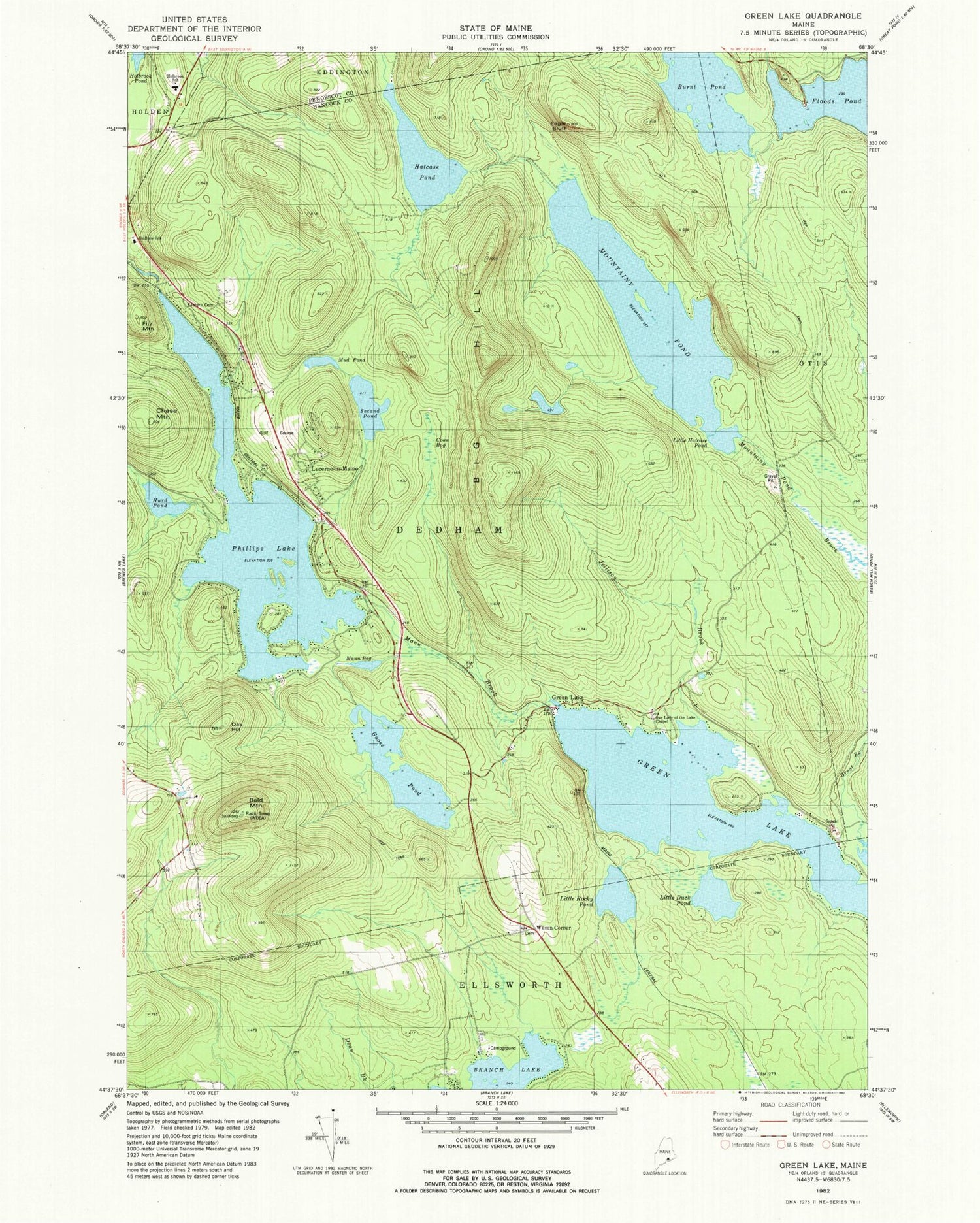
Historical USGS topographic quad map of Green Lake in the state of Maine. Typical map scale is 1:24,000, but may vary for certain years, if available. Print size: 24" x 27"
This quadrangle is in the following counties: Hancock, Penobscot.
The map contains contour lines, roads, rivers, towns, and lakes. Printed on high-quality waterproof paper with UV fade-resistant inks, and shipped rolled.
Contains the following named places: Bald Mountain, Big Hill, Burnt Pond, Camp Matomba, Chase Mountain, Coon Bog, Eagle Bluff, Pine Trail Cemetery, Fitz Mountain, Goose Pond, Green Lake, Hatcase Pond, Hurd Pond, Jellison Brook, Little Duck Pond, Little Hatcase Pond, Little Rocky Pond, Lucerne-in-Maine, Mann Bog, Mann Brook, Mud Pond, Oak Hill, Phillips Lake, Second Pond, Tannery Brook, Wilson Corner, Mountainy Pond, WWMJ-FM (Ellsworth), WKSQ-FM (Ellsworth), Town of Dedham, Phillips Lake Dam, Bald Mountain Trail, Branch Lake Camping Area, Dedham Elementary School, Hansons Landing on Branch Lake, Lucerne Hills Golf Club, Our Lady of the Lake Chapel, Holbrook School, Dedham Lucerne Fire Department Lucerne Station, Wilson Cemetery


