MyTopo
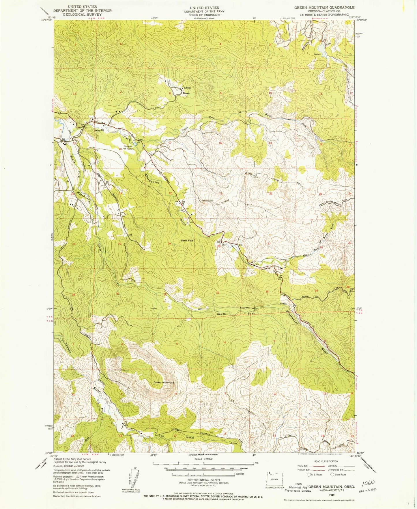
Classic USGS Green Mountain Oregon 7.5'x7.5' Topo Map
Couldn't load pickup availability
Historical USGS topographic quad map of Green Mountain in the state of Oregon. Map scale may vary for some years, but is generally around 1:24,000. Print size is approximately 24" x 27"
This quadrangle is in the following counties: Clatsop.
The map contains contour lines, roads, rivers, towns, and lakes. Printed on high-quality waterproof paper with UV fade-resistant inks, and shipped rolled.
Contains the following named places: Astoria Water Treatment Plant, Barth Falls, Bear Creek Dam, Bear Creek Reservoir, Clatsop County, Estoos, Fox Creek, Glazers Grade, Green Mountain, John Day Creek, Klaskanine Fish Hatchery, Klaskanine Summit, Lilleas, Middle Fork North Fork Klaskanine River, Nobel Ridge Farm, North Fork Klaskanine River, North Fork North Fork Klaskanine River, Olney G S, Osgood Creek, Perkins Creek, Rock Creek, Sigfredson County Park, Snow Point, South Fork Klaskanine River, South Fork Youngs River, Waterworks Creek