MyTopo
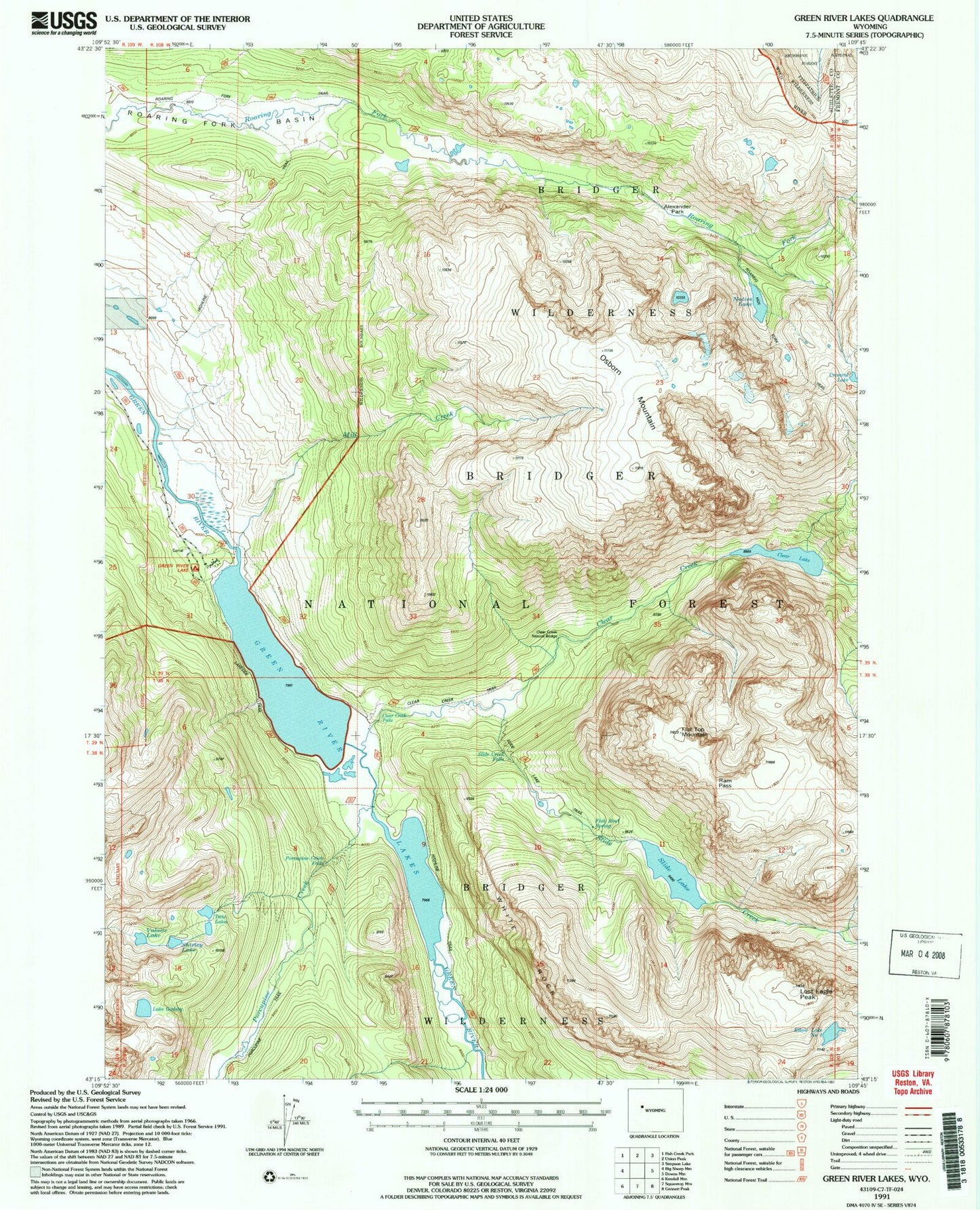
USGS Classic Green River Lakes Wyoming 7.5'x7.5' Topo Map
Couldn't load pickup availability
Historical USGS topographic quad map of Green River Lakes in the state of Wyoming. Scale: 1:24000. Print size: 24" x 27"
This quadrangle is in the following counties: Fremont, Sublette.
The map contains contour lines, roads, rivers, towns, lakes, and grids including latitude / longitude and UTM / MGRS. Printed on high-quality waterproof paper with UV fade-resistant inks.
Contains the following named places: Slide Falls, Clear Creek Falls, Alexander Park, Clear Creek, Clear Creek Natural Bridge, Clear Lake, Fish Bowl Spring, Flat Top Mountain, G P Bar Ranch, Lake Gadsby, Green River Lakes, Lakeside Trail, Lost Eagle Peak, Mill Creek, Native Lake, Osborn Mountain, Porcupine Creek, Porcupine Creek Falls, Ram Pass, Roaring Fork Basin, Shirley Lake, Slide Creek, Slide Creek Falls, Slide Lake, Twin Lakes, Valaite Lake, White Rock, Roaring Fork Trail, Clear Creek Trail, Slide Lake Trail, Elbow Lake Number 2, Green River Lake Campground