MyTopo
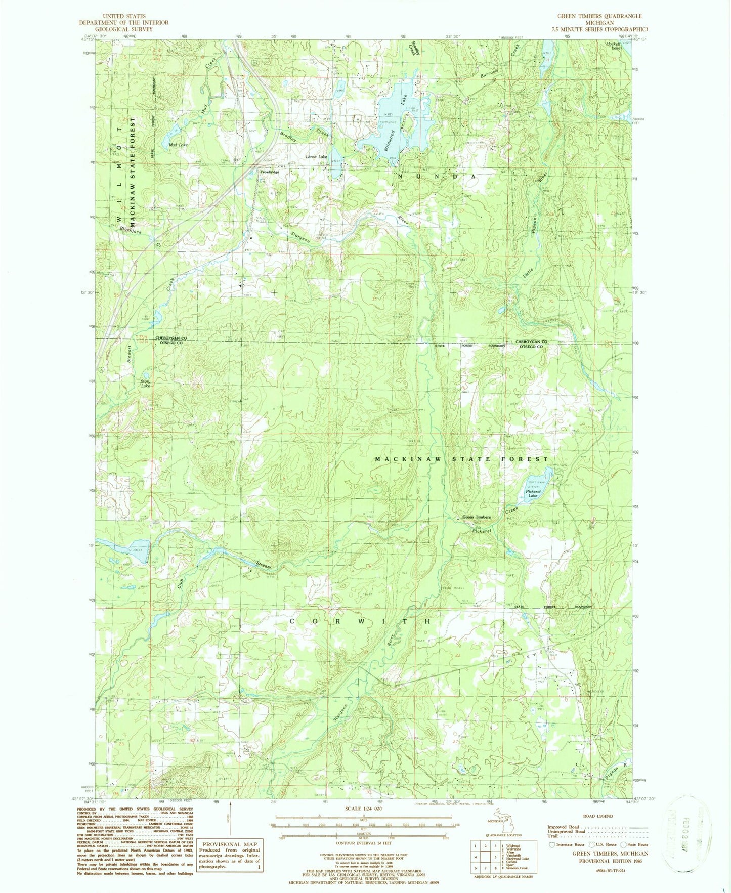
Classic USGS Green Timbers Michigan 7.5'x7.5' Topo Map
Couldn't load pickup availability
Historical USGS topographic quad map of Green Timbers in the state of Michigan. Typical map scale is 1:24,000, but may vary for certain years, if available. Print size: 24" x 27"
This quadrangle is in the following counties: Cheboygan, Otsego.
The map contains contour lines, roads, rivers, towns, and lakes. Printed on high-quality waterproof paper with UV fade-resistant inks, and shipped rolled.
Contains the following named places: Blackjack Creek, Bradley Creek, Burrows Creek, Club Stream, Fontinalis Club, Lance Lake, Mud Creek, Mud Lake, Pickerel Creek, Pickerel Lake, Stewart Creek, Storey Lake, Green Timbers, Trowbridge, Pigeon River State Forest, Township of Corwith, Wildwood Lake, Wildwood Lake Golf Course, Sturgeon River Campground, Elkwood Campground, Trowbridge Station (historical), Trowbridge Post Office (historical), Pickerel Lake State Forest Campground