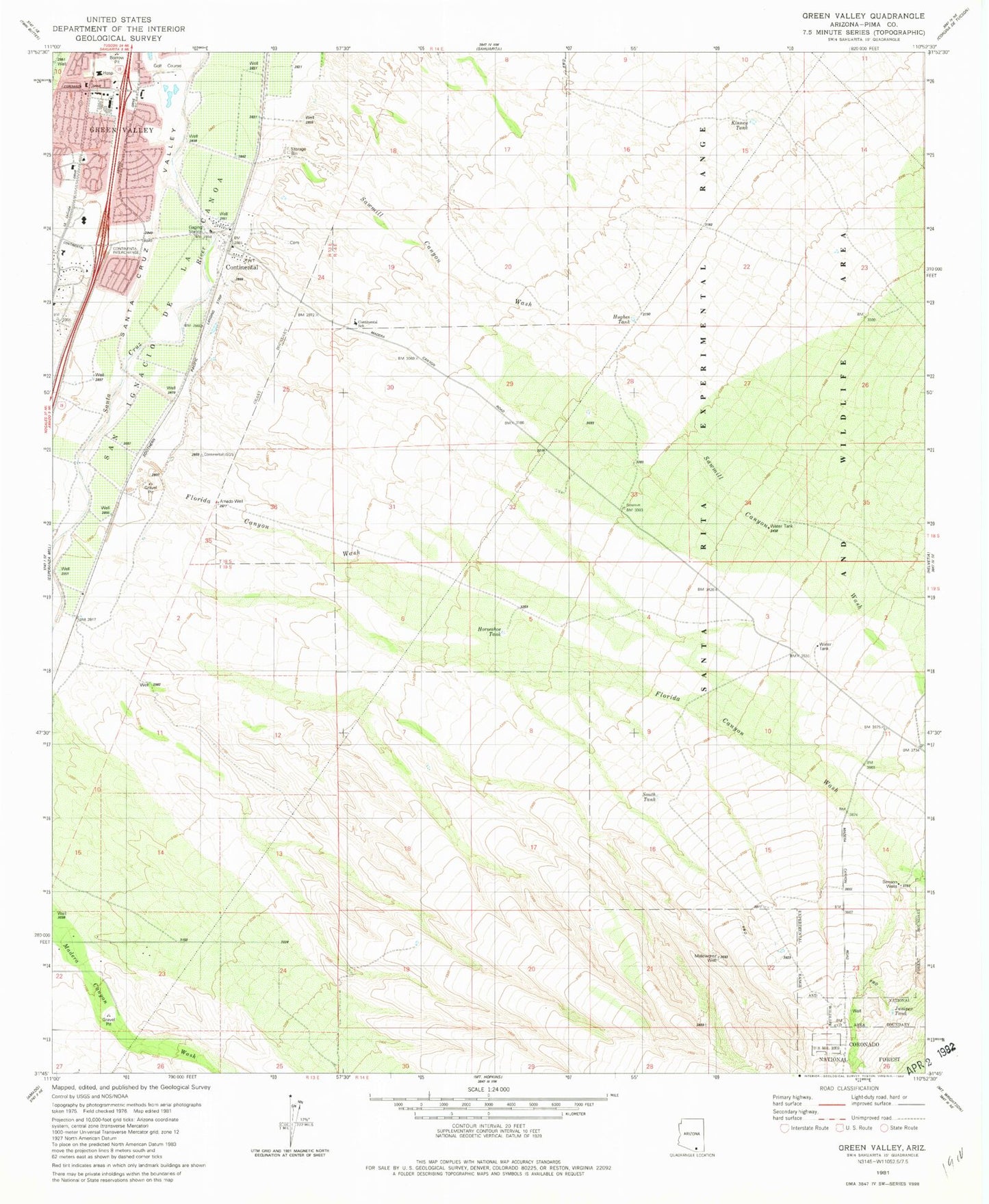
MyTopo
Classic USGS Green Valley Arizona 7.5'x7.5' Topo Map
Couldn't load pickup availability
Historical USGS topographic quad map of Green Valley in the state of Arizona. Map scale may vary for some years, but is generally around 1:24,000. Print size is approximately 24" x 27"
This quadrangle is in the following counties: Pima.
The map contains contour lines, roads, rivers, towns, and lakes. Printed on high-quality waterproof paper with UV fade-resistant inks, and shipped rolled.
Contains the following named places: Amado Well, Benson Wells, Box Canyon Wash, Canoa Hills Golf Course, Christian Science Church, Continental, Continental Airport, Continental Cemetery, Continental Elementary School, Continental Shopping Plaza, Elephant Head Census Designated Place, Florida Canyon Wash, Green Valley, Green Valley Community Church, Green Valley Post Office, Green Valley Shopping Plaza, Havens Green Valley Shopping Mall, Holmlund Assisted Living Suites at La Posada, Horseshoe Tank, Hughes Tank, Juniper Tank, Kinney Tank, Lutheran Church of the Risen Savior, Melendrez Well, Muhlenbergia Tank, Prestige Assisted Living at Green Valley, San Ignacio de la Canoa, Santa Rita Care Center, Sawmill Canyon Wash, Silver Springs Assisted Living Community, South Tank, Torres Blancas Golf Club, West Tank, ZIP Code: 85614