MyTopo
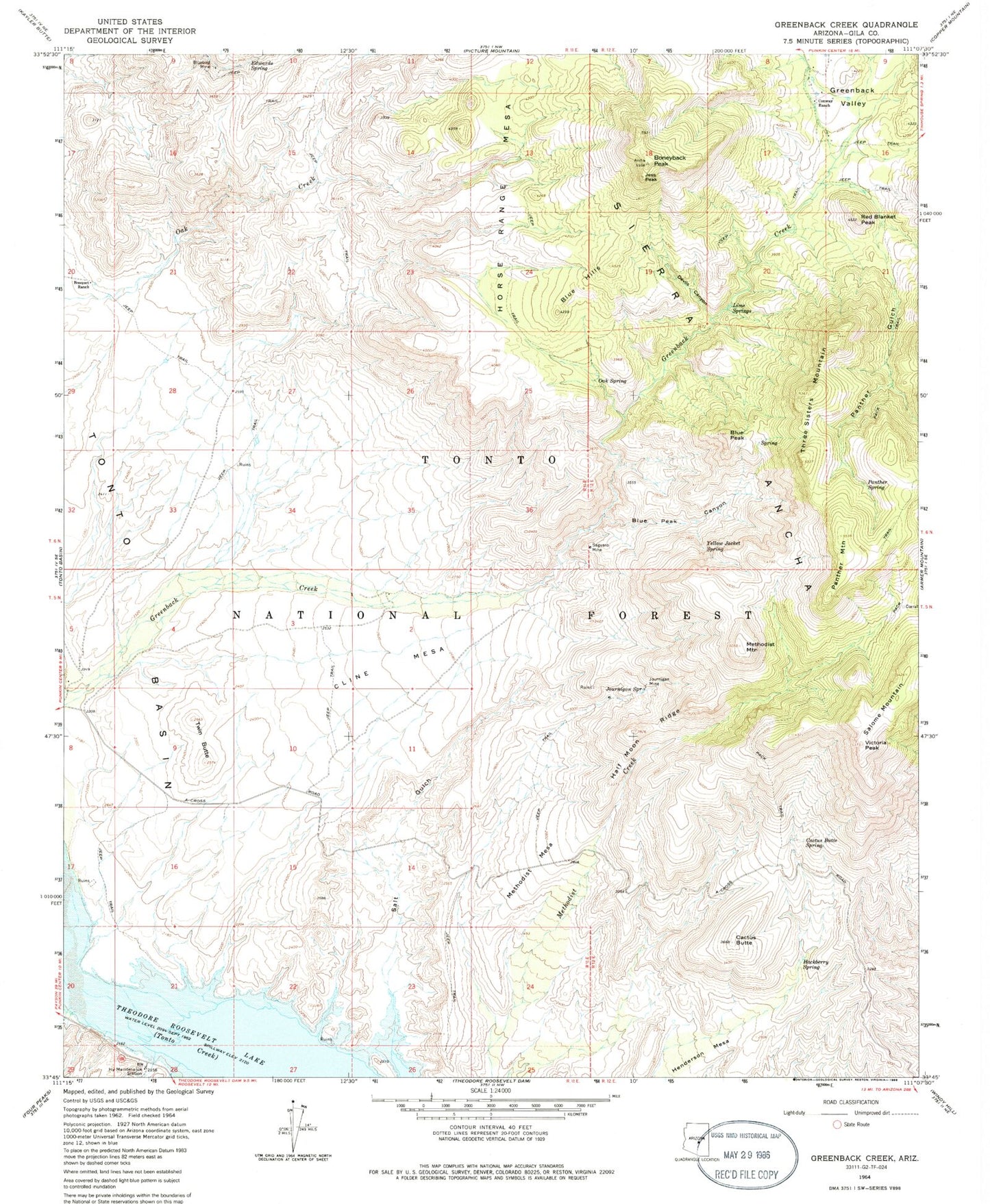
Classic USGS Greenback Creek Arizona 7.5'x7.5' Topo Map
Couldn't load pickup availability
Historical USGS topographic quad map of Greenback Creek in the state of Arizona. Map scale may vary for some years, but is generally around 1:24,000. Print size is approximately 24" x 27"
This quadrangle is in the following counties: Gila.
The map contains contour lines, roads, rivers, towns, and lakes. Printed on high-quality waterproof paper with UV fade-resistant inks, and shipped rolled.
Contains the following named places: Blue Hills, Blue Peak, Blue Peak Canyon, Bluebird Mine, Boneyback Peak, Bouquet Ranch, Bumblebee Creek, Cactus Butte, Cactus Butte Spring, Cholla Tank, Cline Mesa, Conway Ranch, Devils Canyon, Edwards Spring, First Basin Tank, Glendale Point, Greenback Tank, Greenback Valley, Hackberry Spring, Half Moon Ridge, Henderson Mesa, Indian Point, Indian Point Campground, Indian Point Recreation Site, Jess Peak, Journigan Mine, Journigan Spring, Lime Springs, Methodist Mesa, Methodist Mesa Tank, Methodist Mountain, Oak Spring, Panther Gulch, Panther Mountain, Panther Spring, Red Blanket Peak, Saguaro Mine, Salome Mountain, Salt Gulch, Salt Gulch Tank, San Carlos Tank, Schoolhouse Tank, Three Sisters Mountain, Tonto Basin Ranger District, Trick Tank, Twin Butte, Twin Butte Tank, Victoria Peak, Willow Spring, ZIP Code: 85553