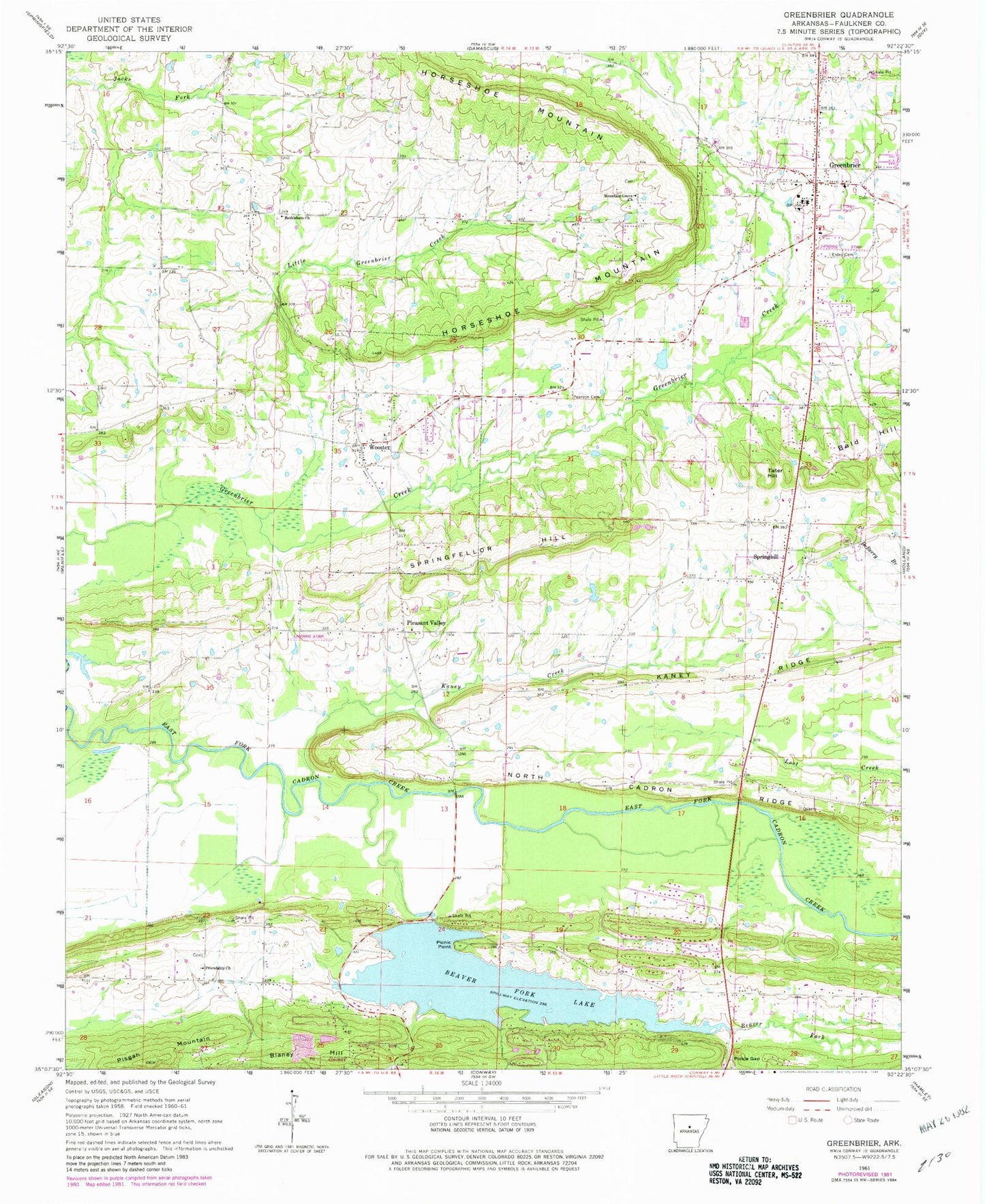
MyTopo
Classic USGS Greenbrier Arkansas 7.5'x7.5' Topo Map
Couldn't load pickup availability
Historical USGS topographic quad map of Greenbrier in the state of Arkansas. Map scale may vary for some years, but is generally around 1:24,000. Print size is approximately 24" x 27"
This quadrangle is in the following counties: Conway, Faulkner.
The map contains contour lines, roads, rivers, towns, and lakes. Printed on high-quality waterproof paper with UV fade-resistant inks, and shipped rolled.
Contains the following named places: Beaver Fork, Beaver Fork Lake, Beaver Fork Lake Dam, Beaverfork Fire Department, Bethlehem Baptist Church, Bethlehem Cemetery, Blaney Hill, Cadron Church, Chael Airport, City of Greenbrier, Clifton Branch, Davenport Ford, Dears Pond, Dears Pond Dam, East Fork Cadron Creek, Estep Cemetery, First Baptist Church, Frauenthal Cemetery, Friendship Cemetery, Friendship Missionary Baptist Church, Friendship School, Greenbrier, Greenbrier Eastside Elementary School, Greenbrier Elementary School, Greenbrier High School, Greenbrier Junior High School, Greenbrier Middle School, Greenbrier Police Department, Greenbrier Post Office, Greenbrier United Methodist Church, Greenbrier Volunteer Fire Department, Greenbrier Volunteer Fire Station 2, Greenbrier Westside Elementary School, Horseshoe Mountain, Horseshoe Mountain School, Kaney Creek, Kaney Ridge, King Bridge, Lakeview Acres, Langstons Store, Lawrence Lake Dam, Lawrences Lake, Little Greenbrier Creek, Metropolitan Emergency Medical Services Greenbrier, Mountain Grove Baptist Church, North Cadron Ridge, Old Linder, Pearson Cemetery, Pickle Gap, Pickle Gap Creek, Pickles Gap, Pickles Gap Baptist Church, Picnic Point, Pisgah Mountain, Pleasant Valley, Pleasant Valley Baptist Church, Pleasant Valley Cemetery, Pleasant Valley School, Shady Grove, Shady Grove Church, Shady Grove School, Spring Hill Church, Springfellor Hill, Springhill, Springhill Cemetery, Springhill School, Stony Point School, Tater Hill, Terry Bridge, Torian Lake, Torian Lake Dam, Town of Wooster, Township of Clifton, Township of East Fork, Walnut Grove School, Woffords Store, Wooster, Wooster Post Office, Wooster School, Wooster Volunteer Fire Department, ZIP Code: 72181