
MyTopo
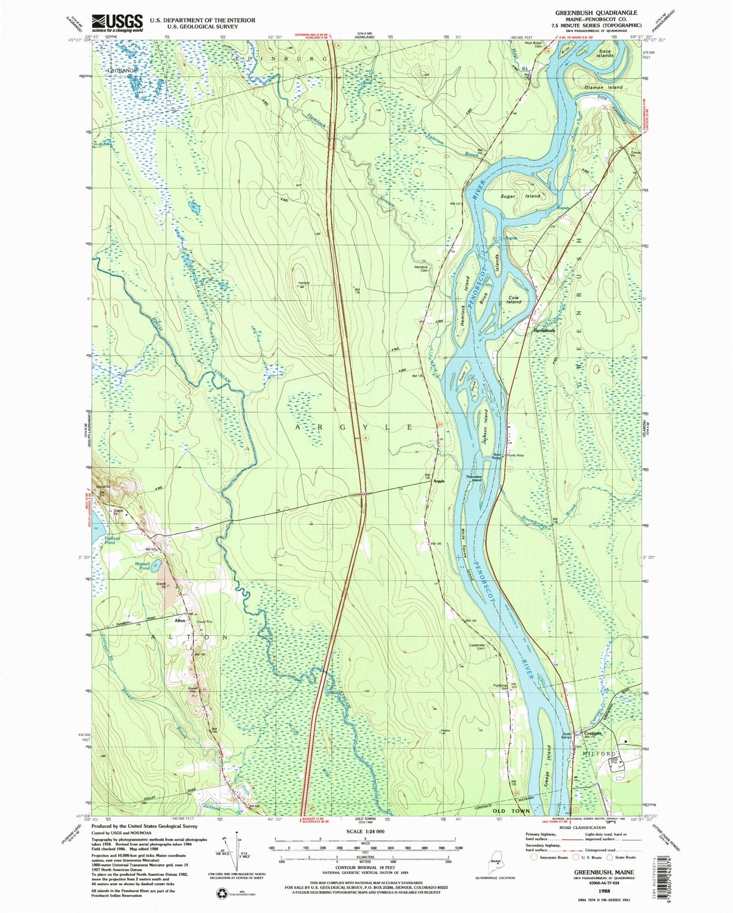
Classic USGS Greenbush Maine 7.5'x7.5' Topo Map
Couldn't load pickup availability
Historical USGS topographic quad map of Greenbush in the state of Maine. Map scale may vary for some years, but is generally around 1:24,000. Print size is approximately 24" x 27"
This quadrangle is in the following counties: Penobscot.
The map contains contour lines, roads, rivers, towns, and lakes. Printed on high-quality waterproof paper with UV fade-resistant inks, and shipped rolled.
Contains the following named places: Alton, Alton Bog, Alton Cemetery, Alton Church, Alton Elementary School, Argyle, Birch Islands, Boombridge Brook, Bride Island, Brown Brook, Cedarvale Cemetery, Costigan, Costigan Brook, Cow Island, Ephriam Brook, Foster Island, Freese Island, Greenbush, Greenbush Post Office, Hazelton Brook, Hemlock Island, Hemlock Stream, Hemlock Stream Cemetery, Horse Island, Hoyt Brook, Hoyt Brook Cemetery, Jackson Island, Judkins Brook, Mansell Pond, Socs Island, Stevens Brook, Sugar Island, Thorofare Island, Township of Argyle, Unorganized Territory of Argyle, WBZN-FM (Old Town), White Squaw Island, ZIP Code: 04468


