MyTopo
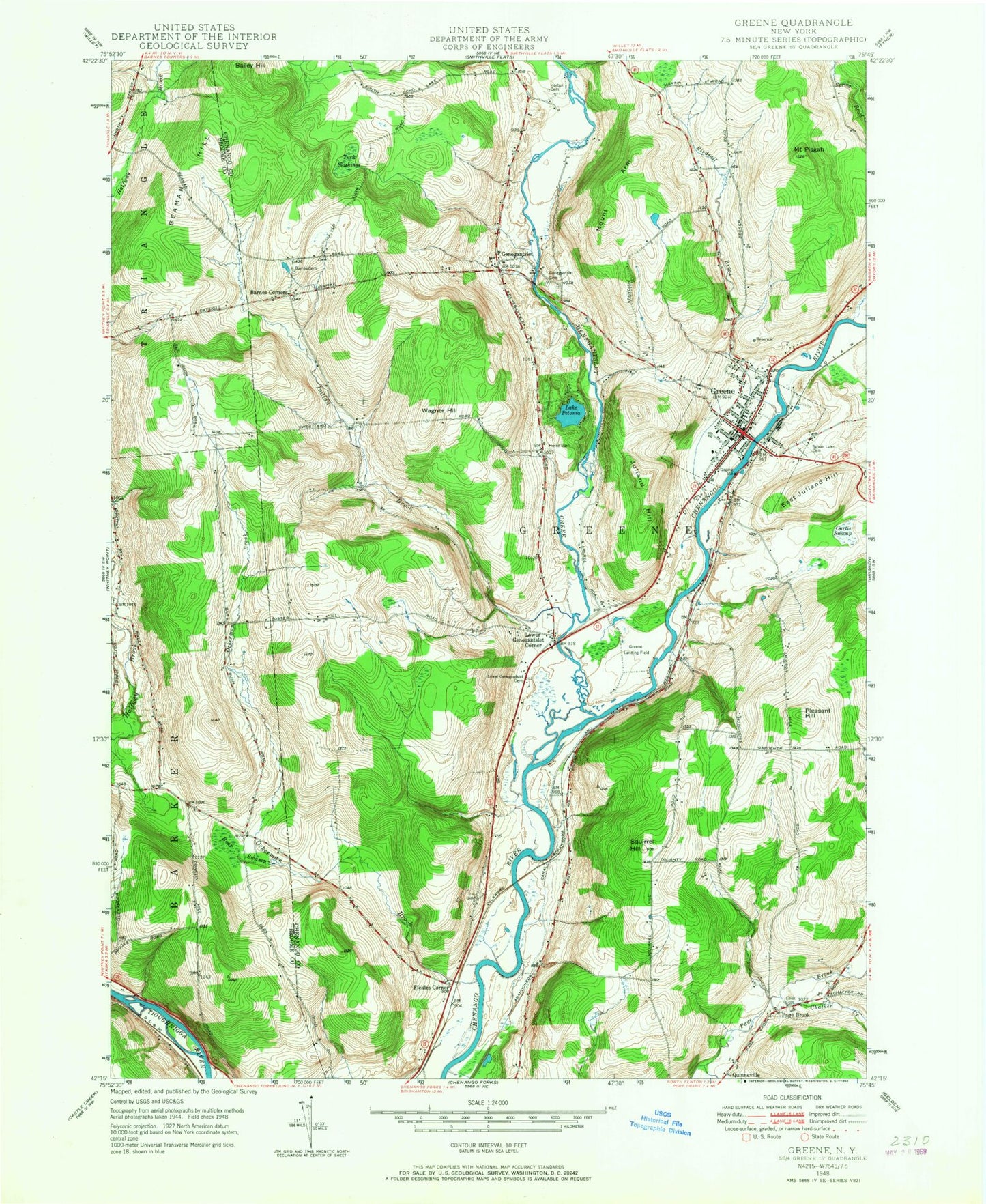
Classic USGS Greene New York 7.5'x7.5' Topo Map
Couldn't load pickup availability
Historical USGS topographic quad map of Greene in the state of New York. Map scale may vary for some years, but is generally around 1:24,000. Print size is approximately 24" x 27"
This quadrangle is in the following counties: Broome, Chenango.
The map contains contour lines, roads, rivers, towns, and lakes. Printed on high-quality waterproof paper with UV fade-resistant inks, and shipped rolled.
Contains the following named places: Bailey Hill, Barnes Cemetery, Barnes Corners, Beaman Hill, Bear Swamp, Berean Bible Church, Birdsall Brook, Canal Street Cemetery, Central Baptist Church, Chalker Creek, Community Bible Fellowship, Curtis Swamp, East Juliand Hill, Elliot Cemetery, Fickles Corner, First Congregational Church, Genegantslet, Genegantslet Cemetery, Genegantslet Creek, Genegantslet Golf Club, Greene, Greene Airport, Greene Emergency Squad, Greene High School, Greene Intermediate School, Greene Middle School, Greene Post Office, Greene Primary School, Greene Village Hall, Greene Volunteer Fire Department, Horton Cemetery, Immaculate Conception Church, Indian Brook, Juliand Hill, Lake Petonia, Lower Genegantslet Cemetery, Lower Genegantslet Corner, Moore Memorial Library, Morse Cemetery, Mount Arm, Mount Pisgah, Ockerman Brook, Page Brook, Pinewoods Mobile Home Park, Pleasant Hill, South Street Cemetery, Squirrel Hill, The Church of Jesus Christ of Latter Day Saints, Town of Greene, Turk Slashings, United Methodist Church, Village of Greene, Wagner Hill, Zion Episcopal Church, ZIP Code: 13778