MyTopo
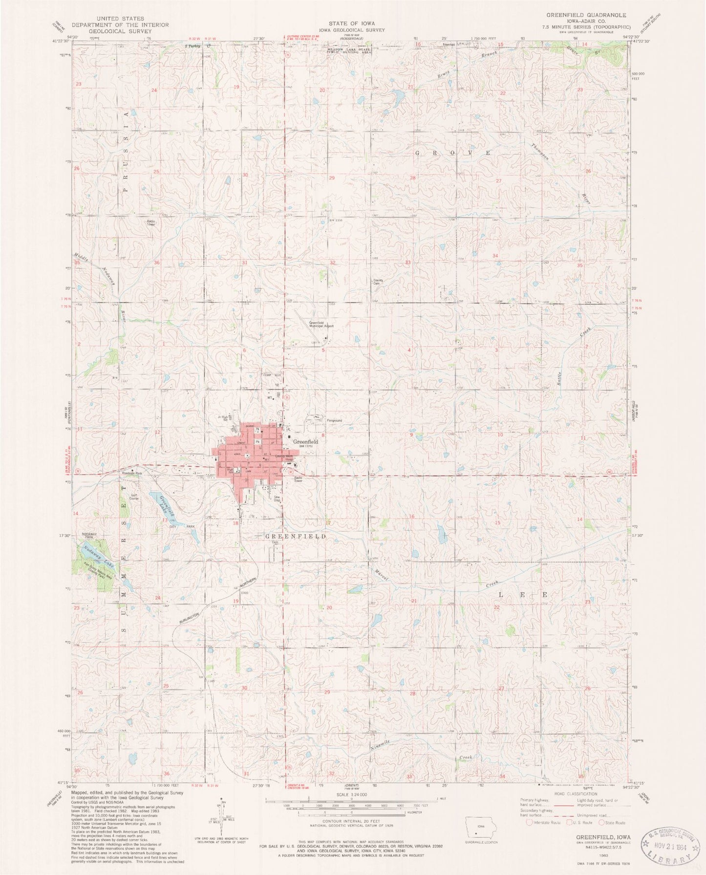
Classic USGS Greenfield Iowa 7.5'x7.5' Topo Map
Couldn't load pickup availability
Historical USGS topographic quad map of Greenfield in the state of Iowa. Map scale may vary for some years, but is generally around 1:24,000. Print size is approximately 24" x 27"
This quadrangle is in the following counties: Adair.
The map contains contour lines, roads, rivers, towns, and lakes. Printed on high-quality waterproof paper with UV fade-resistant inks, and shipped rolled.
Contains the following named places: Adair County, Adair County Cemetery, Adair County Courthouse, Adair County Fairgrounds, Adair County Historical Museum, Adair County Memorial Hospital, Adair County Sheriff's Office, City of Greenfield, Clara Chapel, Cornerstone Evangelical Free Church, Country Club, First Presbyterian Church, Greenfield, Greenfield Cemetery, Greenfield Chiropractic Center, Greenfield City Park, Greenfield Lake, Greenfield Library, Greenfield Manor, Greenfield Municipal Airport, Greenfield Police Department, Greenfield Post Office, Greenfield Volunteer Fire Department, Greenfield Wastewater Plant, Groveland Post Office, Immanuel Lutheran Church, Iowa Aviation Preservation Center, Ken Sidey Nature Area, Lemont, Living Word Family Church, Nodaway Lake, Nodaway Park, Nodaway Valley East Elementary School, Nodaway Valley High School, Plymouth Brethren Gospel Chapel, Saint Johns Catholic Church, School Number 4, Township of Greenfield, Township of Grove, Township of Lee, United Methodist Church, ZIP Code: 50849