MyTopo
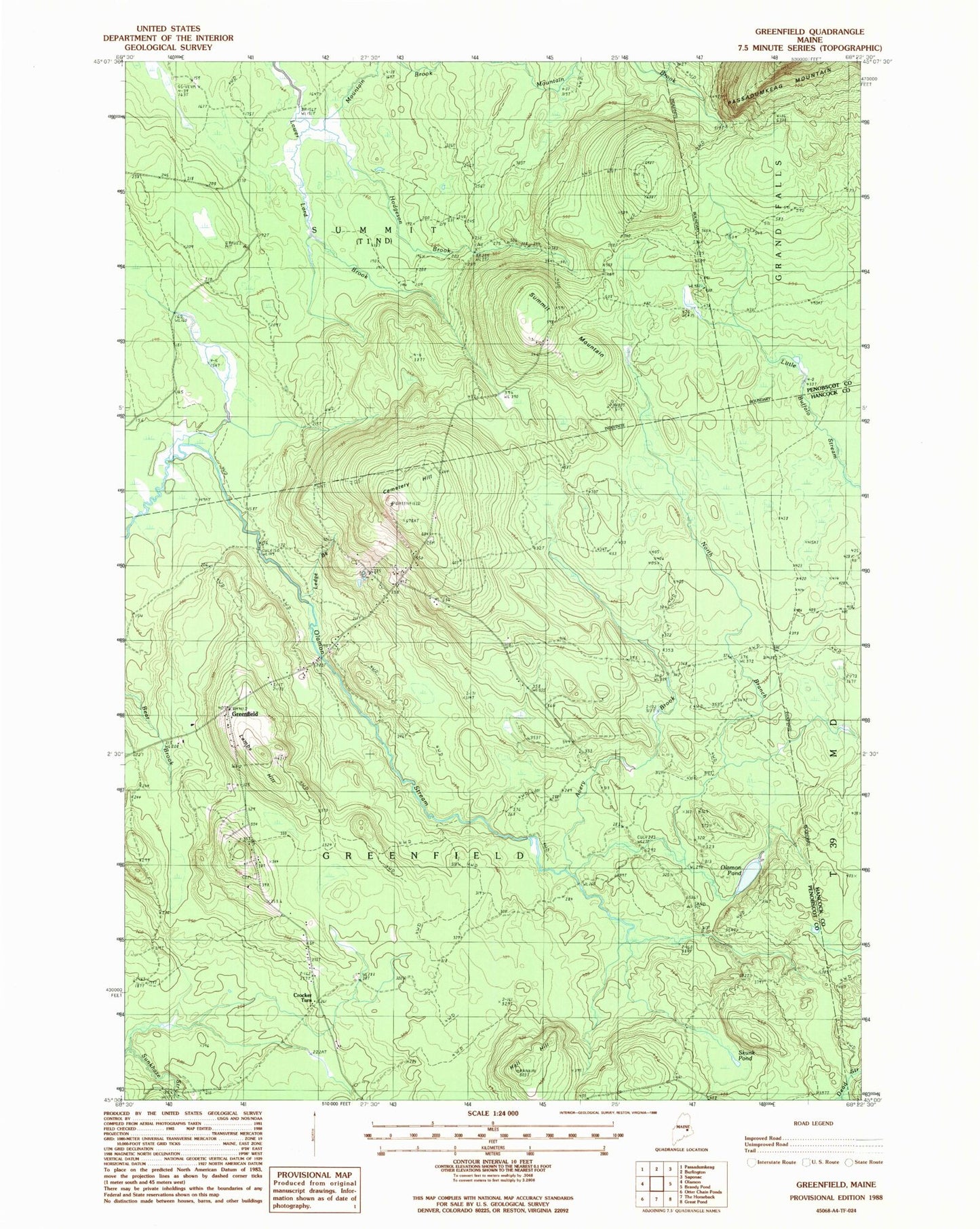
Classic USGS Greenfield Maine 7.5'x7.5' Topo Map
Couldn't load pickup availability
Historical USGS topographic quad map of Greenfield in the state of Maine. Map scale may vary for some years, but is generally around 1:24,000. Print size is approximately 24" x 27"
This quadrangle is in the following counties: Hancock, Penobscot.
The map contains contour lines, roads, rivers, towns, and lakes. Printed on high-quality waterproof paper with UV fade-resistant inks, and shipped rolled.
Contains the following named places: Avery Brook, Cemetery Hill, Crocker Turn, Greenfield, Hall Hill, Hodgeson Brook, Lambs Hill, Ledge Brook, Mountain Brook, North Branch Olamon Stream, Number One Cemetery, Number Two Cemetery, Olamon Pond, School Number 1, Skunk Pond, Stony Brook, Summit Mountain, Township of Greenfield, Unorganized Territory of East Central Penobscot, ZIP Code: 04418