MyTopo
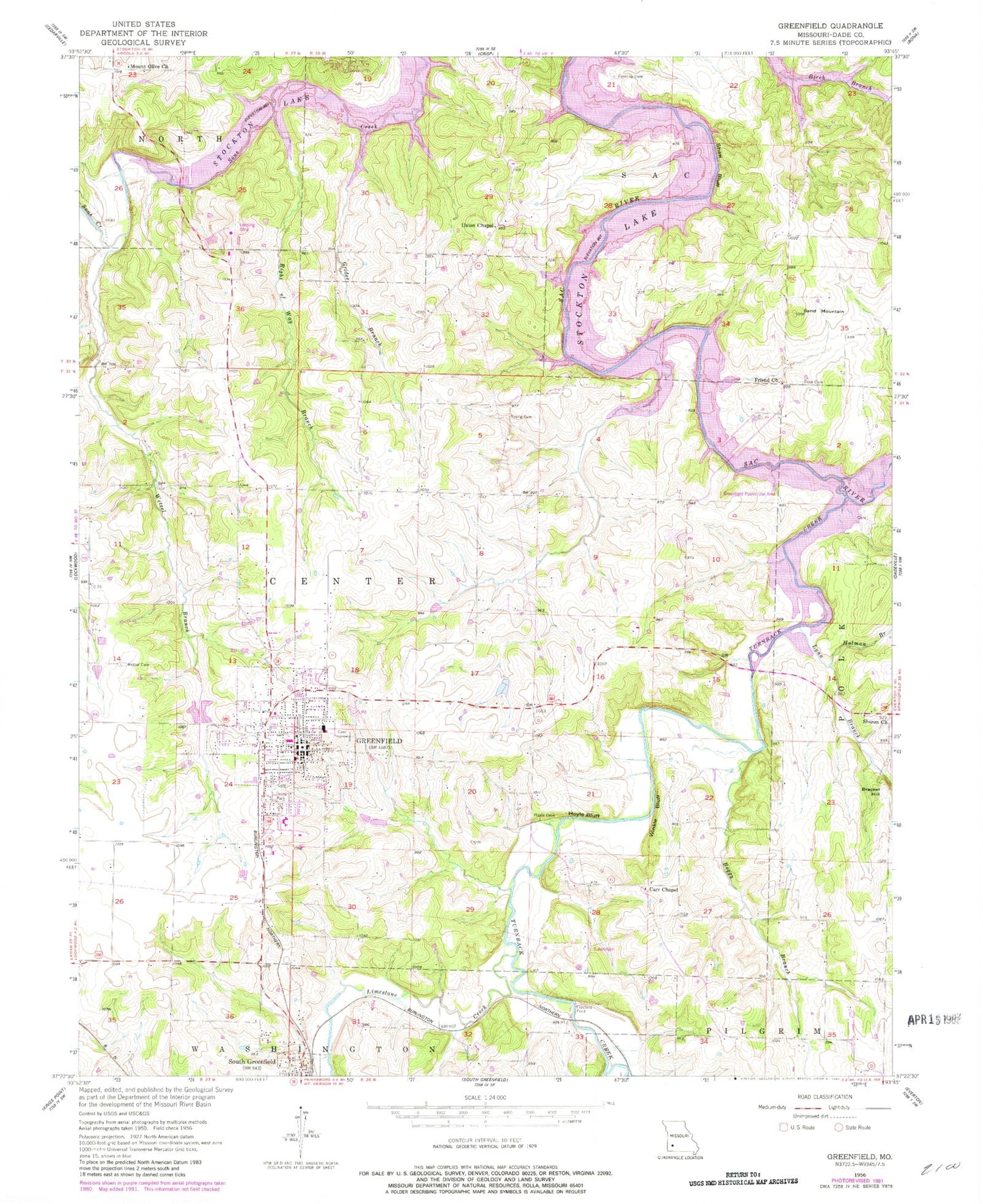
Classic USGS Greenfield Missouri 7.5'x7.5' Topo Map
Couldn't load pickup availability
Historical USGS topographic quad map of Greenfield in the state of Missouri. Typical map scale is 1:24,000, but may vary for certain years, if available. Print size: 24" x 27"
This quadrangle is in the following counties: Dade.
The map contains contour lines, roads, rivers, towns, and lakes. Printed on high-quality waterproof paper with UV fade-resistant inks, and shipped rolled.
Contains the following named places: Boggy Branch, Bracket Hill, Carr Chapel, Fanning Cemetery, Friend Church, Greenfield, Grider Branch, Holman Branch, Hoyle Bluff, Limestone Creek, Mount Olive Church, Right of Way Branch, Rose Cemetery, Sand Mountain, Sharon Church, Shaw Bluff, Toney Park, Turnback Creek, Union Chapel, Wetzel Branch, Wetzel Cemetery, Winkle Bluff, Young Cemetery, Lynn Branch, South Greenfield, Danley (historical), Fiddlers Ford, Greenfield Public Use Area, Lone Jack School (historical), Sand Mountain School (historical), White Oak School (historical), Fairview School (historical), Cave School (historical), Shady Grove School (historical), Lotus School (historical), Friend Bridge, Suttee Bridge, Young Bridge, Dade County, Eagles Point and Red Barn Village Airpark (historical), Rector Lake Dam, Township of Center, City of Greenfield, Village of South Greenfield, Greenfield Fire Department, Greenfield Cemetery, Greenfield High School, Greenfield Elementary School, Dade County Sheriff's Office, Greenfield Post Office