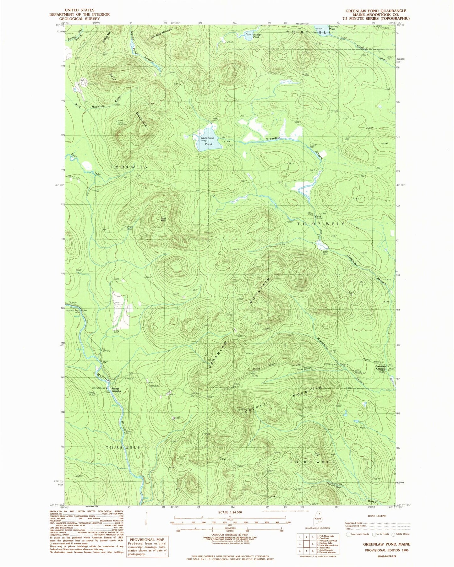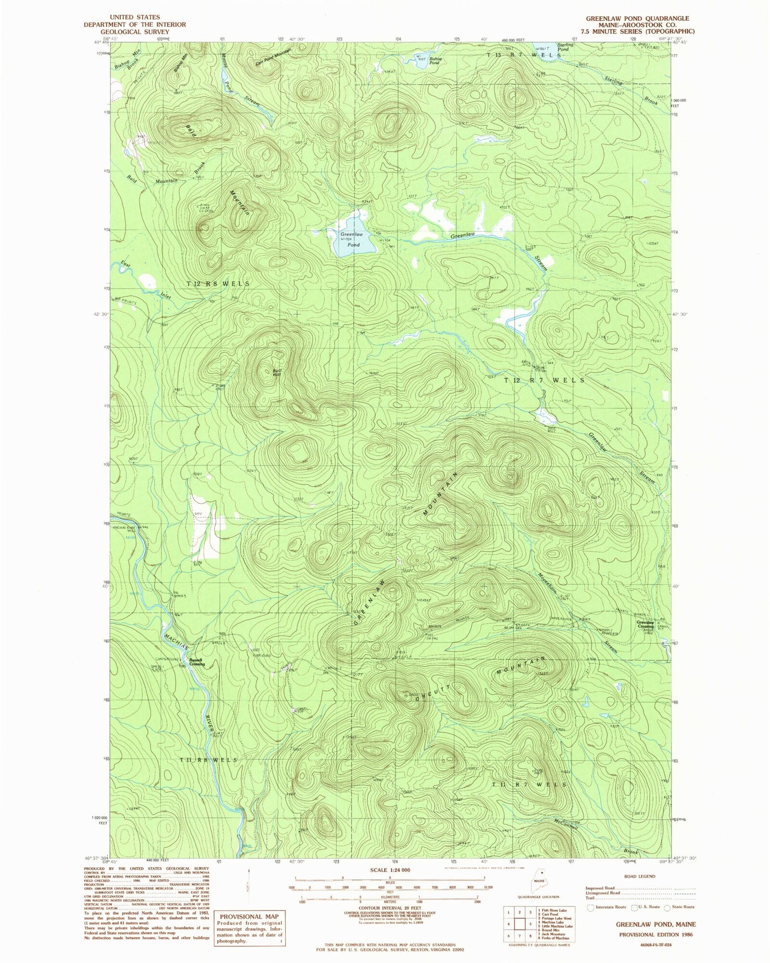
MyTopo
Classic USGS Greenlaw Pond Maine 7.5'x7.5' Topo Map
Regular price
$16.95
Regular price
Sale price
$16.95
Unit price
per
Couldn't load pickup availability
Historical USGS topographic quad map of Greenlaw Pond in the state of Maine. Map scale may vary for some years, but is generally around 1:24,000. Print size is approximately 24" x 27"
This quadrangle is in the following counties: Aroostook.
The map contains contour lines, roads, rivers, towns, and lakes. Printed on high-quality waterproof paper with UV fade-resistant inks, and shipped rolled.
Contains the following named places: Bald Mountain, Bishop Pond, Bull Hill, Greenlaw Crossing, Greenlaw Mountain, Greenlaw Pond, Moose Pond, Orcutt Mountain, Orcutts Camp, Russell Crossing, Sterling Pond, T12 R7 WELS