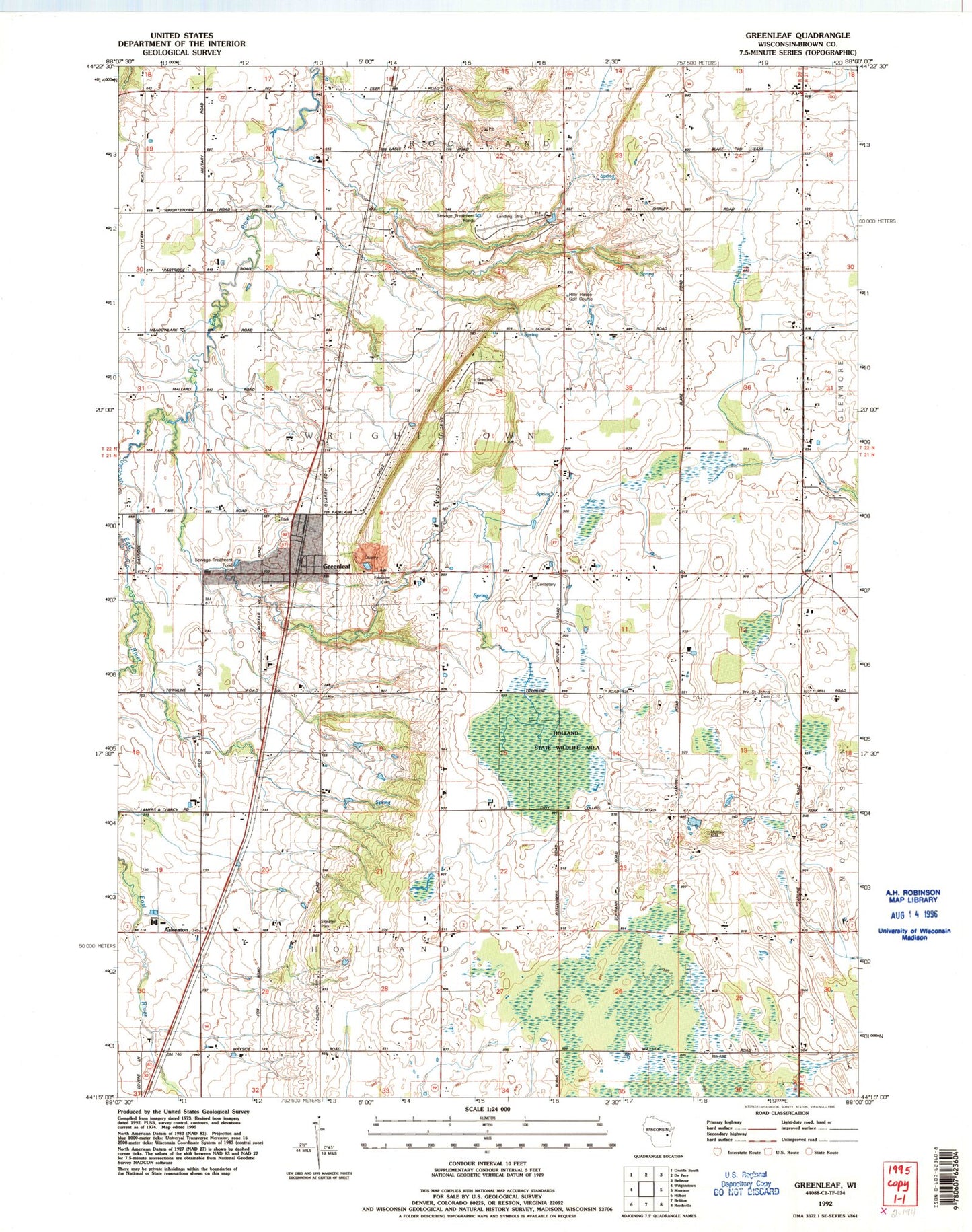
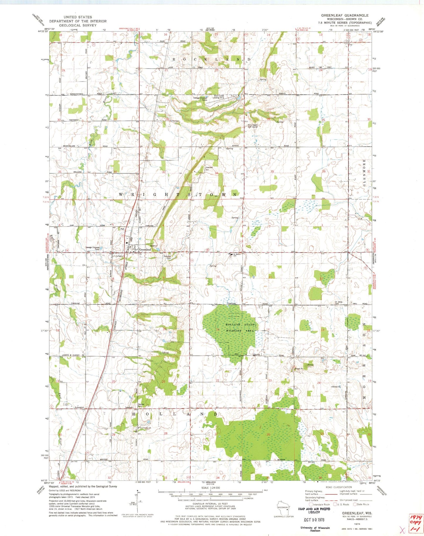
MyTopo
Classic USGS Greenleaf Wisconsin 7.5'x7.5' Topo Map
Couldn't load pickup availability
Historical USGS topographic quad map of Greenleaf in the state of Wisconsin. Map scale may vary for some years, but is generally around 1:24,000. Print size is approximately 24" x 27"
This quadrangle is in the following counties: Brown.
The map contains contour lines, roads, rivers, towns, and lakes. Printed on high-quality waterproof paper with UV fade-resistant inks, and shipped rolled.
Contains the following named places: Askeaton, Askeaton School, Birch Creek Airport, C R Acres Airport, Country Aire Farms, Dyers School, East Creek Farm, East Holland School, Fairview Cemetery, Greenleaf, Greenleaf Census Designated Place, Greenleaf Post Office, Greenleaf Quarry, Greenleaf Volunteer Fire Department, Heatherbrook Farm, Hilly Haven Golf Course, Holland Red Maple Swamp State Natural Area, Holland State Wildlife Area, Jefferson School, Ledgeville School, Pershing School, Ravine School, Saint Johns Cemetery, Saint Johns Church, Saint Marys School, Saint Patricks Church, Schink School, Skeater Park, Town of Holland, Town of Wrightstown, Wobeck Farm, ZIP Code: 54126