MyTopo
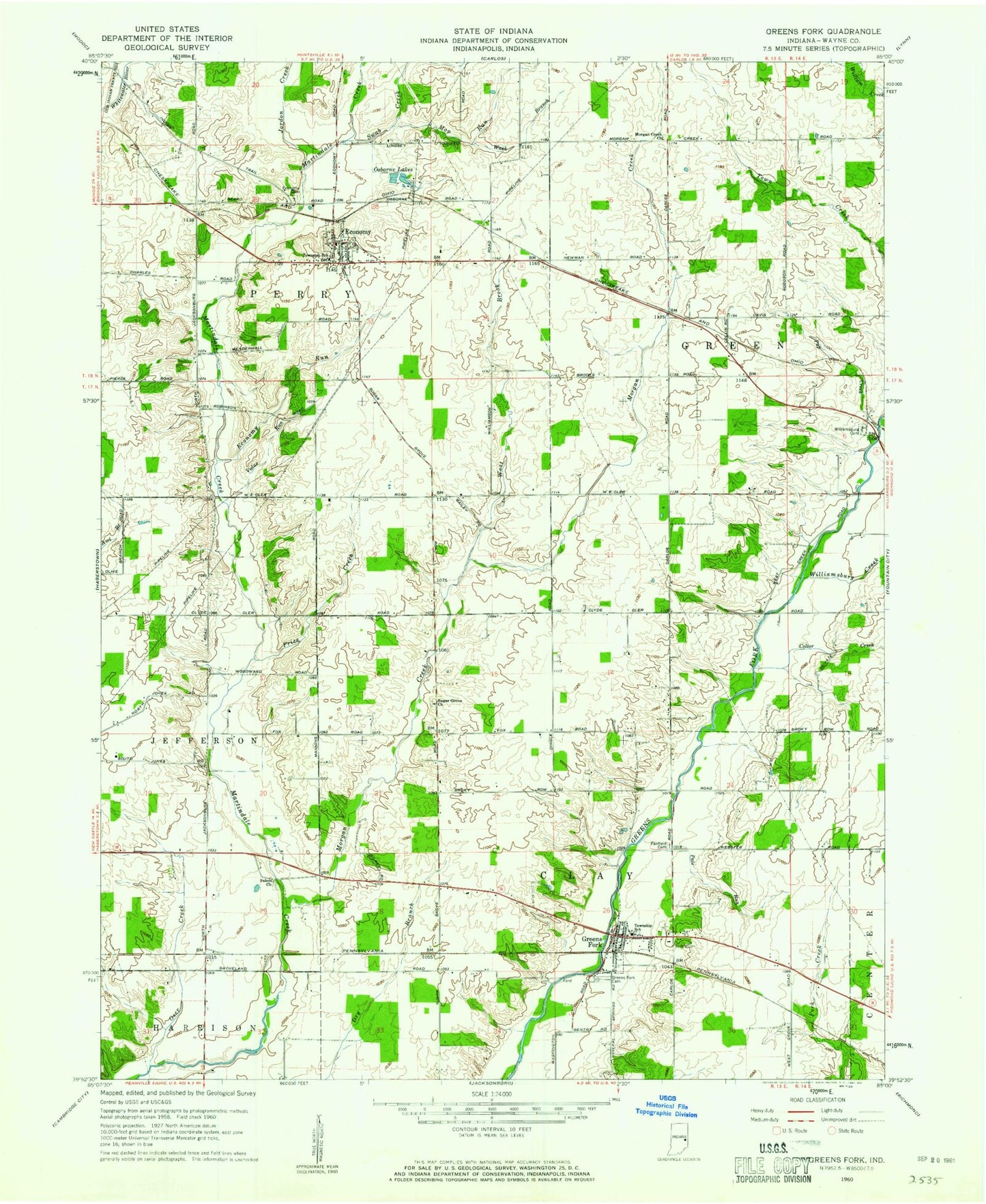
Classic USGS Greens Fork Indiana 7.5'x7.5' Topo Map
Couldn't load pickup availability
Historical USGS topographic quad map of Greens Fork in the state of Indiana. Map scale may vary for some years, but is generally around 1:24,000. Print size is approximately 24" x 27"
This quadrangle is in the following counties: Wayne.
The map contains contour lines, roads, rivers, towns, and lakes. Printed on high-quality waterproof paper with UV fade-resistant inks, and shipped rolled.
Contains the following named places: Clay Township Volunteer Fire Department, Collor Creek, Economy, Economy Cemetery, Economy Post Office, Economy Run, Fairfield Cemetery, Greens Fork, Greens Fork Cemetery, Greens Fork Police Department, Greens Fork Post Office, Jordon Creek, Mop Run, Morgan Creek, Morgan Creek Church, Osborne Lakes, Oser Creek, Pale Run, Perry Township Volunteer Fire Department, Price Creek, Radford Hog Farms, Salem Church, Sugar Grove Church, Swab Creek, Town of Economy, Town of Greens Fork, Township of Clay, Township of Green, Township of Perry, Value Run, Wash Branch, West Brook, Williamsburg Cemetery, Williamsburg Creek, ZIP Codes: 47339, 47345, 47393