MyTopo
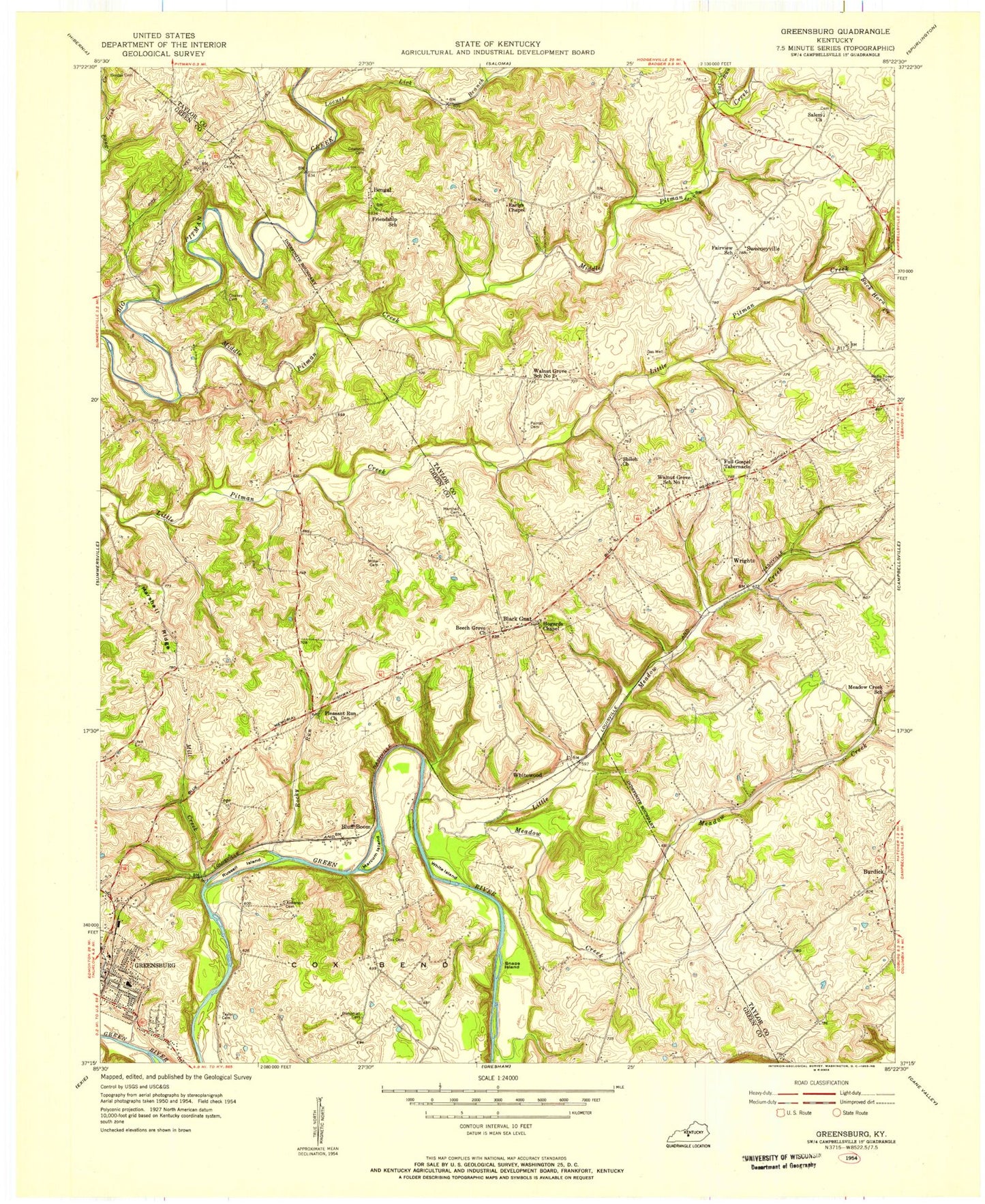
Classic USGS Greensburg Kentucky 7.5'x7.5' Topo Map
Couldn't load pickup availability
Historical USGS topographic quad map of Greensburg in the state of Kentucky. Map scale may vary for some years, but is generally around 1:24,000. Print size is approximately 24" x 27"
This quadrangle is in the following counties: Green, Taylor.
The map contains contour lines, roads, rivers, towns, and lakes. Printed on high-quality waterproof paper with UV fade-resistant inks, and shipped rolled.
Contains the following named places: Anderson Cemetery, Beech Grove Church, Bengal, Black Gnat, Blakeman Cemetery, Bluff Boom, Boom Hole, Buck Horn Creek, Burdick, Campbellsville Country Club, Campbellsville Memorial Gardens, Chaney Cemetery, City of Greensburg, Cowherd Cemetery, Cox Bend, Cox Cemetery, Cox Hole, Earlys Chapel, Flat Run, Full Gospel Tabernacle, Green County Ambulance Service, Greensburg, Greensburg - Green County Fire Department, Greensburg Division, Hobson Island, Hogards Chapel, Lewis Cemetery, Little Meadow Creek, Locust Lick Branch, Marcum Island, Marshall Cemetery Number 1, Marshall Ridge, Meadow Creek, Middle Pitman Creek, Mill Creek, Miller Cemetery, Pleasant Run Church, Rocky Run, Russell Island, Salem Church, Shiloh Church, Sinking Rock Hole, Skaggs Cemetery, Snaps Island, Spillmans Hole, Sweeneyville, Taylor Cemetery, WCKQ-FM (Campbellsville), White Island, White Springs Hole, Whitewood, Wrights, WTCO-AM (Campbellsville)