MyTopo
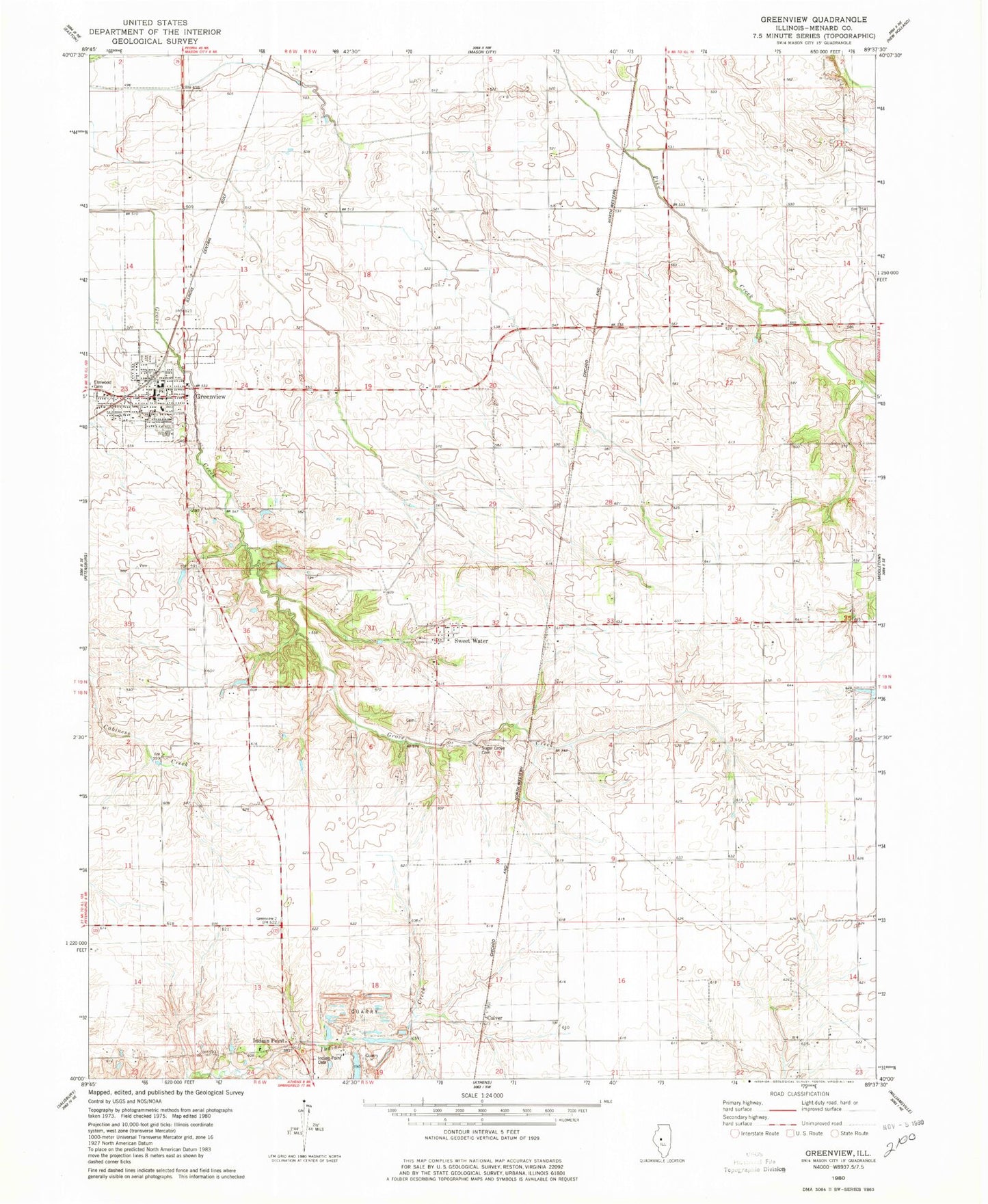
Classic USGS Greenview Illinois 7.5'x7.5' Topo Map
Couldn't load pickup availability
Historical USGS topographic quad map of Greenview in the state of Illinois. Map scale may vary for some years, but is generally around 1:24,000. Print size is approximately 24" x 27"
This quadrangle is in the following counties: Menard.
The map contains contour lines, roads, rivers, towns, and lakes. Printed on high-quality waterproof paper with UV fade-resistant inks, and shipped rolled.
Contains the following named places: Bee Grove School, Culver, Douglas School, Greenview, Greenview Christian Church, Greenview Community Fire Protection District, Greenview Junior High School, Greenview Number 6 Election Precinct, Greenview Police Department, Greenview Post Office, Hedge Row School, Honey Heart School, Indian Point Cemetery, Indian Point Quarry, Indian Point School, Irish Grove Number 4 Election Precinct, North Sangamon United Presbyterian Church, Sugar Grove Cemetery, Sugar Grove Number 5 Election Precinct, Sweetwater, Village of Greenview, Walnut Row School, WLUJ-FM (Petersburg), ZIP Code: 62642