MyTopo
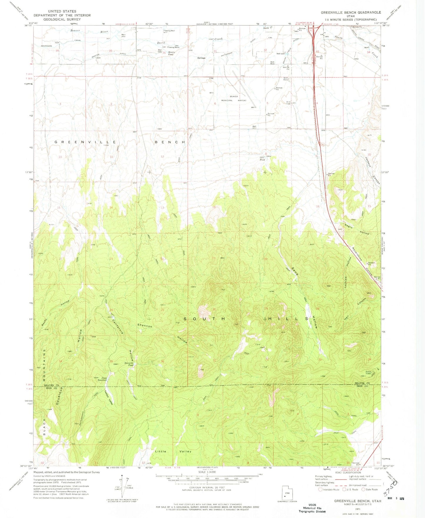
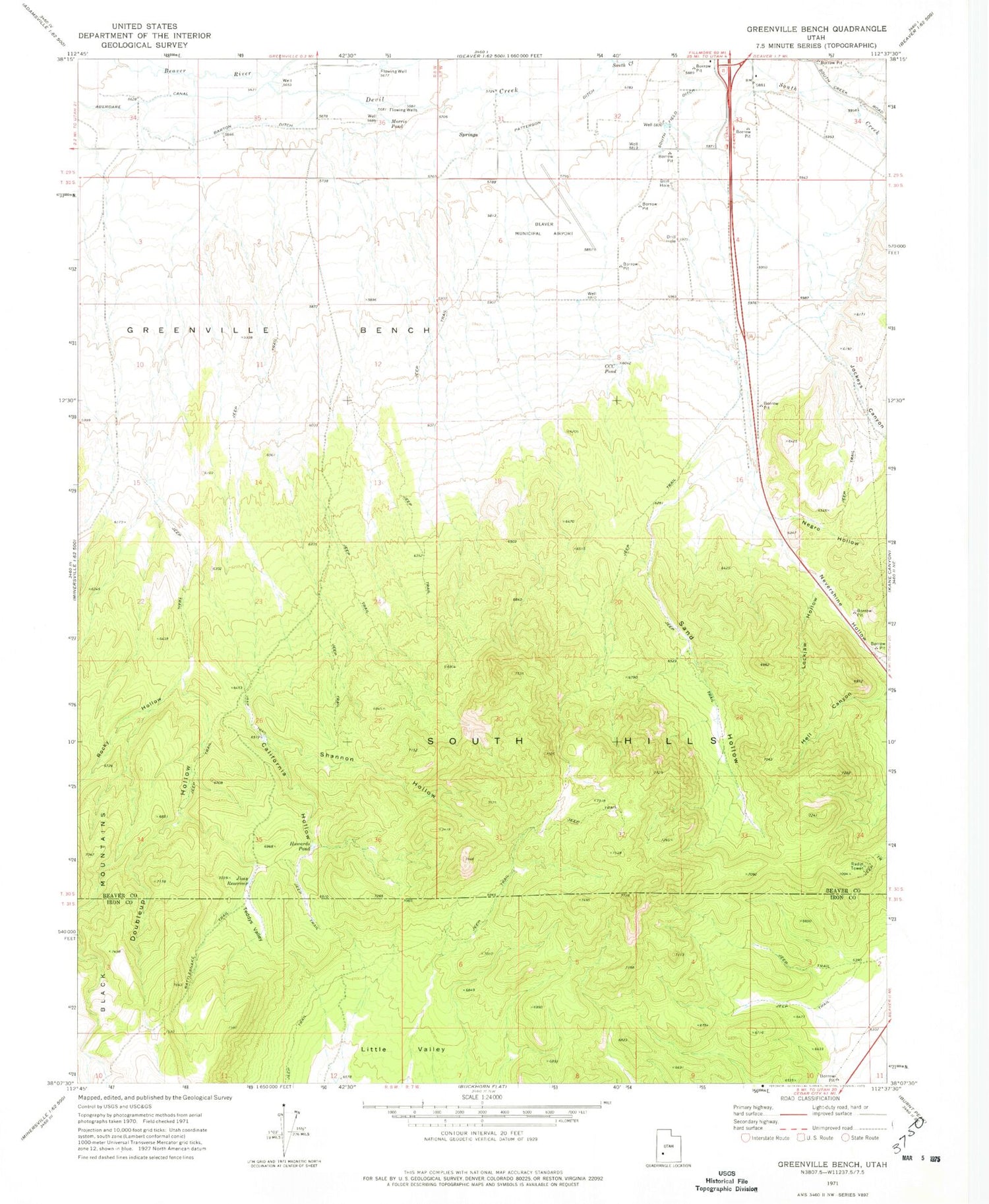
Classic USGS Greenville Bench Utah 7.5'x7.5' Topo Map
Couldn't load pickup availability
Historical USGS topographic quad map of Greenville Bench in the state of Utah. Map scale may vary for some years, but is generally around 1:24,000. Print size is approximately 24" x 27"
This quadrangle is in the following counties: Beaver, Iron.
The map contains contour lines, roads, rivers, towns, and lakes. Printed on high-quality waterproof paper with UV fade-resistant inks, and shipped rolled.
Contains the following named places: Aberdare Canal, Barton Ditch, Beaver County Sheriff's Office Beaver, Beaver Municipal Airport, California Hollow, CCC Pond, Devil Creek, Doubleup Hollow, Greenville Bench, Hell Canyon, Howards Pond, Jims Reservoir, Jockeys Canyon, Lockjaw Hollow, Morris Pond, Negro Hollow, Nevershine Hollow, Rattlesnake Trail, Rocky Hollow, Sand Hollow, Shannon Hollow, South Hills, Teddys Valley, Utah Highway Patrol Section 11 Beaver Office