MyTopo
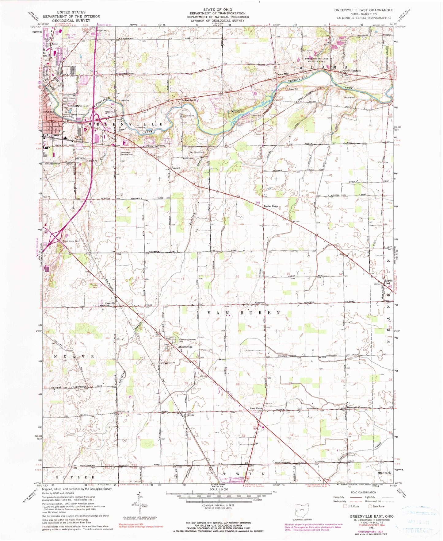
Classic USGS Greenville East Ohio 7.5'x7.5' Topo Map
Couldn't load pickup availability
Historical USGS topographic quad map of Greenville East in the state of Ohio. Map scale may vary for some years, but is generally around 1:24,000. Print size is approximately 24" x 27"
This quadrangle is in the following counties: Darke.
The map contains contour lines, roads, rivers, towns, and lakes. Printed on high-quality waterproof paper with UV fade-resistant inks, and shipped rolled.
Contains the following named places: Abbottsville, Abbottsville Cemetery, Abbottsville Post Office, Abbottsville United Methodist Church, Abney Farms, Baker Landing Field, Bears Mill, Besecker Farm, Bolton Run, Bridge Creek, Brumbaugh Farms, City of Greenville, Concord, County Home Cemetery, Darke Company Lake Wildlife Area Pond, Darke Company Lake Wildlife Area Pond Five Dam, Darke County Lake Wildlife Area, Delisle, Delisle Post Office, Dividing Branch, East Zion Community Cemetery, East Zion Congregational Christian Church, Fourmans Corners, Greenville Country Club, Greenville Electric Generating Station, Greenville Industrial Park, Greenville Township Emergency Services, Greenville Township Fire Department Station 5, Heller Ditch, Jaysville, Jaysville Post Office, Landis, Landis Post Office, Lansdowne Landing Strip, Lindemuth Farms, Martin Cemetery, McQuay Ditch, New Harrison, New Harrison Post Office, Nineveh, Old Abbottsville Cemetery, Olwine Mobile Home Park, Oswalt Farms, Poplar Ditch, Poplar Ridge, Poplar Ridge Post Office, Ross Farm, Routzong Preserve, Saint Marys Cemetery, Sampson, Sampson Post Office, Steel Point, Tegtmeyer Farms, Township of Van Buren, Treaty City Airport, Trump Airport